Xynthia is born
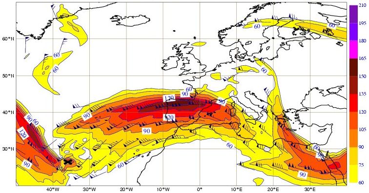
Around 00UTC on 26th February one of the ASCAT swaths passed right over the low-pressure system (Figure 2.2.1). At this time the main depression reached its most southerly position after moving approximately 1900 km southeastward in the last 24 hours. The pressure began to fall significantly after this time, as by now the low-pressure system was right below the left exit area of a jet streak (135/150 kt at 300 hPa) (Figure 2.2.2) and stratospheric air was reaching its lower level (~500 hPa).
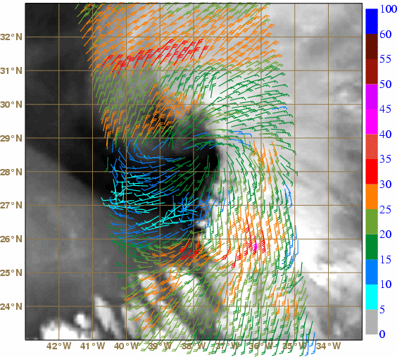
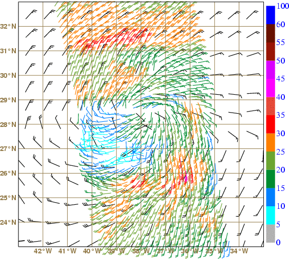
At this stage ASCAT measured winds in the 30-35 kt range to the north and south of the system (Figure 2.2.1), that is Beaufort 7 to 8 (near gale to gale). In fact, in the southeast border of the storm centre ASCAT wind was even reaching the 37.5-42.5 kt range (Beaufort 8 to 9, gale to strong gale). Taking into account these wind speed values, if this storm were to be considered of tropical nature, being below 30°N, it would already be reaching tropical storm intensity. The ECMWF wind analysis at 00:00 UTC was practically coincident with the ASCAT pass. Therefore, ASCAT data were likely to have been assimilated into this ECMWF model run. The ECMWF analysis reproduced winds reaching 30 kt on both the north and south areas referred above, but nevertheless missed the narrow region of strong gale winds (Figure 2.2.3, left).
In fact, the minimum pressure centre at the surface was not totally clear in ECMWF's MSLP analysis, although a value of 1003 hPa, approximately at 27.5°N 37°W was proposed (Figure 2.2.3, right). In Figure 2.2.3, the MSLP analysis is overlaid with the surface pressure derived from ASCAT winds, which is obtained with the Planetary Boundary Layer Model from the University of Washington (UWPBL, more details in Patoux et al, 2003). This promising estimate, which is valid both in mid-latitudes and tropics, suggests a minimum of 1004.3 hPa, therefore very close to the ECMWF estimate, but around 150 km to the northwest, at 28.5°N 38°W. These estimates correspond closely with a 00:00 UTC observation of 1003.4 hPa from a drift buoy located around 26°N 38°W, where the ECMWF and UWPBL estimates are around 1005 hPa and 1005.5 hPa, respectively.

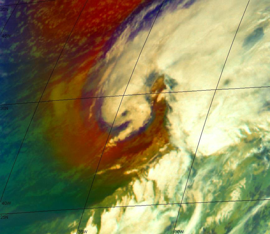
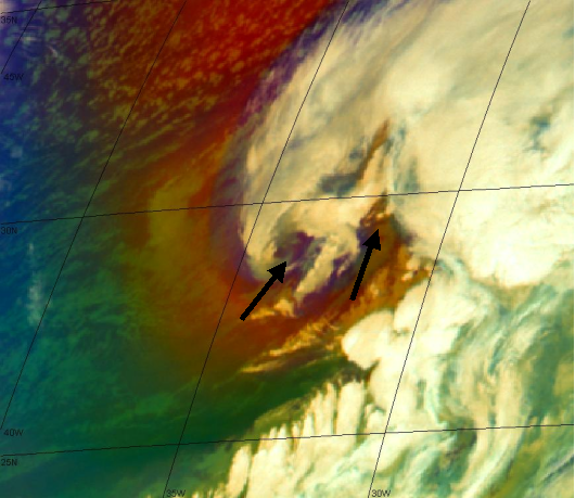
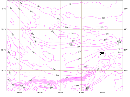
It was during the 26th that this low-pressure system was named Xynthia. Between 04:00 and 08:30 UTC Xynthia was surrounded by dry stratospheric air, depicted by brown-reddish shades in the Airmass RGB image from MSG (Figure 2.2.4). Between 05:00 and 06:30 UTC it was possible to detect what seems to be an eye in the centre of the low (Figure 2.2.4, left). In the following hours, two new particular regions of stratospheric (dry) air intrusion became very clear in the images (depicted by black arrows in Figure 2.2.4, right). At this early stage (until around noon the same day) Xynthia had incipient frontal characteristics at mid and upper levels, although there was already a ridge of potential equivalent temperature at 850 hPa with large gradients (mainly meridional) over the area (Figure 2.2.5). In the tongue of warm air, convection was very active and organized. In the course of the day Xynthia's frontal structures became better defined.