The early stages
The low-pressure system that later become Xynthia was observed by ASCAT on 25th February 2010 between 12:52 and 12:55 UTC (Figure 2.1.1). The nearest (in time) MSG observation corresponds to the 12:45 UTC image (MSG scan time of this area around 12:55 UTC) and confirms how the two ASCAT swaths surround the most active area, as the dry intrusion and cloudy areas clearly lie between the two swaths. The left swath shows northeast winds ranging between 25 and 30 kt (Beaufort 6 to 7), corresponding to the northwest quadrant of the low. To the east of the most active area, winds in the right swath are in general below 20 kt.

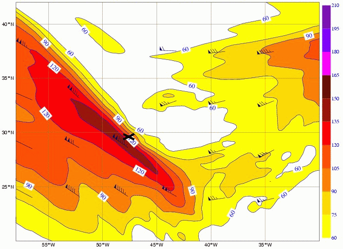
The low-pressure system formed in a subtropical area of the North Atlantic (at around 30°N and east of Bermuda) within a southwesterly flow at low and mid levels and within an upper level wave embedded in the westerly/zonal flow. The stratospheric air corresponding to the dark area in WV6.2 image (and between the ASCAT swaths) was bordered to the west by an intense northwest branch of the polar jet (Figure 2.1.2), which interacted with the already existing surface low.
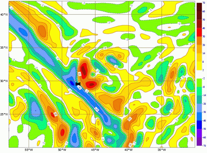
This area had a sharp southeast-northwest temperature gradient between a warm moist tropical air mass and a colder and drier air mass (Figure 2.1.3), with strong dipoles of warm and cold advection in the low levels. In addition there was a strong upper-level positive vorticity advection east and northeast of the low centre (Figure 2.1.4) causing upward motion. Also, a strong vertical wind speed shear existed over the area. At this time, deep convection could already be seen on marked WV boundaries (Figure 2.1.1).

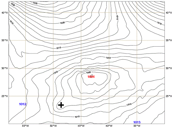
The low-pressure system was in a region where the sea surface temperature (SST) ranged between 20 and 23 °C south of 30°N and between 17 and 19 °C north of 30°N. Later on 25th, a second low coming from the lower latitudes was absorbed by the main low, yielding a complex low-pressure system, which remained over the SST gradient area until the middle of the following day, 26th February (Figure 2.1.5).
This first ASCAT observation of the system (25th around 12 UTC) may seem disappointing as it fails to find the centre of the low as well as the location of the wind maximum. However, ASCAT provides a hint of the asymmetry of wind speed at this stage (Figure 2.1.1), namely regarding the northwest (more intense) and southwest quadrants (less intense). And, of course, it is only the beginning of the story...