
Identify and interpret fields and derived products

Presentation during the event week on Convection in June 2009.
Christo Georgiev from the Bulgarian Meteorological Service will talk about Deep moisture convection (DMC) with the thermodynamic context as seen in WV channels 6.2 and 7.3 of Meteosat Second Generation.
The talk will be followed by a practical session done by Estelle deConing from the South African Weather Service who will talk about the successful implementation of GII (Global Instability Index) and the operational use of it, at their weather service using their model as first guess.

Presentation during the event week on Convection in June 2009.
Presentation from DLR where Tobias Zinner and Caroline Forster will present the topic Synthetic satellite images based on COSMO. The talk will be divided in two halves. First, RTTOV implementation into COSMO is explained and Tobias will show applications of synthetic satellite data in the DLR remote sensing and weather forecast groups. Afterwards, Caroline Forster would present her work on the combination of satellite based nowcasting and COSMO forecast via synthetic satellite data.
The second part of this session will be done by Mateja Irsic Zibert from the Environmental Agency of the Republic of Slovenia. The title of her presentation will be on convection in Slovenia: Remote sensing data on selected examples.

Presentation during the event week on Convection in June 2009.
The recent version of NWCSAF has seen a whole list of updates and improvements of the products. One of this is the Convective Rainfall Rate (CRR). This product was developed by AEMET in Spain. Cecilia Marcos will explain the products, the algorithms behind it and show case studies.
The presentation will be followed by Ramon Vazquez who acts as a trainer to AEMET. He will talk about operational nowcasting and monitoring of convection at AEMET.
Presentation during the event week on Convection in June 2008.
Kris Bedka (University of Wisconsin) and John Mecikalski (University of Alabama) gave a presentation on the Convective Initiation (CI) method. The CI product identifies cumulus-type clouds within an MSG image and uses the temporal evolution of the related MSG observations to identify rapidly growing cumulus as likely candidates to evolve into potentially strong convective storms up to one hour in the future.
This session was continued by the Portuguese Met Service (IM). Besides the diagnostic tools from Numerical Weather Prediction models currently in use, satellite and radar products were addressed, including automatic warnings, e.g. for hail.

Presentation during the event week on Convection in June 2008.
Marianne Koenig (EUMETSAT) demonstrated the GII product. For the forecaster this was a very interesting talk as it showed the advantages the use of GII has to a model. Case studies saw the potential the GII product has and which added value(!) the GII has to a normal model run.
The lecture was followed by Maurice Schmeitz from KNMI on the development and verification of a new model output statistics (MOS) system, which is intended to help the forecasters to decide whether a weather alarm for severe thunderstorms should be issued.
Presentation during the event week on Convection in June 2008.
Marianne Koenig (EUMETSAT) demonstrated the GII product. For the forecaster this was a very interesting talk as it showed the advantages the use of GII has to a model. Case studies saw the potential the GII product has and which added value(!) the GII has to a normal model run. The session was followed by Jenni Teittinen from the Finnish Meteorological Institute who talked about warnings and the assessment of warnings in Finland.

Presentation during the event week on Convection in June 2008.
Guy Kelman (Hebrew University of Jerusalem) also showed some more examples of nowcasting convection over the States. The session was followed by a very good presentation of Natasa Strelec Mahovic (DHMZ) who in depth presented what material and products the Forecaster have available in Croatia when they start their working day and the day turns out to be convective.
Presentation during the event week on Convection in June 2008.
Guy Kelman (Hebrew University of Jerusalem) explained the relationship between cloud top temperature and effective radius and emphasised the advantage this can have on the lead time and the possibility to nowcast areas with a high potential of severe convection. The session was followed by Wilfried Jacobs (DWD) on the Automatic weather and product monitoring (Automon).
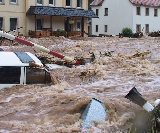
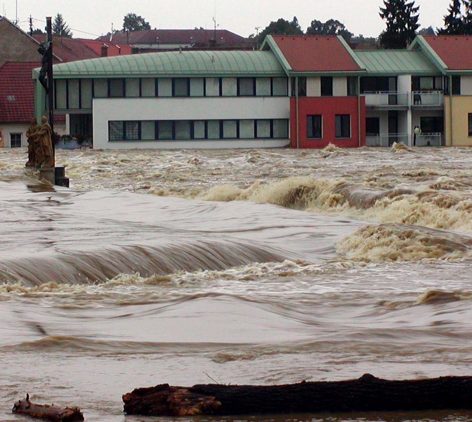
Case study on the abundant rainfall on 23 September 2008 in Valencia and Alicante.
On 23 September 2008 an amazing amount 326 mm in three hours was recorded in Sueca in the Province of Valancia. The convective events leading up to this event are discussed in this small case study by Ramon Vazquez. The satellite images as well as the radar and data from the ground are presented and discussed.
On 7th October 2008 a cold front crossed northwestern part of the Iberian Peninsula, producing large amounts of precipitation and causing disruption of same activities in the affected areas.
In northwestern Portugal, a maximum of 41 mm in 6 hours was obtained in an automatic weather station (AWS) in a mountain area and a maximum of 20 mm in 1 hour in a coastal area, both reaching the orange warning lower threshold for meteoalarm (40mm in 6 hours and 20mm in 1 hour, respectively). The Portuguese meteorological service (IM) issued a yellow warning with 24 hours advance, and the orange warning has been issued 7 hours before the beginning of the period of heaviest precipitation.
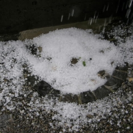
The 23rd of July was marked by a fast transition of a cold front (about 80 km/h) from west to east which went along with severe thunderstorms and hail.
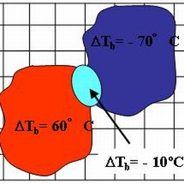
The 23rd of July was marked by a fast transition of a cold front (about 80 km/h) from west to east which went along with severe thunderstorms and hail. The catastrophic event caused enormous agricultural damage and the Austrian farmer alliance reported that about 60 000 hectare arable lands were devastated. The destruction mostly caused by hail was estimated to sum up 15 million euro. On this account people insist on investigations to find out what exactly caused the event. Besides on the meteorological perspective there is always great interest in improving forecast methods and forecast tools. In principle the following report provides a detailed analysis of the weather event. Basically the high potential of prefrontal thunderstorms was known, although there were diverse estimations about its development. It was the change of the wind direction due to the interaction between the convergence line and the foehn that induced the following weather development. Contributing to the wiki case studies this report should lead to a better understanding of the atmospheric conditions that special day and introduce new now casting-products (GII and SAI).
On September 12th 2010 a major PV anomaly, in the rear of a cold front, moved over France and hit Germany and Switzerland in the late evening and also Austria during the night. On the front side of this anomaly convective cells developed and brought some rain showers and thunderstorms.
On September 12th 2010 a major PV anomaly, in the rear of a cold front, moved over France and hit Germany and Switzerland in the late evening and also Austria during the night. On the front side of this anomaly convective cells developed and brought some rain showers and thunderstorms. At first the ECMWF-model, especially the 00 UTC run from September 12th, was lacking performance shifted the PV maximum more westward. In this case study we analyse not only the synoptic situation, but also the model error. In the following we take a look at the MPEF (Meteosat Product Extraction Facility) Divergence product, how it works and whether it would have been helpful in this case as a nowcasting tool.