
NWP skills for operational meteorologist
Listed here are other resources related to "NWP skills for operational meteorologist" tag:
Note: click on an image to open the Resource
Sofia Chabhi presents a marine forecast case study of Storm Ingrid.
The presentation examines the passage of Storm Ingrid (22–24 January 2026) and its severe impacts along the Moroccan coastline using satellite observations and remote sensing data. It analyzes the key oceanographic and meteorological features of the storm, highlighting how satellite imagery aids in monitoring extreme events and improving coastal vigilance.
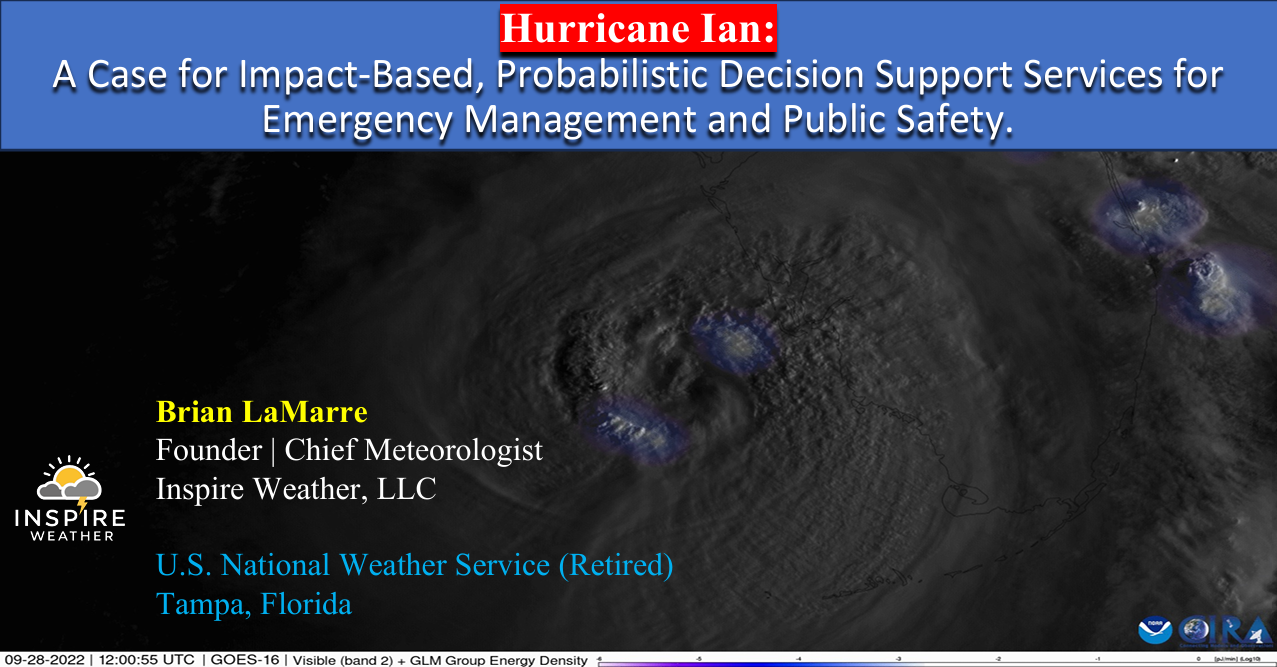
Brian LaMarre discusses Hurricane Ian and the role of impact-based, probabilistic forecasts in supporting emergency management and public safety decisions.
Hurricane Ian made landfall as an intense Category 4 hurricane on September 28, 2022, on the southwest coast of Florida in the United States, claiming 156 lives in the U.S., including 66 direct fatalities in Florida. Drowning in storm surge waters was the primary cause of death. This presentation highlights how the National Weather Service worked proactively to prepare the public through engagement with core partners in media and emergency management before, during and after the storm. Public perception, based on lived experiences from past storms impacting the region, was a factor in the overall response. Additionally, there was a lack of understanding of how small changes in track can result in significant differences in impact based on the angle of approach of a hurricane moving toward Florida's north-south oriented coastline.
Soukaina Boughanem talks about the process of forecasting and monitoring tropical convection over Morocco.
The presentation focuses on tropical convection over Morocco, with an emphasis on its forecasting and monitoring in relation to the northward extension of the ITCZ. The main atmospheric features and the use of numerical models, satellites, radar and observations for operational monitoring are also discussed.
Abhishek Lodh talks about how satellite observations, data assimilation and coupled numerical models improve forecasts of monsoons, tropical weather hazards and their impacts over the Indian subcontinent.
Accurate representation of initial conditions in NWP is critical for improving the prediction of high-impact tropical weather and monsoon systems over the Indian subcontinent. Operational developments at NCMRWF, including the assimilation of satellite-derived ASCAT soil moisture and INSAT-3D land surface temperature observations, demonstrate improved prediction of monsoon depressions, tropical cyclones, precipitation, and extreme temperatures, with enhanced forecast skill and extended predictive capability. These advances in land–atmosphere initialization strengthen operational early-warning information for weather-sensitive sectors and support better anticipation of impacts on communities, agriculture, infrastructure, and critical services.
Nanda Alfuadi talks about the multi-NWP model assessment regarding high-impact weather simulation.
The presentation examines the performance of four numerical weather prediction models (WRF assimilation, WRF non-assimilation, IFS, and GFS) during a heavy rainfall case in Jakarta, the capital city of Indonesia. Specifically, the discussion focuses on how effectively these models captured the high-impact weather signal starting three days before the event.
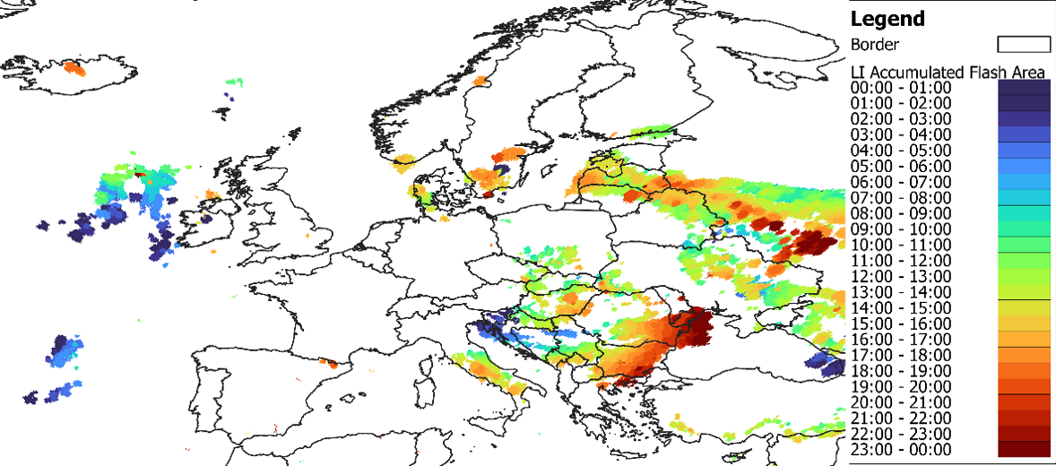
The NWC SAF MTG-I Lightning Imager Prototype Products Workshop introduces the upcoming NWC SAF GEO-LI software package, planned for release in 2027, and provides an overview of the new generation of products based on data from the MTG Lightning Imager.
The workshop combines technical presentations with practical examples, offering participants useful guidance on how to interpret and exploit LI-based products and their use in combination with other satellite products available in the NWC SAF EWC Viewer based on ADAGUC.
The recording of the event consists of three parts:
NWC SAF Project Manager Pilar Ripodas (NWC SAF/AEMET): A Short Introduction to the NWC SAF GEO-LI Software Package
Lecture slides
Raluca Gabrian (NWC SAF/NMA RO): NWC SAF MTG-I1 Lightning Imager Products prototypes: overview, algorithms and their applications; 5:18
Lecture slides
Adelina Mihai (NWC SAF/NMA RO): NWC SAF LI prototypes in the European Weather Cloud (EWC); 28:38
Lecture slides
Francesca Di Giuseppe discusses ECMWF fire prediction systems and the advantages of SPARKY, a new data-driven system for predicting fire activity and burned area.
Traditional fire danger indices estimate environmental conditions conducive to fire but do not directly predict when and where fires will occur. This presentation introduces a shift toward fire activity forecasting, using data-driven approaches that integrate weather, fuel conditions, and ignition sources. By leveraging machine learning and Earth observation data, these systems provide probabilistic forecasts of actual fire occurrence and spread. The approach improves early warning capabilities, reduces false alarms in fuel-limited regions, and offers actionable information for fire management, supporting more effective preparedness, response, and long-term risk mitigation strategies.
Emilio Chuvieco presents data sets and products generated by the ESA FireCCI programme.
The presentation is about the set of burned area products derived from the European Space Agency's Climate Change Programme. They include a Sentinel-3 SYN global product, generated from 2019 until present, at 300 m resolution; a Terra-MODIS-based 250 m product generated from 2001 to 2022, and a high-resolution global mosaic based on Sentinel-2 MSI images for 2023. All products have been statistically validated using higher resolution images and are used for different applications, including fire emissions and the impact of burning on tropical deforestation.
Carlos da Camara addresses the application of remote sensing for the development of an early warning system for fire danger.
In recent years, Europe has been affected by severe wildfires that are driven by vegetation stress and fire weather, and have severe impacts at social, economic and ecological levels. To assist fire managers and firefighters, the LSA SAF has developed an early warning fire danger system for Europe. The system relies on a set of regional models that provide forecasts of local meteorological fire danger based on statistical models of fire radiative power that use the so-called Fire Weather Index as a covariate. The rationale will be described in detail, and several case studies will be presented.
Stephan Bojinski introduces the MTG-S and the instruments onboard.
An overview of Meteosat Third Generation (MTG) and the InfraRed Sounding mission is provided. The MTG-S satellite was launched on 1 July 2025 with an InfraRed Sounder (IRS) on board, passively measuring upwelling radiance in 1953 channels from geostationary orbit, every 30 min over Europe, and less frequently over other areas of the Earth disc. Valuable retrievals of humidity and temperature are expected with vertical resolution of 1-2km and spatial resolution of ~6-7km over Europe, complementing model-derived fields or radiosonde profiles. IRS is also sensitive to atmospheric trace gases such as NH3, SO2 and CO. Since this capability is a first-ever for EUMETSAT and its users, significant user training is required to visualise and interpret the data directly, e.g., in nowcasting applications. Strong impact on improving weather forecasting skill is expected by assimilating IRS radiances in NWP models, similar to data from its IASI sister missions in polar orbit. EUMETSAT informs its member states regularly informed about the status of IRS testing and release of early data via its MTG User Preparation user group and the Core NWP user group.
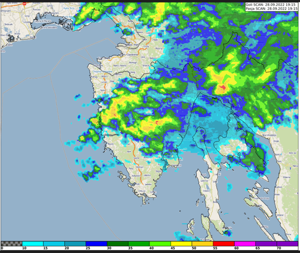
Case study about the extreme precipitation event in Rijeka, Croatia on 28 September 2022. The study focuses on the special case of convective development that caused the severe event.
This study accompanies the simulator.
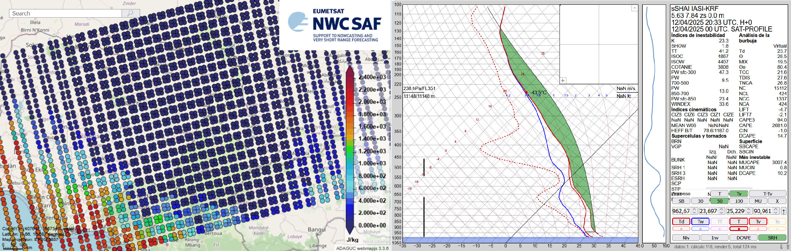
The Nowcasting SAF is planning a new software package dedicated to the new geostationary MTG-S Infrared Sounder instrument (IRS). This new software package will generate Satellite Humidity And Instability products (sSHAI) that will be key in Nowcasting using the IRS instrument. It will also deliver services to make the best use of MTG-IRS channels and combine its virtues with those of the MTG imager FCI.
In this Workshop you will learn about these revolutionary product and services. You will also have a taste of what will come in a few months with MTG-IRS by using in real world applications the prototype product obtained from the polar orbiting IASI instrument.
The Workshop is comprised of 4 presentations:
Part 1. X. Calbet (AEMET) - Introduction GEO-S
Part 2. N. Peinado-Galán (AEMET) - sSHAI prototype
Part 3. N. Peinado-Galán (AEMET) and X. Calbet (AEMET) - Practical cases with course attendants using SHAI on the EWC
Part 4. Miguel-Ángel Martínez (AEMET) - Other services from the GEO-S package: quickIRS, sSHAI_ES and Remapping tool