The role of Potential Vorticity (PV)
A "Rapid Cyclogenesis" is a rapidly deepening storm which can be enlightened from different points of view. In this chapter, the relationship between "Rapid Cyclogenesis" and upper and low level PV is studied. All numerical parameter fields are computed from NWP analysis fields.
Two different views on the role of PV are included in this chapter, namely:
- The downward protrusion of stratospheric air (PV values > 2 units)
- The influence of sinking upper level PV maxima upon a tropospheric baroclinic zone.
According to theory, PV anomalies develop where dry stratospheric air descends into the troposphere on an isentropic surface. PV values below 1 unit can be regarded as tropospheric air while PV values higher than 2 units are characteristic of stratospheric air; it is also known that the limits of 1 and 2 PV units should not be regarded too strictly. Processes such as tropopause folding or cut off upper level lows, could lead to PV anomalies (containing stratospheric air) at lower levels.
Another view considers the interaction of higher and lower layers. If a sinking PV anomaly approaches a baroclinic zone, cyclogenesis can be released or strengthened by the upper air phenomenon. In this theory, stratospheric air need not necessarily protrude downward into low layers, but it enhances the circulation and cyclogenesis there.
There is a very good relationship between these PV considerations and the jet streak consideration, because there is downward penetration of PV along the cyclonic side of a jet streak, resulting in Dark Stripes in WV imagery.
Lothar
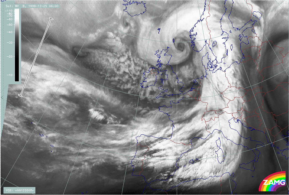
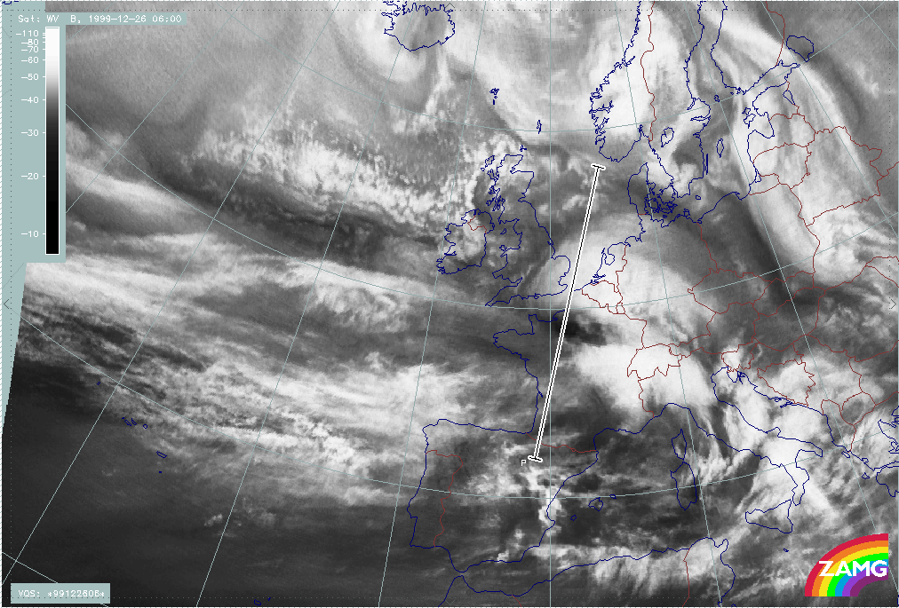
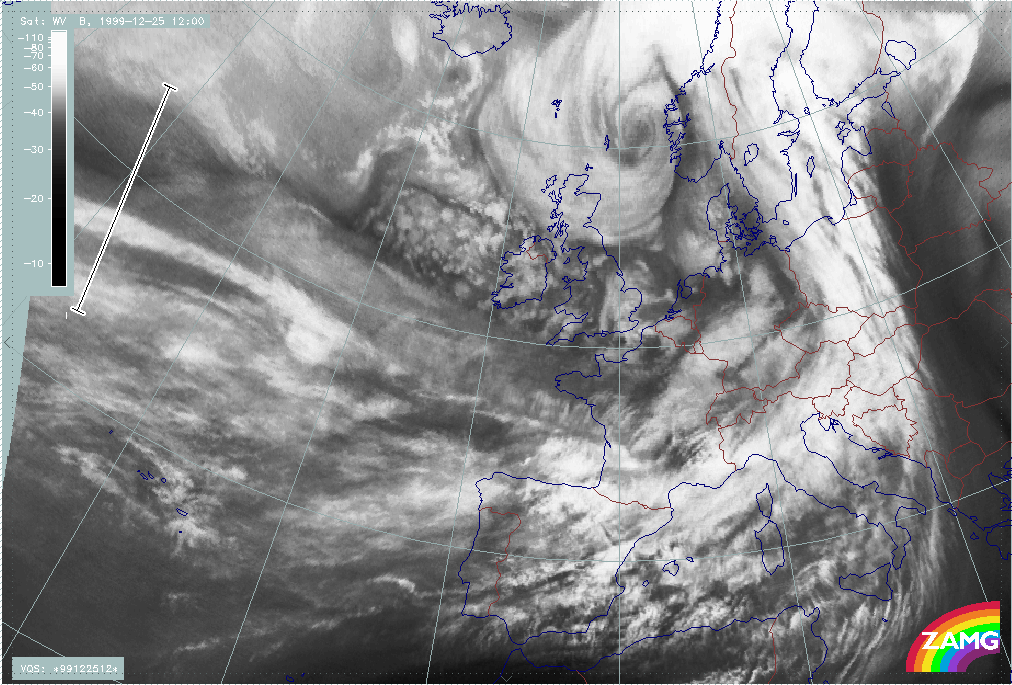
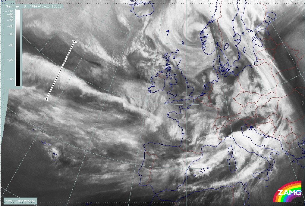
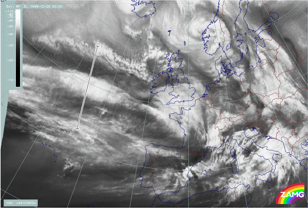
The loop below shows vertical cross sections superimposed on WV images. The cross sections have been chosen so that they cross the area immediately to the rear of the cloud head and the darkest area of the WV stripe.
|
25 December 1999/06.00 UTC - Meteosat WV image; position of vertical cross section indicated; 25/06.00 - 26/06.00 UTC 6-hourly image loop
|
|
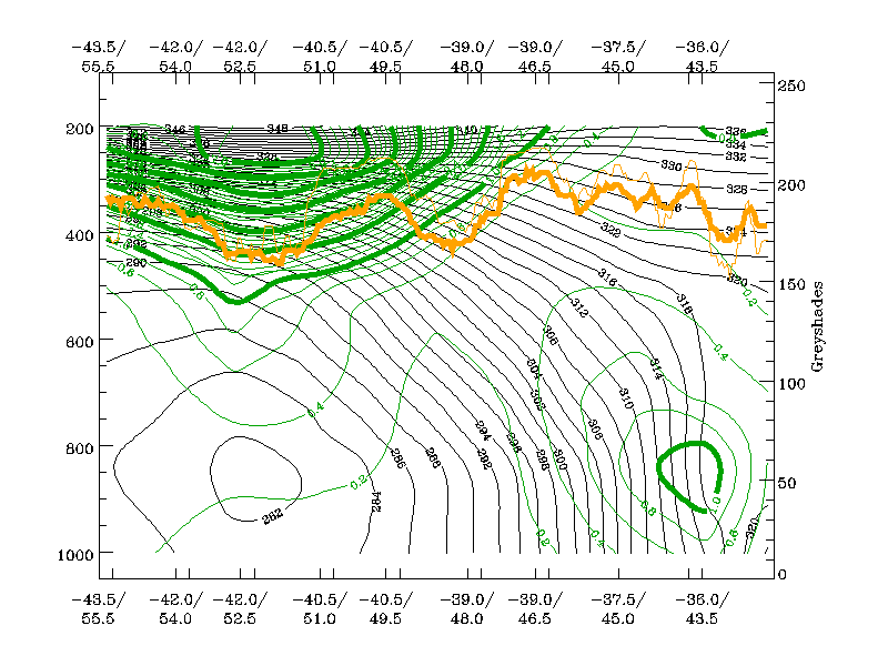
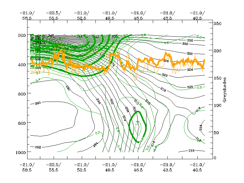
The loop below shows the corresponding vertical cross sections containing isentropes and PV.
|
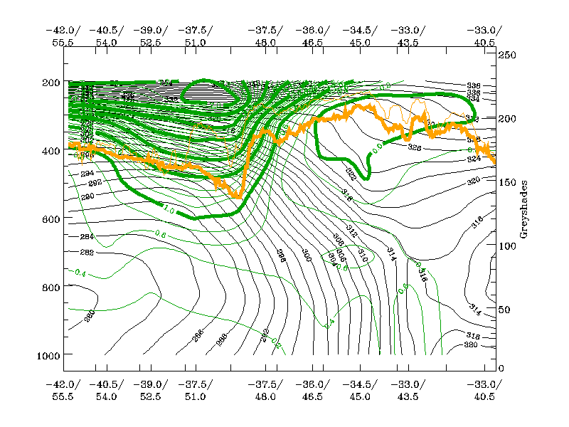
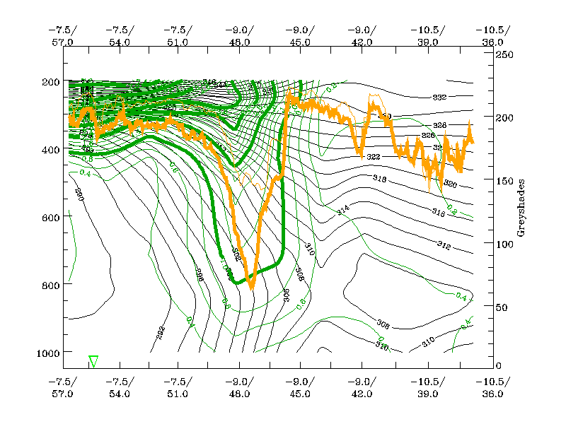
25 December 1999/06.00 UTC - Vertical cross section; green: potential vorticity, orange thin: IR pixel values, orange thick: WV pixel values; 25/06.00 - 26/06.00 UTC 6-hourly image loop
|
|

The following remarks can be summarised:
- If the PV = 2 value is regarded as the boundary between stratospheric and tropopsheric air, then this dry air mass protrudes down to about 400 - 450 hPa;
- Since this can be regarded as tropopause height, the values indicate a rather low tropopause;
- But: there is, subsequently, no further downward protrusion with this line of 2 PV units;
- Instead, the lowest height of the PV = 2 units approaches the frontal zone and, in parallel, low level PV (and airmass rotation) intensifies.
- The frontal zone (characterised by isentropes) is rather broad and during the approach of a PV anomaly, an intensification of low level PV occurs, especially in the northern part which happens to be closer to the approaching upper level PV maximum.
- Finally, the two PV maxima merge and are enclosed by the PV = 1 unit line.
The development of Lothar, therefore, seems to have been assisted by the interaction of an upper level PV maximum and a low level baroclinic zone.
Lothar successor
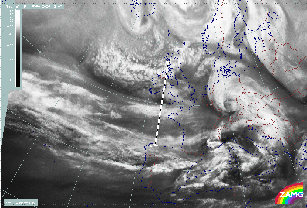
The loop below shows vertical cross sections superimposed on WV images. The cross sections have been chosen so that they cross the area immediately to the rear of the cloud head and the darkest area of the WV stripe.
|
25 December 1999/06.00 UTC - Meteosat WV image; position of vertical cross section indicated; 25/06.00 - 26/12.00 UTC 6-hourly image loop
|
|

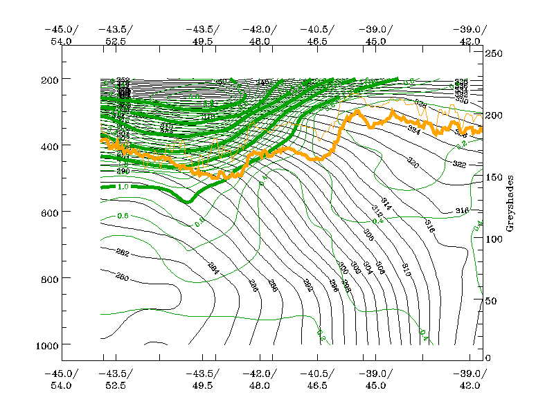
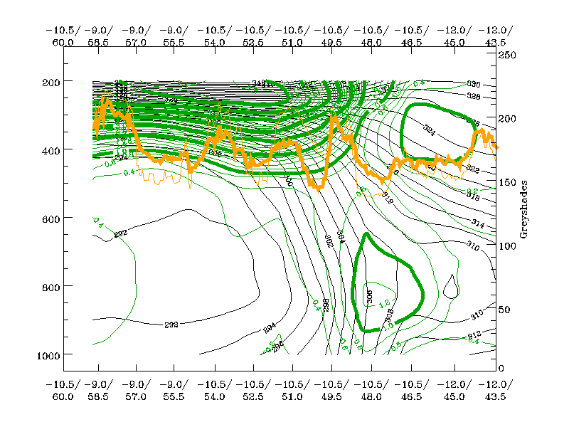
The loop below shows the corresponding vertical cross sections containing isentropes and PV.
|
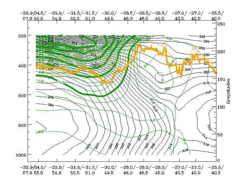
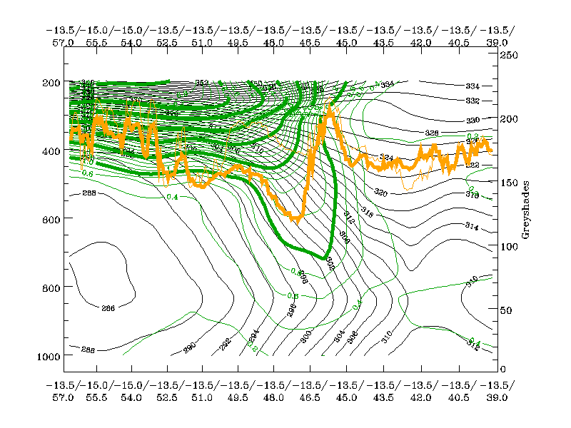
25 December 1999/06.00 UTC - Vertical cross section; green: potential vorticity, orange thin: IR pixel values, orange thick: WV pixel values; 25/06.00 - 26/12.00 UTC 6-hourly image loop
|
|
The following remarks can be summarised:
- As in the two other storm cases, there is a upper level PV maximum protruding downward to around 450 - 500 hPa until 26 December/00.00 UTC; the effect of downward protrusion is even more pronounced in the PV = 1 line;
- As in the other two cases, there is a very broad baroclinic zone
- As in the other two cases, there is an intensification of PV in the northernmost part of the baroclinic zone
- In contrast to the other two cases, the PV = 1-2 maxima ascends rather than descending further in the phase where rapid development could be considered possible.
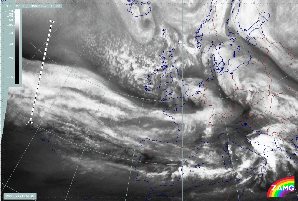
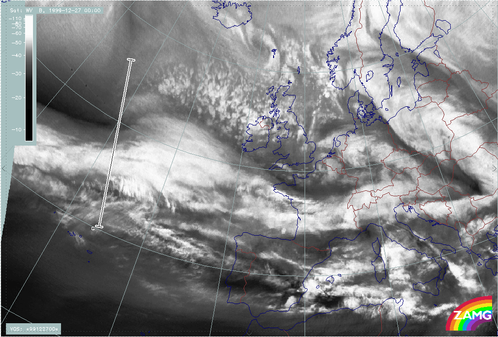
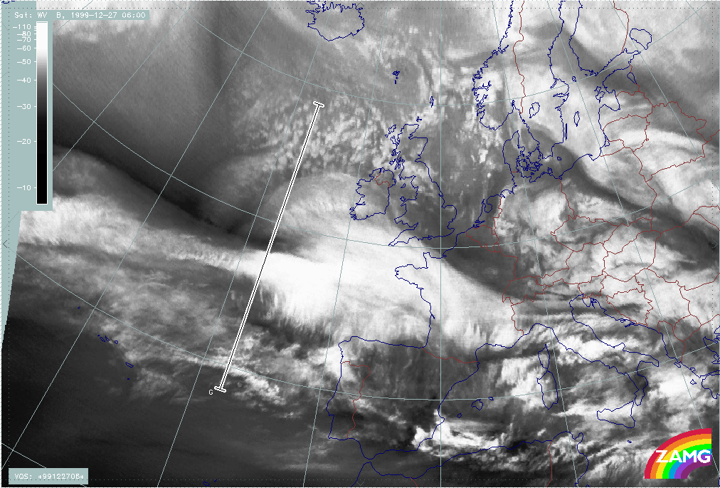
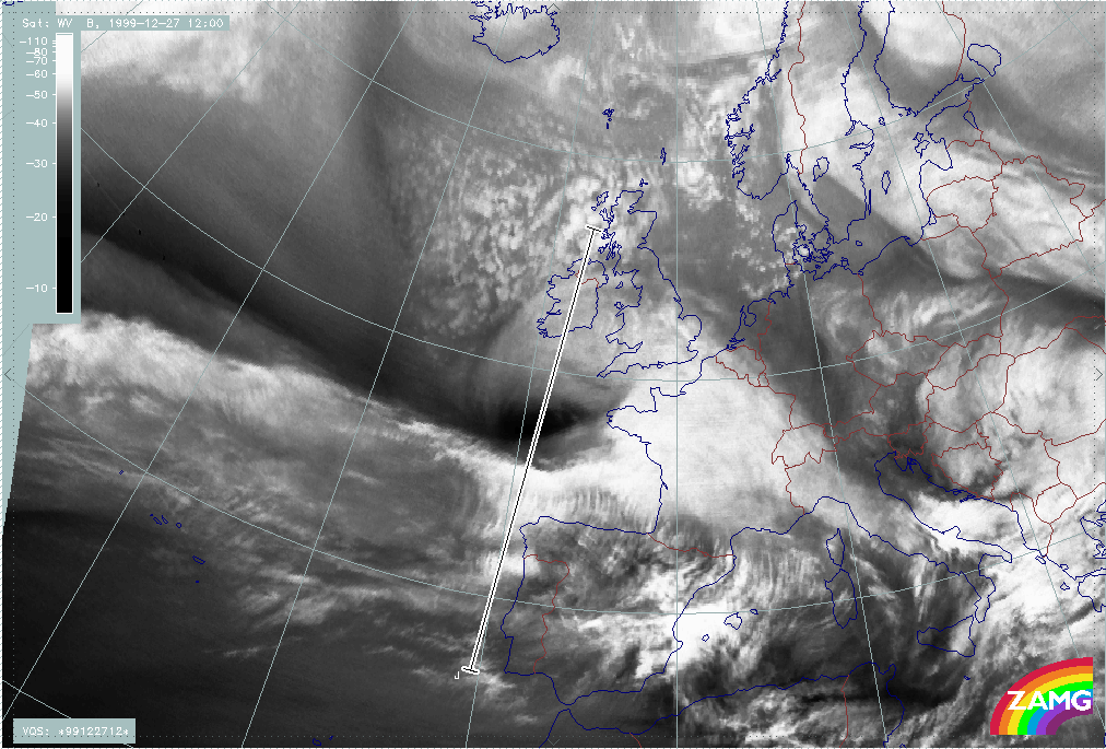
Martin
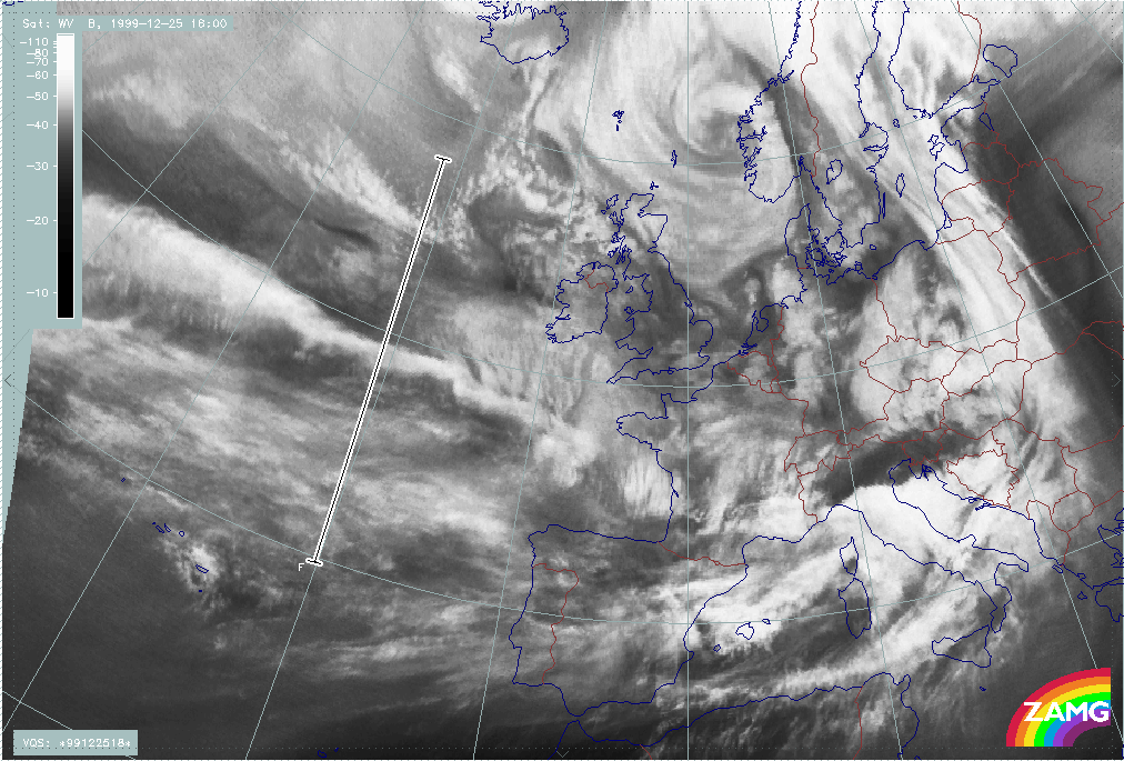
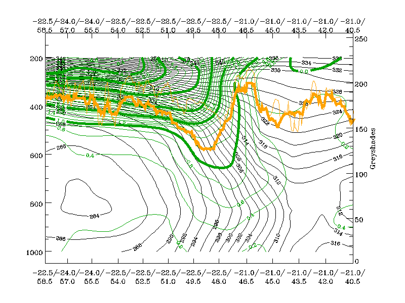
The loop below shows vertical cross sections superimposed on WV images. The cross sections have been chosen such that they cross the area immediately to the rear of the cloud head and the darkest area of the WV stripe. Only when rapid development takes place, the vertical cross section shifts somewhat into the region of the cloud head. Therefore a large change in the distribution of PV has to be considered and thus two vertical cross sections are computed and compared.
|
26 December 1999/12.00 UTC - Meteosat WV image; position of vertical cross section indicated; 26/12.00 - 27/12.00 UTC 6-hourly image loop
|
|

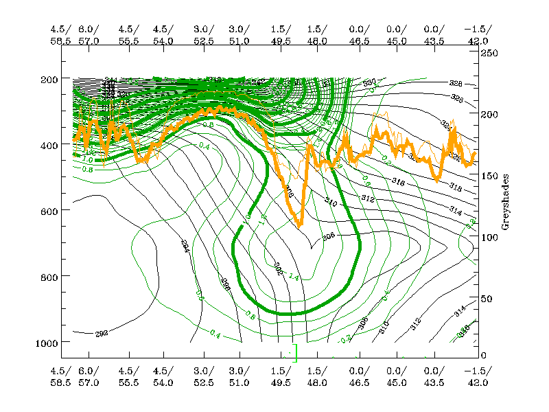
The loop below shows the corresponding vertical cross sections containing isentropes and PV.
|
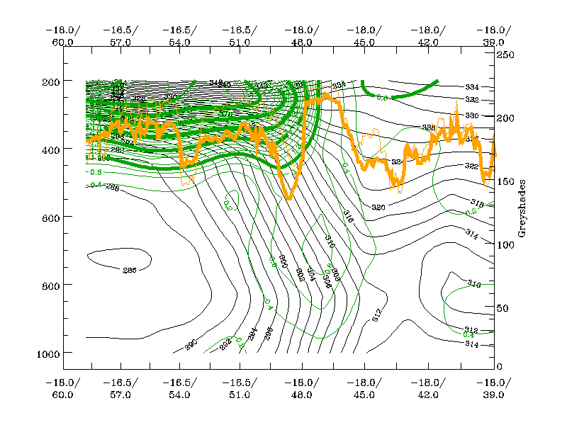
26 December 1999/12.00 UTC - Vertical cross section; green: potenial vorticity, orange thin: IR pixel values, orange thick: WV pixel values; 26/12.00 - 27/12.00 UTC 6-hourly image loop
|
|
The following remarks can be summarised:
- The vertical cross section of PV, which is located immediately behind the cloud head in the whole phase, shows that the PV=2 unit line descends to about 500 hPa, representing a rather low tropopause height,
- The PV = 1 unit line protrudes rapidly downward as far as 800 hPa;
- Low level PV in the baroclinic zone, which is extremely broad, is not as distinct as it was the case for Lothar;
- But, as for Lothar, there is an increase in low level PV during the approach of the PV 2 unit line;
- In contrast to Lothar, where the low level PV was much more intensive (a column of PV values > 1 unit developed throughout the whole troposphere). In this case, the downward protrusion of the 1 - 2 units line and the corresponding air mass seems to be the dominant feature.