Relation between upper level jet streak and surface wave
The relationship between the development of surface wave features and upper level flow in the Christmas storms is studied below. All numerical parameter fields are computed from NWP analysis fields.
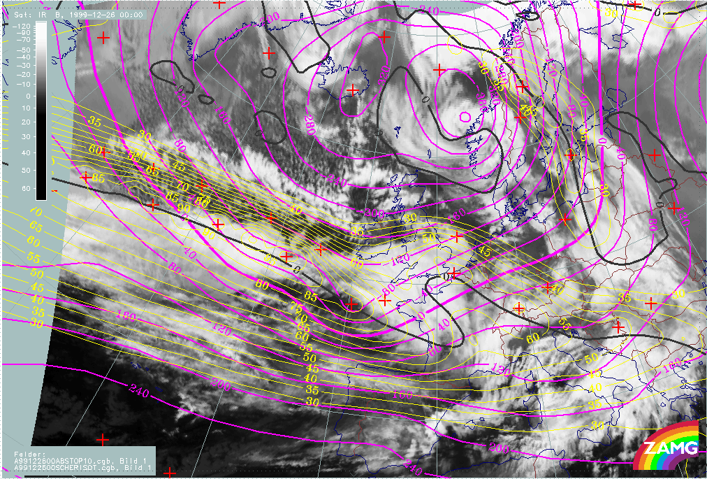
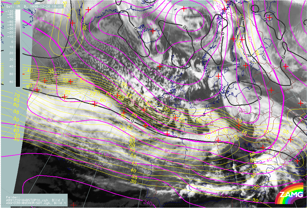
Lothar and Lothar successor
The loop below contains the height contours at 1000 hPa (for the surface features) and isotachs at 300 hPa (for the jet features).
|
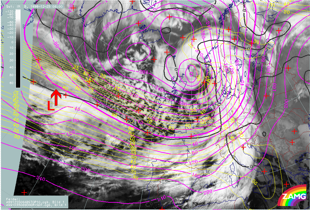
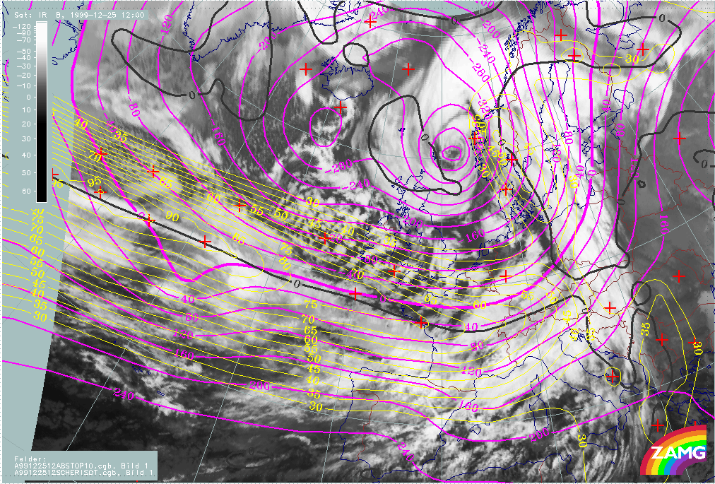
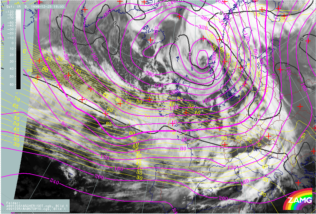
25 December 1999/06.00 UTC - Meteosat IR image; yellow: isotachs 300 hPa, black: shear vorticity 300 hPa, magenta: height contours 1000 hPa; 25/06.00 - 26/12.00 UTC 6-hourly image loop
|
|
The following remarks can be summarised:
- At 25/06.00 UTC, the surface low is on the anticyclonic side of the jet and close to the jet core; at this stage there is no clear relationship with the exit region;
- In the phase from 25/12.00 - 18.00 UTC the surface low is still on the anticyclonic side of the jet but much nearer to the exit region; as the right exit region is not an area for cyclonic development, the low cloud head exist but without any rapid development; however, at 18.00 UTC the surface low is already very close to the jet axis.
- From 26/00.00 UTC, the surface depression has moved into the left exit region and "Rapid Cyclogensis" begins.
- For Lothar successor the surface low moves during the whole period from the anticylonic side to the cyclonic side of the jet. Only from 26 December/12.00 UTC does the relationship with an exit region becomes more distinct. This is also the point in time where some signs of a Rapid Cyclogenesis (e.g. darkening in the WV imagery) occur. Until this time the rather weak features in the surface trough and the poor relationship with an exit region can be reasons for the lack of a rapid development.
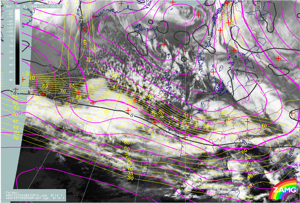
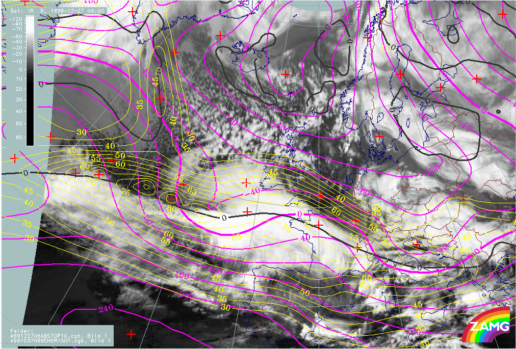
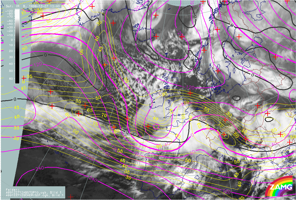
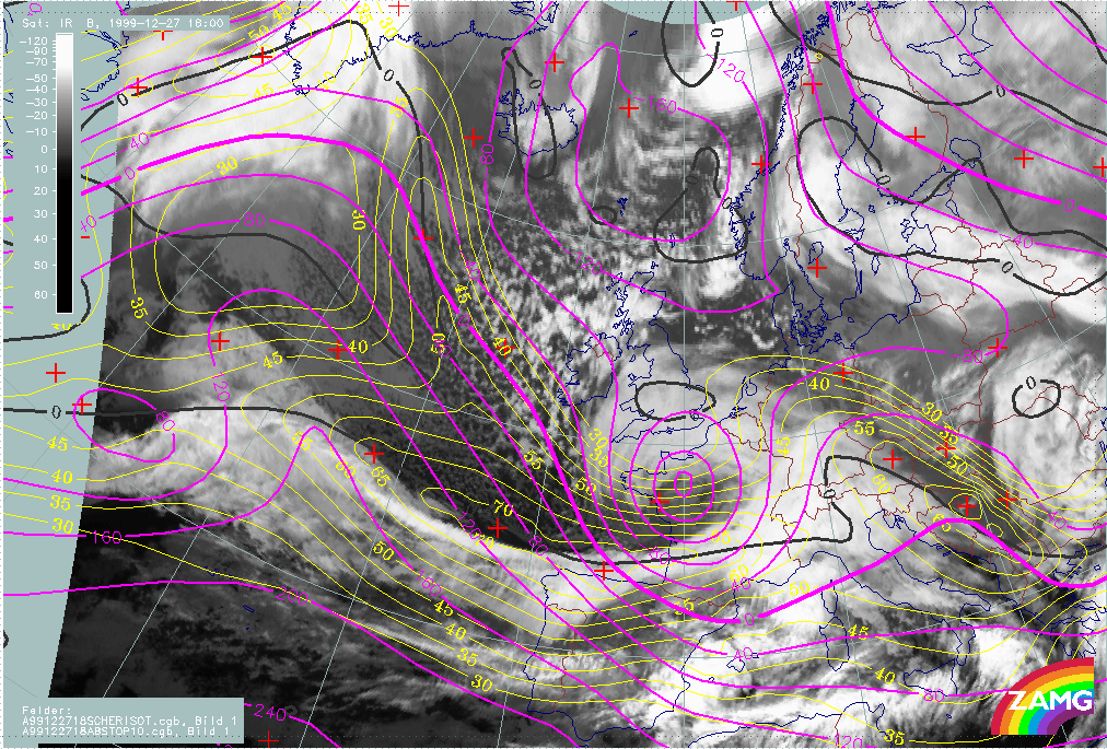
Martin
The loop below contains the height contours at 1000 hPa (for the surface features) and isotachs at 300 hPa (for the jet features).
|
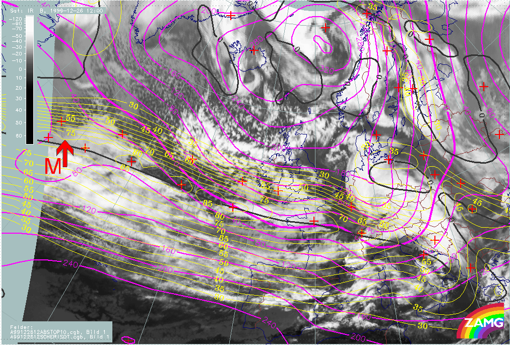
26 December 1999/12.00 UTC - Meteosat IR image; yellow: isotachs 300 hPa, black: shear vorticity 300 hPa, magenta: height contours 1000 hPa; 26/12.00 - 27/18.00 UTC 6-hourly image loop
|
|
The following remarks can be summarised:
- At 26/12.00 UTC the surface low is located on the anticyclonic side of the jet; because the jet is elongated there is no clear relationship with the exit region;
- During the next 12 hours, till 27/00.00 UTC, there is a strengthening of the jet streak, and a development of two smaller scale velocity maxima in and immediately behind the area of the "low" cloud head;
- During this phase the surface low moves from the anticyclonic to the cyclonic side of the jet. It is still difficult to visually determine an exit region;
- During the phase 27/00.00 UTC - 12.00 UTC, there are very distinct image features showing Rapid Cyclogenesis, and a further increase of the jet streak; there is now a clear relationship between the surface low, the left exit region and the "Rapid Cyclogenesis" area.
- Therefore (also for Martin) a movement of surface depression from the anticyclonic side into the left exit region can be seen; the fast development only starting after the surface depression has reached the left exit region. In case of Martin the intensification of the jet streak is an important feature for rapid development.