Baroclinic zone and surface wave
A "Rapid Cyclogenesis" is a rapidly deepening storm which can be enlightened from different points of view. In this chapter, the pre-existing baroclinic zone and Wave are studied. All numerical parameter fields are computed from model analysis fields.
Prior to the start, a frontal zone with a (sometimes only shallow) surface Wave must be present. Such Waves are reflected in the height fields at lower levels, but also show up in temperature advection fields where there is a juxtaposition of WA and CA maxima (see Conceptual Models: Wave ). Upper level troughs coupled with PVA in the area of the front provide further hints for likely Wave development.
Lothar and Lothar successor
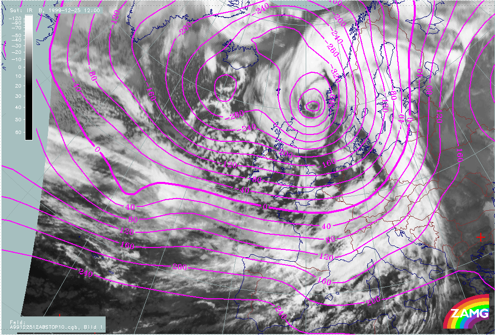
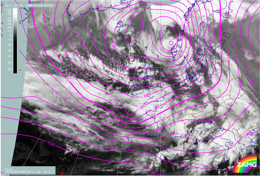
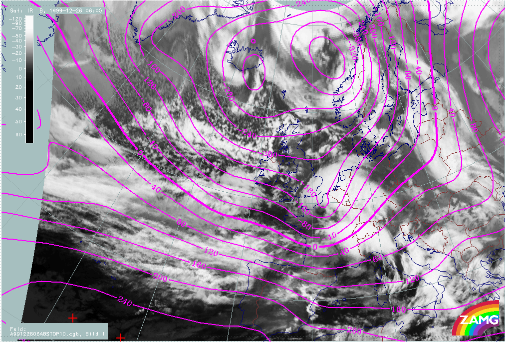
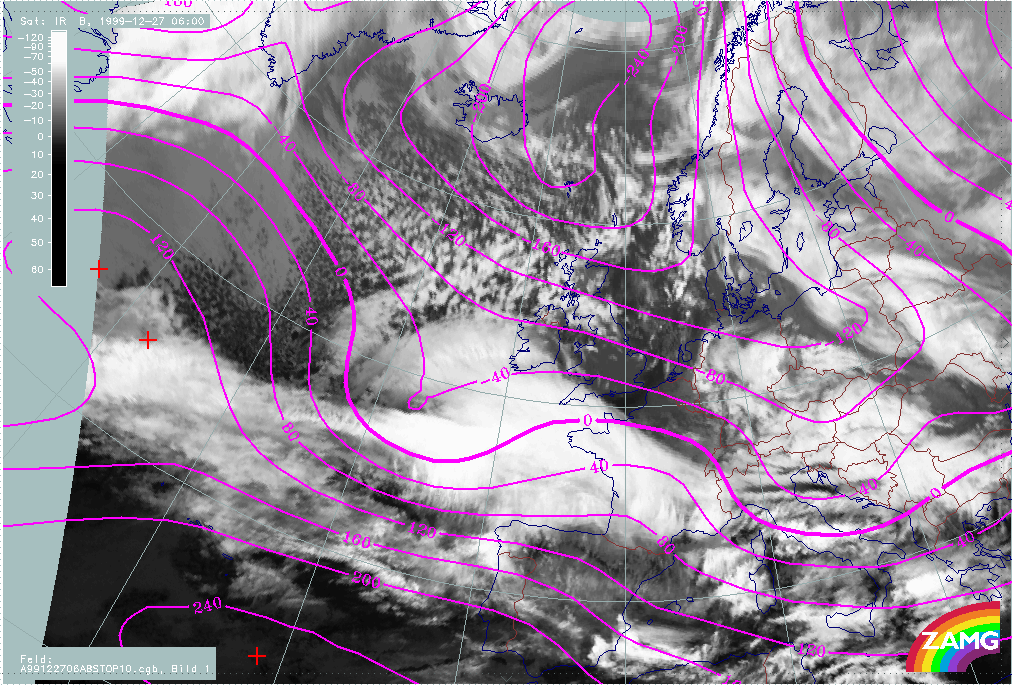
A loop showing changes in surface height at 1000 hPa, from 25 December/06.00 UTC to 26 December/12.00 UTC, shows: the deepening of the surface low corresponding to Lothar, a weak and not intensifiying surface trough corresponding to Lothar successor and the relationship between the surface lows and typical cloud features.
|
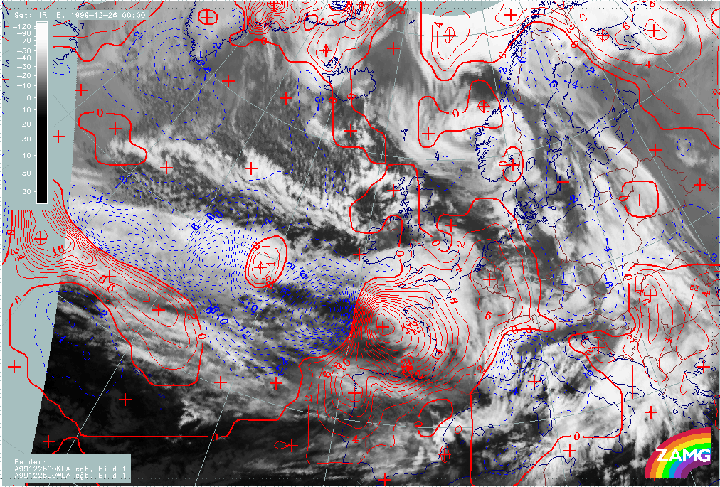
25 December 1999/06.00 UTC - Meteosat IR image; magenta: height contours 1000 hPa; 25/06.00 - 26/12.00 UTC 6-hourly image loop
|
|
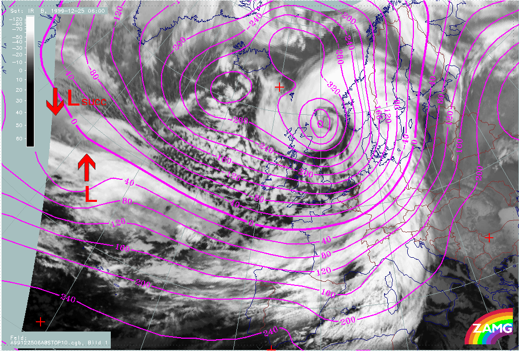
The following remarks can be summarised:
- There is a surface minimum throughout the whole phase associated with the frontal cloud band, however, during the whole period there is no low centre with closed isolines shown in the model analyses.
- For Lothar, there is a remarkable deepening of the surface minimum, from values of 0 - 40 gpm to values of (-180 gpm), between 25/06.00 and 26/06.00 UTC;
- Relationship between the surface minimum and cloud features:
- Period 25/06.00 - 12.00 UTC
The surface depression is associated with the cloud dissipation area within the zonal frontal cloud band; there is not yet any relationship with the cloud head; - Period 25/18.00 - 26/00.00 UTC:
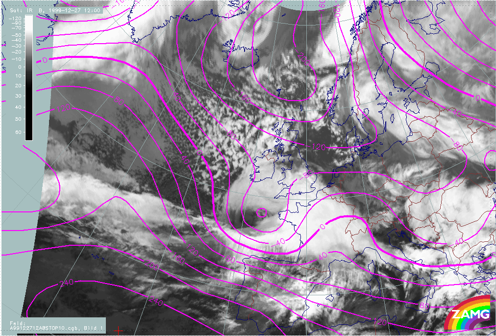
The location of the surface depression is shifted northward to the transition area between the cloud head and the higher cloud within the zonal frontal cloud band; - Period 26/06.00 - 12.00 UTC:
The surface depression is clearly associated with the area of "Rapid Cyclogenesis".
- Period 25/06.00 - 12.00 UTC
- The cloud features of "Lothar successor" are associated with a surface trough with rather weak curvature; there is no intensification of this trough during this phase.
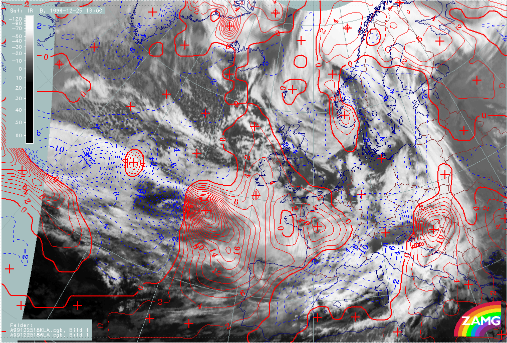
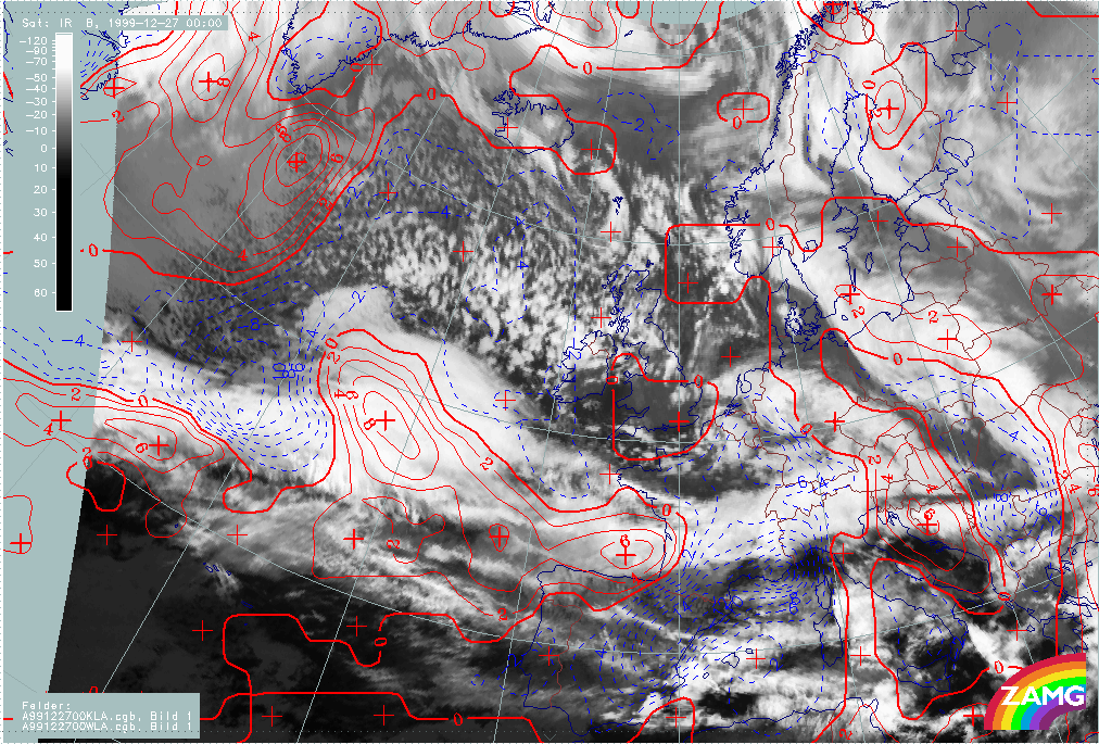
The field of TA is another parameter which can be used to indicate Wave development. For well developed Waves there is usually a juxtaposition of a WA maximum within the cloud bulge and a CA maximum in the cold air immediately behind the Wave. The zero line of TA crosses the Wave and surface low.
|
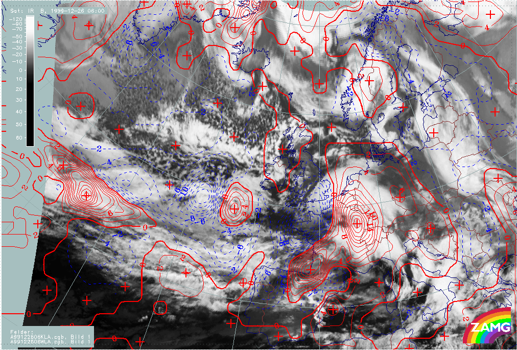
25 December 1999/06.00 UTC - Meteosat IR image; red: temperature advection - WA 700 hPa, blue: temperature advection - CA 700 hPa; 25/06.00 - 26/12.00 UTC 6-hourly image loop
|
|
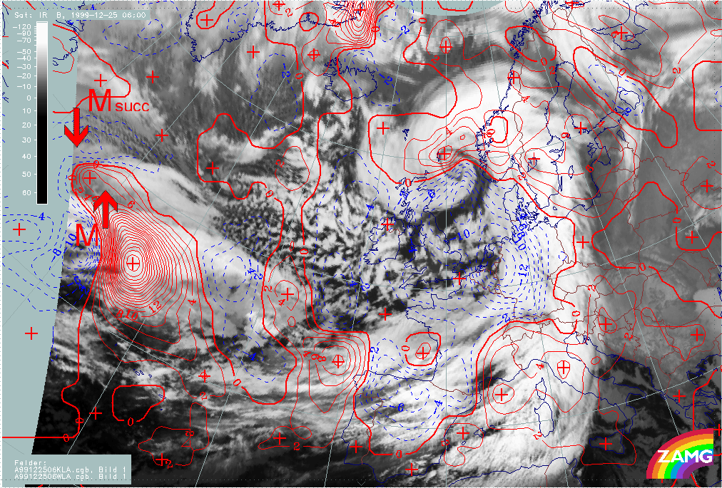
The following remarks can be summarised:
- There are very strong CA-WA maxima within the region of "Rapid Cyclogenesis" during the whole process;
- The maximum of CA coincides very well with the area of cloud dissipation in the frontal cloud band; in this region another CM, the "Front Decay" could be valid, for which meso scale CA is a indicative factor;
- The WA maximum is close to the Warm Front cloud shield but the coincidence of both is not perfect in the early phases of the storm;
- The cloud head area in the early phases is under the influence of CA; only during the later phases can WA be associated with some parts of the cloud head. However, the western part of cloud head is under CA during the whole phase; this deviates somewhat from the ideal concept of "Rapid Cyclogenesis".
- In the active period of "Rapid Cyclogenesis", the spiral centre is in accordance with the zero line of TA.
- For "Lothar successor" there is a distinct juxtaposition of small to meso scale WA and CA maxima during the whole phase; but, as for Lothar, the WA is superimposed on the frontal cloud band and only partially on the cloud head of "Lothar successor"
- A dramatic increase in the intensity of the WA maximum takes place on 26 December between 09.00 an 12.00 UTC; this is coincident with the phase where there is the appearance of the Dark Stripe in WV imagery, indicating the immediate start of Rapid Cyclogenesis.
Both parameters (height of 1000 hPa and the TA at 700 hPa) indicate the existence of intensive Wave development for Lothar. For Lothar successor the situation is basically similar as there is a surface trough and WA/CA maxima, however, there is no deepening of the surface height field. There is, currently, no explanation for this.
Martin
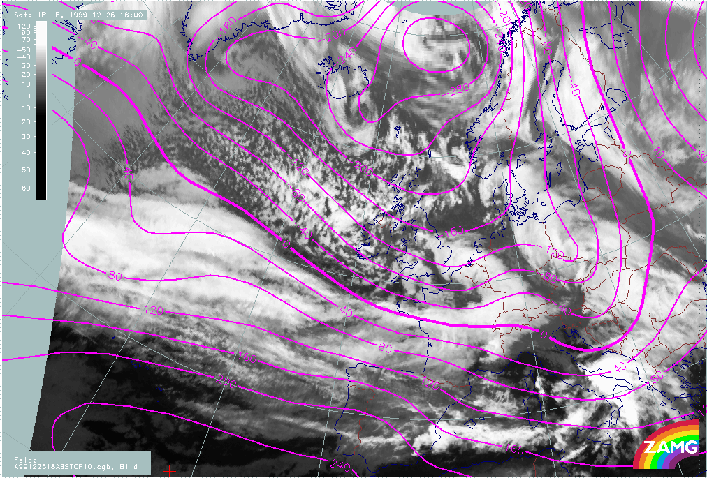
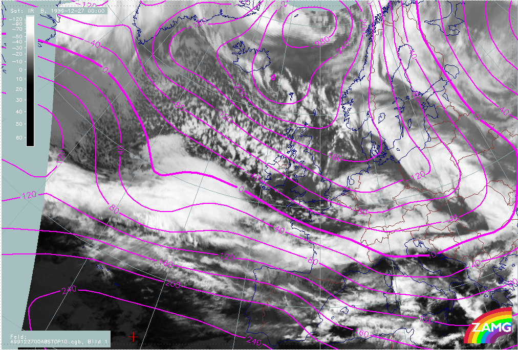
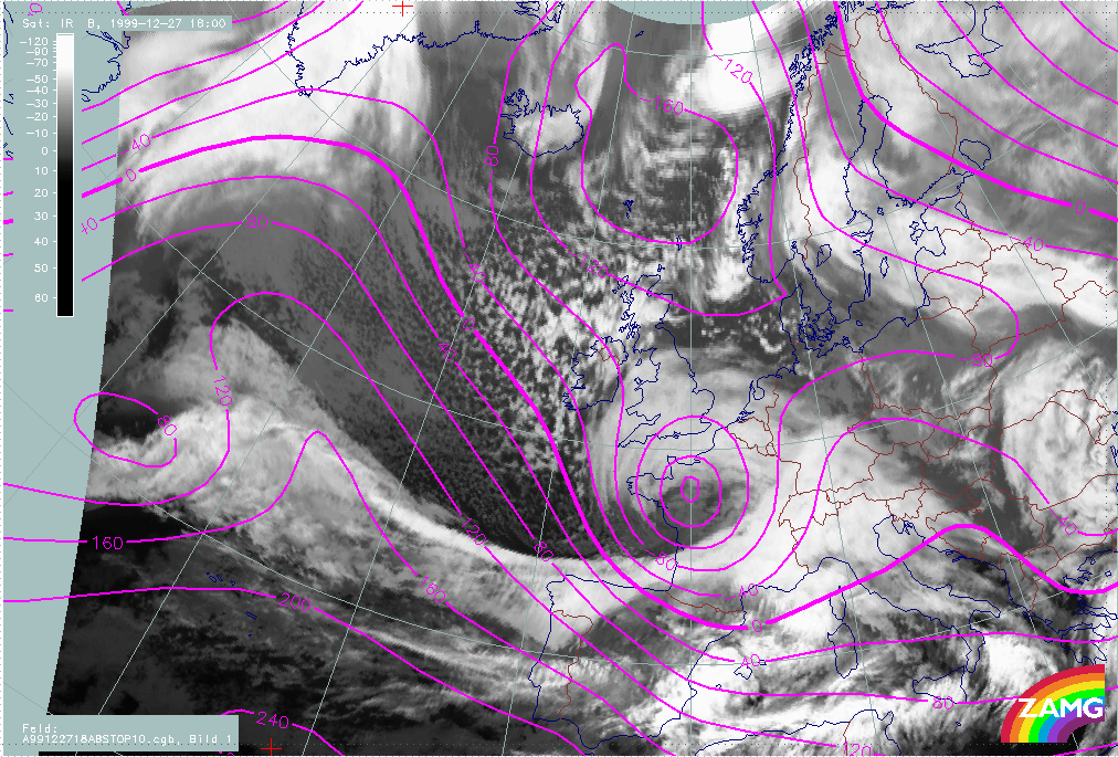
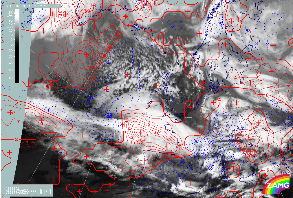
The loop showing changes in surface height at 1000 hPa from 26 December/12.00 UTC to 27 December/18.00 UTC shows several interesting features: the deepening of the surface low corresponding to Martin, and its associated cloud features.
|
26 December 1999/12.00 UTC - Meteosat IR image; magenta: height contours 1000 hPa; 25/06.00 - 26/12.00 UTC 6-hourly image loop
|
|
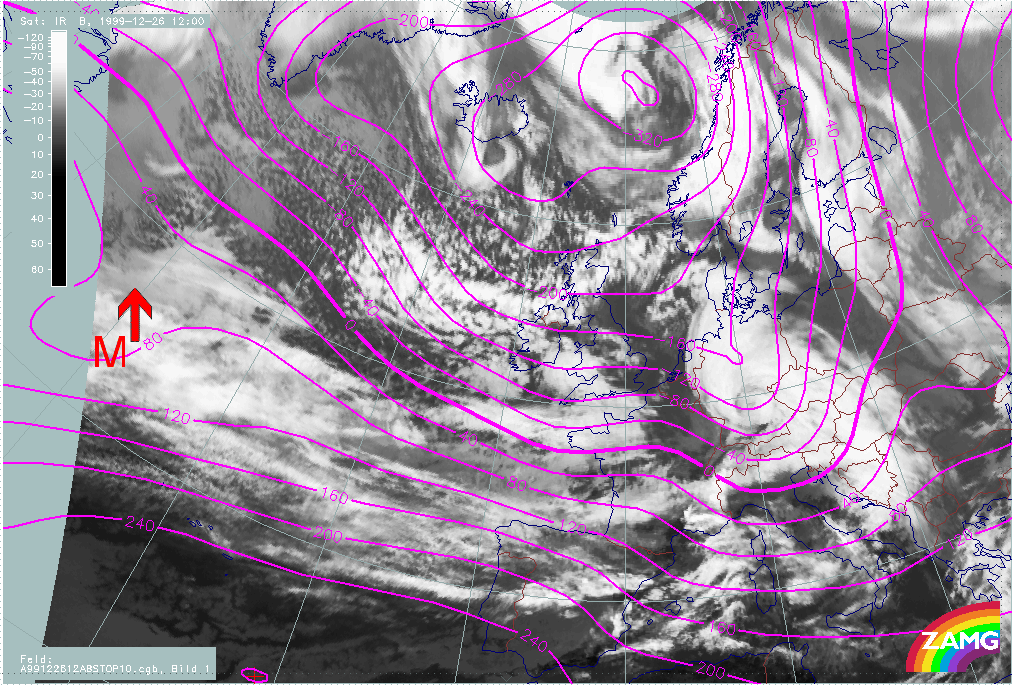
The following remarks can be summarised:
- There is a well marked surface low during the whole period which becomes intense in the later phases of the storm; a closed low centre appears in the isolines during the Rapid Cyclogenesis (not seen with Lothar).
- A deepening of the surface minimum from values of 40 - 80 gpm to (-200 gpm) takes place between 26/12.00 UTC and 27/18.00 UTC;
- Unlike Lothar, the low centre comprises the low cloud head and the zonal frontal cloud band during the whole period.
- The surface low of Lothar successor (seen in the eastern parts of the image) only becomes more intense in the later phases of the storm, where a merging of different cloud systems takes place.
|
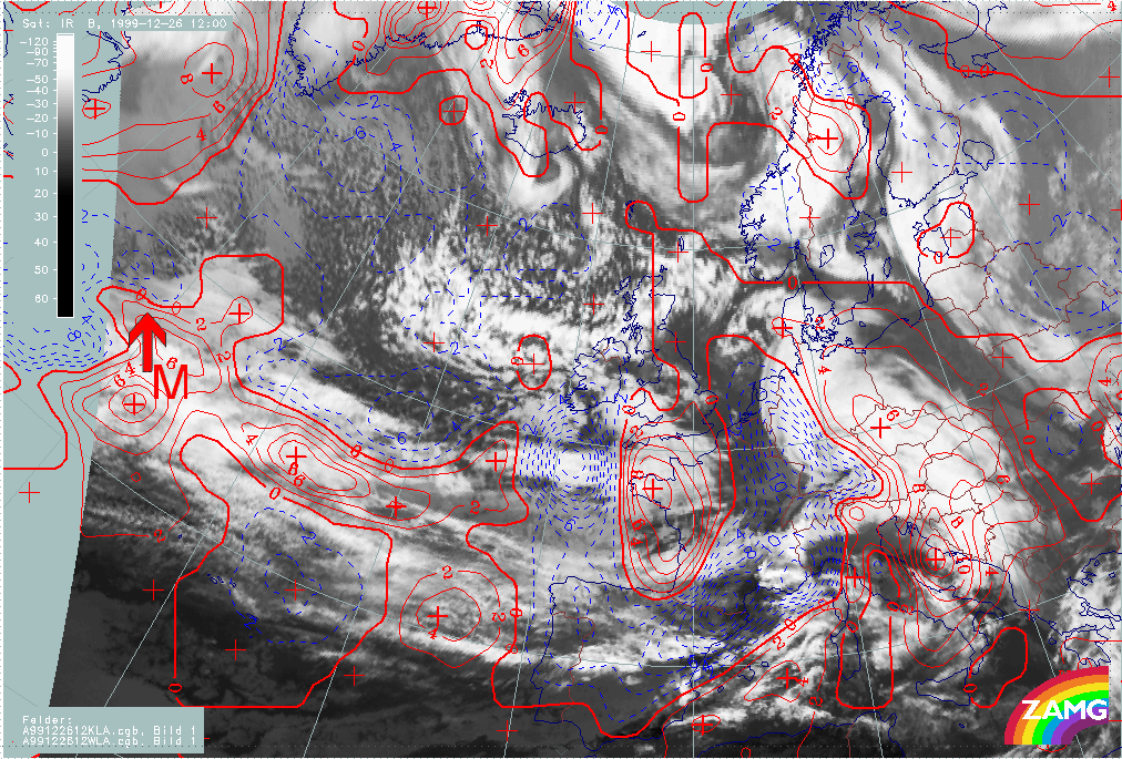
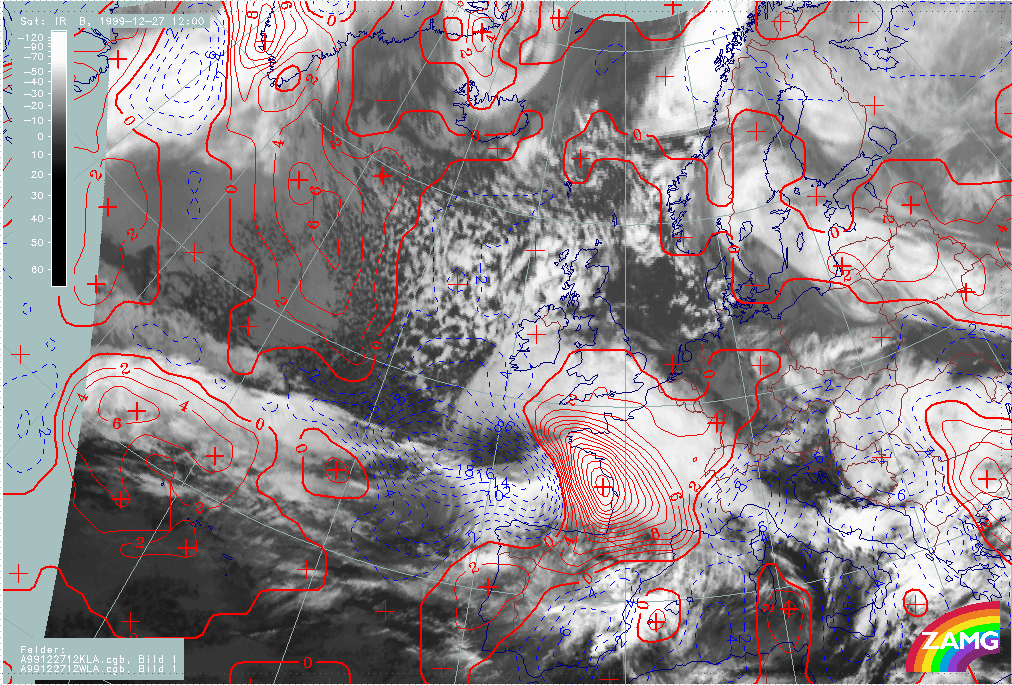
26 December 1999/12.00 UTC - Meteosat IR image; red: temperature advection - WA 700 hPa, blue: temperature advection - CA 700 hPa; 25/06.00 - 26/12.00 UTC 6-hourly image loop
|
|
The following remarks can be summarised:
- As for Lothar and Martin, very strong CA-WA maxima can be detected near the region of "Rapid Cyclogenesis";
- Although the CA maxima are very intense even for Martin, there is, no notable dissipation of frontal cloud;
- The WA maximum corresponds to the Warm Front Shield; compared to Lothar, the cloud head area is much more under the influence of WA; the splitting Comma feature lies within CA; during the rapid development of the cloud head, its western part is again under the influence of WA;
- As for Lothar, the distribution of TA in the Martin case deviates from the ideal Wave configuration of the TA field;
- In the rapid development period, the spiral centre is close to the zero line of TA.
- During the further development of Lothar successor, the CA region broadens and increasingly contains the cloud spiral.
For Lothar and Martin, both parameters (the height of 1000 hPa and the distribution of TA) fulfill one pre-condition of "Rapid Cyclogenesis" and indicate a Wave feature in the appropriate area.