Clear air turbulence near deep convective clouds
It should be noted that transverse cirrus bands with a hint of clear air turbulence can also be observed above or around deep convective clouds. An example is described in the case study of 25 May 2009. In the morning of that day, Meteosat observed an interesting convective system over Northern France, with strong overshooting tops, a high-level plume and radial cirrus clouds. The Meteosat-8 rapid scan loop (HRV channel) from 6:00 to 7:00 UTC shows the high-level plume and the radial cirrus clouds. Gordon Bridge, who was flying through the area of radial cirrus clouds from London over Belgium to Frankfurt (see marked line in Fig. 3.29) noted some moderate turbulence at around 35.000 ft in the vicinity of Brussels, which interrupted the serving of refreshments for a short while. This moderate turbulence could well have been what is called "convectively induced turbulence".
The following image shows some of the wave structures, but MSG SEVIRI has too coarse a resolution to detect the smaller waves (less than 5 km wavelength), which are visible in MODIS images.
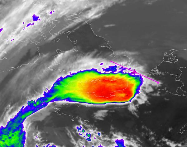
Fig. 3.29: 25 May 2009, IR10.8, 06:45 UTC. Particular wave structures [EUMETSAT]
This case of deep convection contains a very good example of gravity waves. If wind shear is weak, gravity waves look like concentric ripples. In the presence of strong wind shear, the waves can break (KelvinHelmholtz instability) and cause clear air turbulence.
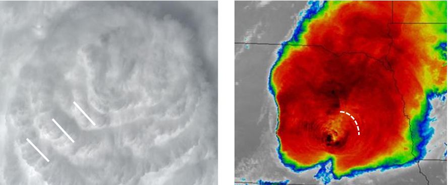
Fig. 3.30: Gravity waves on top of thunderstorms [Pao K. Wang, Wisconsin]
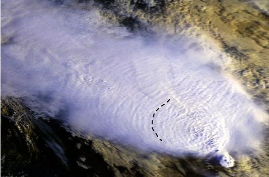
Fig. 3.31: Gravity waves on top of thunderstorms [Pao K. Wang, Wisconsin]