Clear air turbulence in the vicinity of jet fibres
Jet fibres are long and narrow stripes of high, cold clouds. These clouds indicate a jet axis and CAT
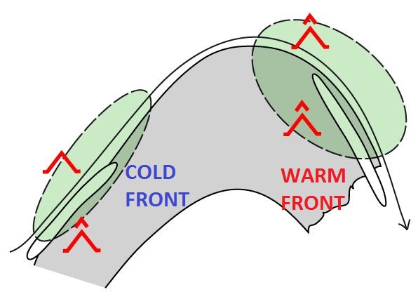
Fig. 3.1: Conceptual model of jet fibres [SatManu]
It has been observed that jet fibres are mostly found over warm front shields or behind a cold front.
Jet fibres are high altitude cirrus clouds with no connection to the surface weather. However, as they occur along the jet streak, jet-related phenomena such as turbulence can be expected in that region.
Turbulence generally occurs in a zone of high horizontal and vertical wind shear around the jet streak. Furthermore, a sharply curving jet stream on the poleward side of a warm front shield is associated with greater turbulence than a straight jet stream behind a cold front.
Figures 3.2 and 3.3 show jet fibres in the Dust RGB. Thin, high level ice clouds such as jet fibres appear black in this RGB combination, and can be distinguished from thick clouds, which appear red.
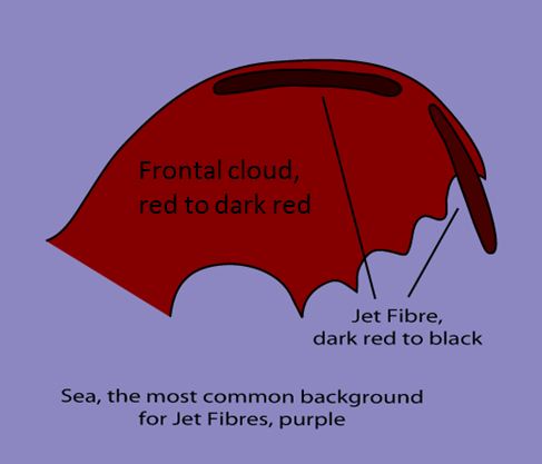
Fig. 3.2: Jet fibres in the Dust RGB [SatManu]
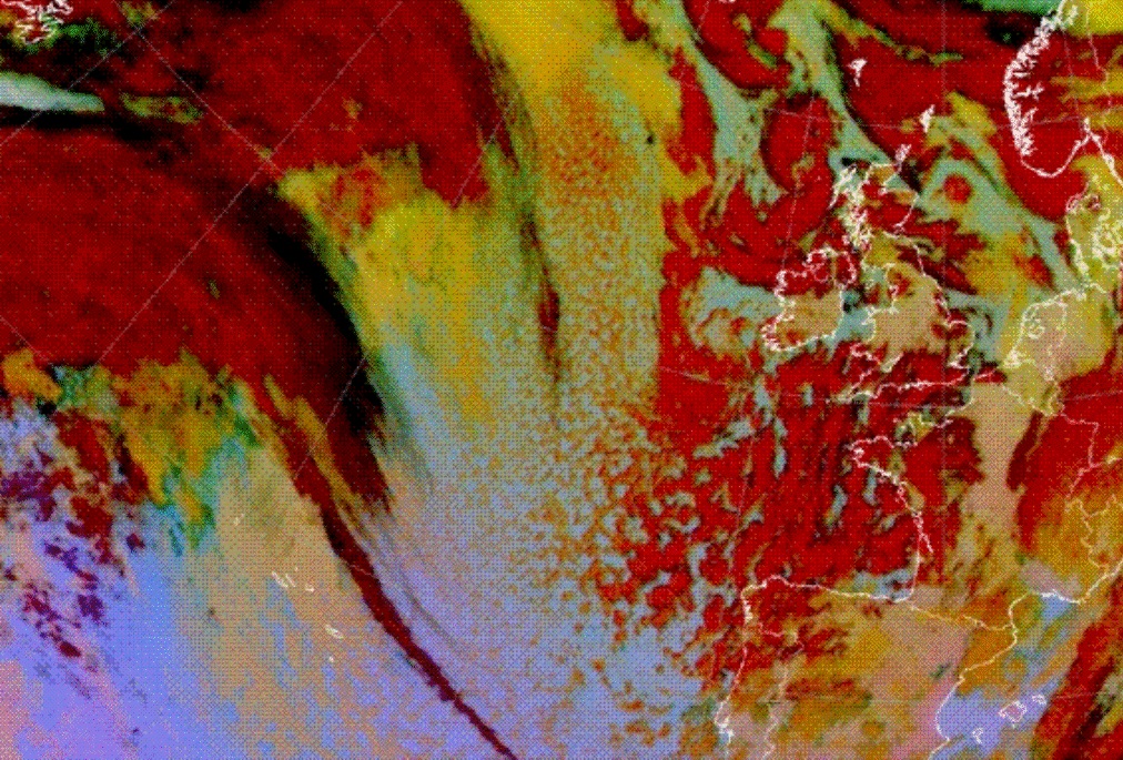
Fig. 3.3: 20 January 2009, 06 UTC, Meteosat 9, Dust RGB
When a fiber appears above a lower-level cloud feature, the cloud texture is different, which makes the fiber distinct from its surroundings. Jet fibres can appear anywhere jet streams are found, but they are easier to detect above the sea than over land because they contrast more strongly against the sea surface. In most cases jet fibres persist for 8 to 12 hours.
Please see the Manual of Synoptic Satellite Meteorology (SatManu) for more details on Jet Fibres .