An operationally usable method to find regions with potential for CAT:
- Compare the schematics in Figure 3.16 with the 300 hPa geopotential analysis to find areas with potential for CAT.
- Look for cloud patterns typical for CAT in different satellite images.
- Compare observations and analysis with the forecast. The result of the comparison is a good basis for your own aviation forecasts.
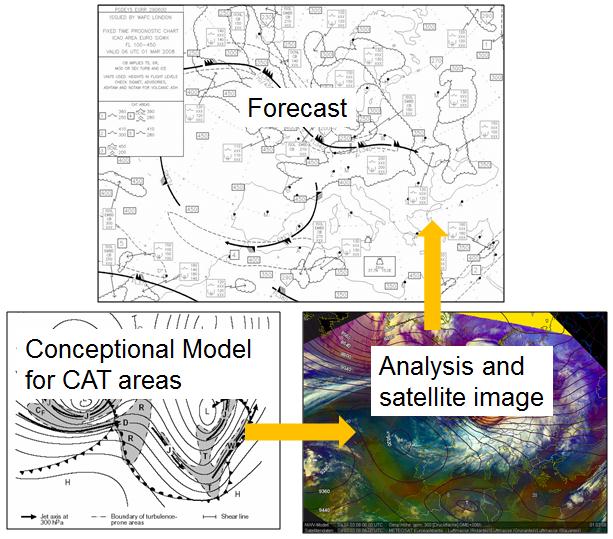
Fig. 4.1: An operationally usable method to find potential CAT areas
Click on the small image to enlarge it. The Conceptual Model image also contains a legend for the letters of different CAT areas.
This training module was designed to teach you the correlation between clear air turbulence and some cloud patterns that are typical for these situations. In many cases satellite images provide the first clue or a confirmation for the presence of CAT, and they are one of the most important parts of the decision-making process surrounding CAT.