
Satellite skills and knowledge for operational meteorologist
Listed here are other resources related to Satellite skills and knowledge for operational meteorologist tag:
Note: click on an image to open the Resource
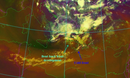
Christo Georgiev (NIMH) presents influence of synoptic and mesoscale dynamical process, through water vapour imagery, on the intensification of wildfires.
Studies of large fires in Australia, Tasmania, USA and Southeastern Europe have shown a link between fire activity and dry stratospheric intrusions with downward transport of energy and momentum down to the lower troposphere. In such cases the rapid increase of fire activity was accompanied by a dry band in satellite Water Vapour (WV) imagery, which is indicative of pronounced descent of upper-tropospheric or stratospheric air which is normally much dryer than the lower tropospheric one and has much higher potential vorticity. When these descending air masses, reach the Earth’s surface they affect the wind speed, moisture and ozone concentration, which could generate a spike in fire activity.
Case-study examples of such severe events over areas of Central and Eastern Mediterranean are considered in the presentation. Combination of WV imagery, satellite soundings and satellite estimations of fire radiative energy contribute to better understanding of dry stratospheric intrusion depth and related dynamical processes, which govern the intensification of wildfire occurrence and spread.
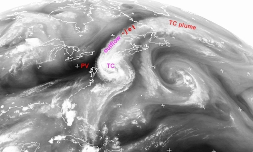
Christo Georgiev (NIMH) discusses the effect of vorticity on tropical cyclones and development of severe thunderstorms, through the scope of water vapour imagery.
Water vapour (WV) images provide useful information to anticipate the effects of upper-level dynamic environment on the intensity of a tropical cyclone (TC) as well as on its extratropical transition (ET), a gradual process in which a TC loses tropical characteristics and becomes more extratropical in nature. Analyses of WV imagery shows that during ET stage over subtropical areas, advection of potential vorticty anomaly can influence the ET and control the process.
Large amounts of water vapour, originated by TCs may be involved in transfer of moisture by planetary waves, associated with ET developments and give rise to a narrow regions of strong meridional water vapour flux. The presentation shows WV imagery synoptic-scale analysis, which shows supply with additional large amount of moisture of an existing already favourable convective environment. The
combination lead into an environment with very high CAPE and potential to accelerate upward, acquiring kinetic energy and forming strong vertical motions in a deep tropospheric layer. The process is illustrated by a case of catastrophic hailstorm over Bulgaria, Eastern Mediterranean.
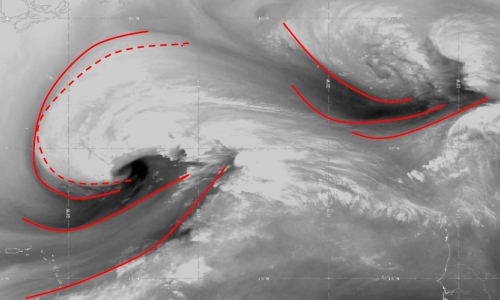
Nataša Strelec-Mahović (EUMETSAT) shows and analyses several cases of water vapour structures in the atmosphere using satellite imagery.
Features occurring in the WV6.2μm images indicate the processes going on in the atmosphere, since these dark (dry) and white (moist) structures result from a combination of vertical motion, moisture advection and horizontal deformation within the mid and upper troposphere. Frequently, water vapour images reveal structures such as dark stripes, mountain wave signatures, or circular or spiral formations known as water vapour eyes, eddies or vortices. We will look at how these features can be used as tracers of three-dimensional atmospheric motions on the meso- and synoptic scale and how they relate to e.g. jet-streams, upper-level lows or turbulence.

Christian Herold (DWD) investigates the usefulness of IASI L2 products in nowcasting, detecting and analyzing sting jets in rapid cyclogenesis.
Strong winds southwest of the center of a Shapiro-Keyser-Cyclone are often associated with a cold conveyor jet or a sting jet. The sting jet is a strong mesoscale flow with a very high damage potential. It is a massive challenge for NWP and forecasters to correctly predict a sting jet. The question is, can IASI profiles help forecasters for a better prediction of such mesoscale severe wind events connected with sting jets? In this specific context, some case studies will be presented.
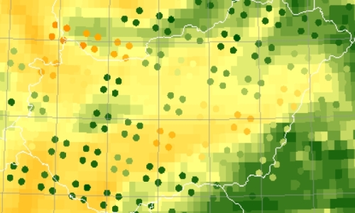
Zsofia Kocsis (OMSZ) talked about the reasons behind the experiment of merging SYNOP data with the IASI L2 profiles.
Using IASI L2 profiles, different instability indices (e.g. Lifted Index, CAPE) and water vapour content in different layers can be determined, which provides information on the convective environment. These indices were studied in several convective cases which led us to try to merge the IASI profiles and Synop measurements. In this presentation we present the reasons why we choose to combine these different measurements and we also present some of our experiences with the blended IASI product.
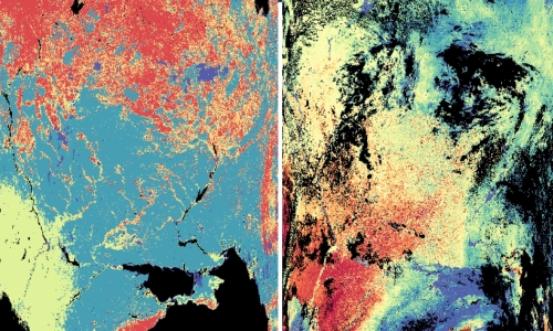
Phil Watts and Loredana Spezzi (EUMETSAT) give an overview of the possibilities of water-vapour retrieval of the future EPS-SG satellites.
The METimage instrument on board of the future EPS-SG satellite series opens a new era for the retrieval of water wapour imaging products at EUMETSAT. Equipped with 20 channels covering the spectral range 0.4-13μm and including both Near infrared and thermal infrared water vapour absorption bands (0.9, 6.7 and 7.3μm), METimage will allow the retrieval of operational water vapour imagery products with unprecendented resolution (down to 500m) from a low-Eart orbit. These products are expected to greatly enhance the EUMETSAT service in support of numerical weather prediction, nowcasting and climate monitoring.
In this contribution, we report the retrieval approach chosen for METimage water vapour imagery products and demonstrate it using MODIS measurements. We focus in particular on the uncertainty and quality assessment planned for these products. We aim at gathering the fundamental user feedback to achieve the state-of-the-art retrieval and validation approach, and to foster cooperation and exchange for the analysis and characterization of these products once they become available. In particular, we would like to discuss key points that have an impact on the use of our products in forecasting applications (such as the use of prior forecast information in the retrieval, the product spatial resolution and content (e.g., uncertainties, quality indicators, diagnostic parameters, etc., and the advantage of combining NIR/IR measurements, not available from previous EUMETSAT missions).
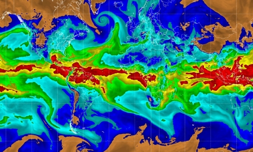
Sheldon J. Kusselson (CIRA) shows us the Advected Layered Precipitable Water (ALPW) and Total Precipitable Water (TPW) products and how to apply them for forecasting hazardous events.
Water vapor availability is a key factor in forecasting heavy precipitation. Passive microwave instruments onboard several polar orbiting spacecraft measure emission from water vapor and provide a capability to sense layers of and total water vapor in the atmosphere. Via fusion of passive microwave retrievals from five or more polar orbiting spacecraft and model wind fields, the Advected Layered Precipitable Water (ALPW) and Total Precipitable Water (TPW) products are created hourly. The new ALPW product and upgraded Total Precipitable Water products, including a percent of normal TPW product, will become operational for forecasters in 2023. In the meantime, CIRA already produces the products hourly on the internet. During the past decade applications for the ALPW and TPW products have been developed for many different types of weather events, with a focus on heavy precipitation. This presentation will highlight applications for various weather hazards such as heavy rain causing flooding and heavy snow. Case studies using applications for the ALPW and TPW products in different parts of the world, including Europe, will be presented.
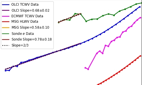
Xavier Calbet (AEMET) presents his work on water vapour variability in the atmosphere and the effect of the variability on the water vapour fields in its vicinity.
Water vapor at small scales (< 6 km) behaves, on average, in an stochastic way. This behavior can be described by simple stochastic models (Gaussian Random Fields). Knowing the variability (or turbulence) of water vapor in a location, mainly via measurements, we can infer the statistical characteristics of water vapor fields in its vicinity. This model will help us in: determining whether water vapor measurements from satellites can be more or less biased, integrate different water vapor measurements coming from differing spatial scales together in a coherent way, estimate the turbulence that is potentially present in the atmosphere. Direct consequences of this concept regarding Nowcasting still need to be explored in the future.
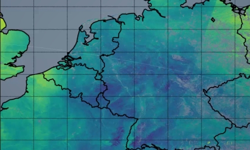
Jan El-Kassar and Cintia Carbajal Henkel (Free University of Berlin) talk about their efforts to develop an optimal estimation algorithm for the 0.865 and 0.914 micrometer bands to retrieve a total column water product.
MTG-FCI will feature a band configuration in the rho-sigma-tau absorption band of water vapour (0.865 and 0.914 microns). We are developing an optimal estimation algorithm for these two bands to retrieve a total column water vapour product, which will be highly sensitive to boundary layer moisture.
We show preliminary results from a first prototype based on COWa (Copernicus Sentinel-3 OLCI Water Vapour) applied to spatially high-resolved data (~300m) from the Ocean and Land Colour Imager (OLCI) onboard the polar-orbiting satellites Sentinel-3.
In a next step we analyse the relationship between spatial variability metrics in the water vapour field and convective initiation over Germany, exploiting the advanced observation capabilities of current and future satellite-based imagers.
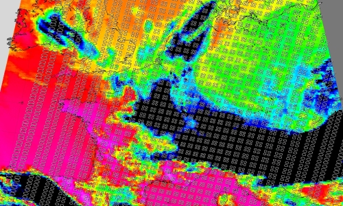
Thomas August (EUMETSAT) presents the current polar satellite sounders and makes a comparison with the capabilities of the future MTG infrared sounder
Satellite infrared sounders like IASI allow retrieving the vertical structure of the atmospheric humidity. Their measurements are exploited in synergy with the microwave (MW) sounders, when such companions are present on the same platforms as is the case in the operational EUMETSAT Polar System (EPS) programme and in the EPS-Second Generation (SG). This synergy increases the yield and quality of sounding in cloudy pixels. The future infrared sounder (IRS) onboard Meteosat Third Generation (MTG) will operate without MW companions. It will however provide unprecedented spatio-temporal sounding, with a typical ground-resolution of 7km and observations every 30 minutes over Europe.
The extensive utilisation of machine learning guarantees the provision of reliable atmospheric temperature and humidity profiles and uncertainty estimated within less than 30 minutes from sensing. We present here the characteristics of satellite thermodynamic profiles from the current and future missions and the experience made in studies with meteorological services to contribute to nowcasting severe weather events, and prepare to the future sounder missions.
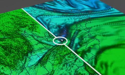
Bryan Guarante (University of Wisconsin) uses a COMET course to explain the usefulness of analysing water vapour images with a goal of assessing the NWP fields.
In dynamically-active regions of the atmosphere, water vapour imagery approximates the same surface as the 1.5PVU height or pressure surface. Because of this, we can take advantage of the WV channels to find areas of mismatch between the NWP and the real atmosphere to adjust our synoptic scale forecasts.
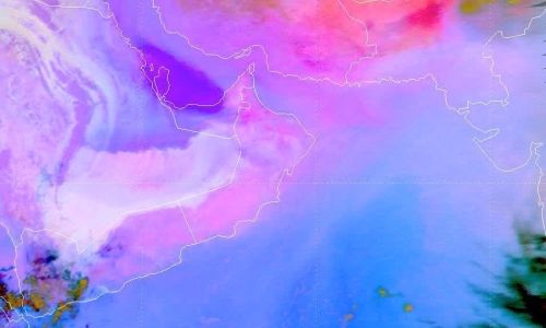
Ivan Smiljanić (EUMETSAT) shows how the current MSG satellites can see low-level moisture and how does the moisture affect the weather.
High humidity in the air, close to the ground, could make you feel soggy in the summer but otherwise you won’t notice it. So why is it important to know all about it – is there a lot or very little moisture, where is it, what are dynamics of the moisture field? Well, moisture is really a key ingredient for many features in the atmosphere that can affect our daily lives to a high degree, from thunderstorm clouds to a fog or rime. In this session we will see how water vapour becomes a fuel for features in atmosphere to form, through a few real examples.