
Land
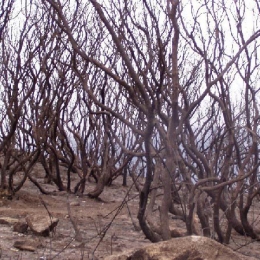
Every summer forest fires make it to the headlines. This training module will explain all the meteorlogical aspects associated to forest fires give you a wide range of products.
The past decade forest fires have received much media attention due to the impact it has in environmental terms. This CAL is mainly for forecasters that deal with forest fires. However, the module may be used by others dealing with forest fires like, civil protection agents, fireman or forecasters.
The purpose of this training module is to give an overview on the different RGB types created from the AVHRR instrument.
This training module describes MetOp AVHRR (Advanced Very High Resolution Radiometer) RGB schemes that are based on EUMETSAT recommendations. The 'recipes' were tuned to create high quality MetOp/AVHRR RGB images as similar as possible to the SEVIRI RGB schemes recommended by EUMETSAT.
The main aim of the training module is to help the users (weather forecasters and/or other experts) understand and use these RGB types by giving them background information, examples and exercises.
The module takes the following structure:
- The aim of the RGB type
- Physical background
- How to create the given RGB type
- Typical colors
- Examples of interpretation
- Benefits and limitations
- Comparisons with other RGB types and/or single channel images
- Exercise
Jean Christophe Calvet talks about the assimilation of H-SAF soil moisture products into models.
Length: 28 minutes.
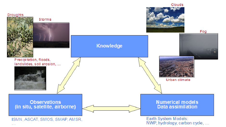
In situ and satellite-derived soil moisture observations are needed to better understand and simulate land surface processes. This has been the subject of active research for more than two decades. The transfer to operations in weather forecast, hydrometeorological, and drought monitoring applications also implies the integration of satellite-derived observations into models. Examples of the use of soil moisture observations, simulations, and data assimilation are presented.
Silvia Puca introduces the H-SAF and its products.
Length: 23 minutes.
H SAF started in 2005 and aims to provide remote sensing estimates of relevant hydrological parameters: instantaneous rain rate and cumulated rainfall, soil moisture at surface and in the root zone, snow cover and water equivalent. The project involves experts from 12 national meteorological and hydrological European Institutes of Austria, Belgium, Bulgaria, Finland, France, Germany, Hungary, Italy, Poland, Romania, Slovakia and Turkey, and from ECMWF.
The H SAF main objectives are: to provide new satellite-derived products (precipitation, snow parameters and soil moisture) from existing and future satellites with sufficient time and space resolution to satisfy the needs of operational hydrology, and to perform independent validation in order to assess the usefulness of the new products for fighting against floods, landslides, avalanches, and evaluating water resources.
David Fairbairn presents examples of downloading, converting the format to regular netCDF files and visualizing the data in Python.
Length: 19 minutes.
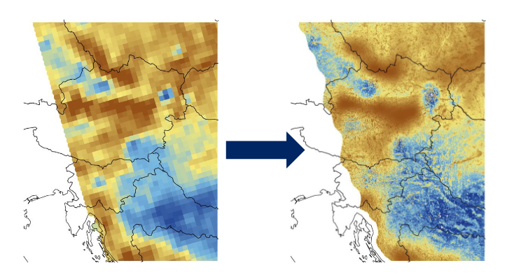
H-SAF root-zone soil moisture products are freely available online. They are currently stored in daily files on a reduced Gaussian grid in GRIB binary format, which increases storage efficiency. Examples of downloading, converting the format to regular netCDF files and visualizing the data in Python are presented. The new metview-python package is also introduced, allowing direct applications in GRIB format.
Apostolos Giannakos introduces the Python library that can be used for reading, comparison and validation of soil moisture datasets.
Length: 27 minutes.
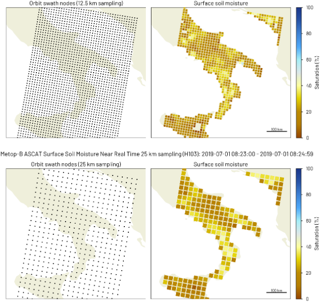
H-SAF Surface Soil Moisture (SSM) products that are comprised of Near Real-Time (NRT) SSM products and Climate Data Record (CDR) products are freely available at the H SAF data portal. Examples of downloading, reading and displaying SSM data in Python are presented. Ascat python software package that reads and converts data derived from the Advanced Scatterometer (ASCAT) on-board the series of Metop satellites and pytesmo python library that can be used for reading, comparison and validation of geospatial time series soil moisture datasets are introduced.
Sebastian Hahn discusses the algorithmic background of the ASCAT SSM retrieval and describes the properties and characteristics of currently available ASCAT SSM products.
Length: 32 minutes.
H-SAF Surface Soil Moisture (SSM) products are derived from the Advanced Scatterometer (ASCAT) on-board the series of Metop satellites operating in space since more than 14 years. The SSM retrieval is based on a semi-empirical change detection method developed by TU Wien, which exploits the multi-incidence angle measurement capability of the fan-beam scatterometer ASCAT. While ASCAT Near Real-Time SSM products are most current and well suited for Near Weather Prediction (NWP), ASCAT Climate Data Record (CDR) products ensure long-term consistency and stability. This presentation will discuss the algorithmic background of the ASCAT SSM retrieval and describe the properties and characteristics of currently available ASCAT SSM products.
The presenters show examples for the use of SM data in identifying drought conditions in some regions worldwide.
Length: 25+14 minutes.
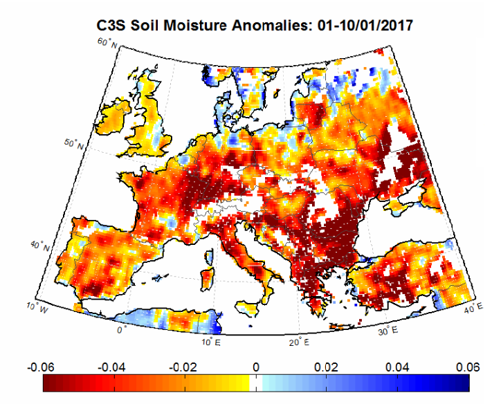
Satellite soil moisture (SM) products are highly suitable for monitoring agricultural drought. As satellite SM products cover long time periods and are available for large regions, the spatial and temporal analysis of drought conditions can be performed. The presentation will describe the theoretical background for performing drought analysis with satellite SM data, and will show some examples for the actual use of the data in identifying drought conditions in some regions worldwide.
Simone Gabellani and Fabio Delogu describe how soil moisture estimated trough satellite can be compared and validated with other sources of information.
Length: 38+39 minutes.
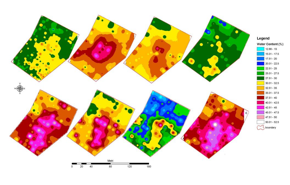
Soil Moisture is a crucial variable in hydrological applications. It can be measured and estimates in different way and along different spatial and temporal scale. The presentation describes how soil moisture estimated trough satellite can be compared and validated with other sources of information; theoretical basis and practical example will be showed.
Stefania Camica and Lucca Brocca describe the theoretical background for using satellite SM products in flood prediction.
Length: 19+24 minutes.
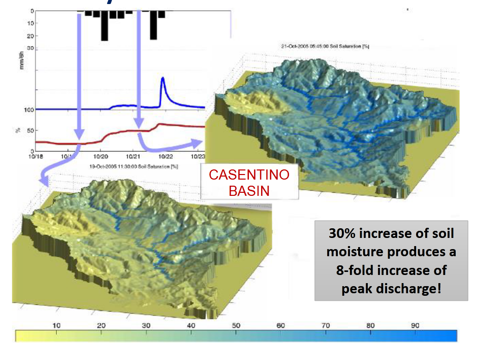
Satellite soil moisture (SM) products have been largely used for flood prediction. The knowledge of initial soil moisture conditions before a rainfall event is critical to determine the magnitude of a flood event. The presentation will describe the theoretical background for using satellite SM products in flood prediction, and will show examples for understanding the critical role of initial soil moisture for predicting floods.
Nicola Berni presents the impact of soil moisture products for flood and land slide warning.
Length: 17 minutes.
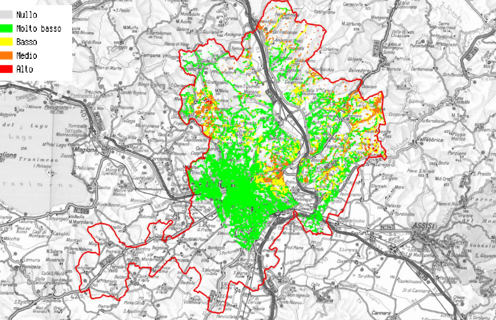
Umbria Region Civil Protection Early Warning center (Central Italy) is in charge of alerting and monitoring critical events for Civil Protection purposes (mainly landslides and floods). In last ten years the office has used, in cooperation with national research institutes, satellite data to improve modeling/forecasting tools performances, monitoring activities about possible impacts of severe rainfall events able to trigger floods and landslides at regional scale. In fact, the estimation of the soil water content has proved to be a key parameter for better forecast models implementation both for landslide than for flood risk issues.
Elina Tuhkalainen treats the formation and dissipation of fog at airports in Finland.
Length: 35 min
Author: Elina Tuhkalainen (FMI)
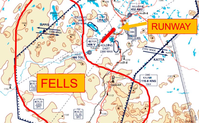
In this presentation formation and dissipation of fog and stratus will be treated. The presenters will also address how these phenomena occur around the year and how they affect the services at the airports in Finland.