
Land
Hans De Vries focusses in his presentation on the situation in The Netherlands, where storm surge forecasts are generated by WMCN and KNMI.
Length: 45 min
Author: Hans de Vries (KNMI)
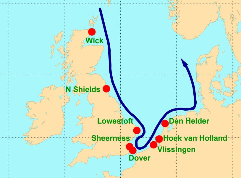
Several countries along the North Sea have densely populated areas and major political and economic activities close to the coast - places that are vulnerable to storm surges. To protect these areas coastal defence requires continuous attention. Several storm surge barriers have been constructed over the last decades that can be closed if the water level rises too high. Examples are the Thames Barrier in London and the Maeslantkering near Rotterdam. To alert local authorities and to operate the movable barriers efficiently, good and timely storm surge forecasts are essential. These forecasts make use of state-of-the-art meteorological forecasts and techniques like ensemble forecasting. This presentation will focus on the situation in The Netherlands, where storm surge forecasts are generated in close cooperation between the Water Management Centre Netherlands (WMCN) of Rijkswaterstaat and the Royal Netherlands Meteorological Institute (KNMI).
Presentation 1 of the Environment Event Week 2016
Length: 30 min
Author: Oleg Dubovik (University of Lille)
The GRASP (Generalized Retrieval of Aerosol and Surface Properties) algorithm has been developed for enhanced characterization of the properties of both aerosol and land surface from diverse remote sensing observations. The overall concept of the algorithm is described by Dubovik et al. (2014), while the detailed are given in the paper is by Dubovik et al. (2011). The algorithm is based on highly advanced statistically optimized fitting implemented as Multi-Term Least Square minimization (Dubovik, 2004) and deduces nearly 50 unknowns for each observed site. The algorithm derives a set of aerosol parameters similar to that derived by AERONET including detailed particle size distribution, the spectral dependence on the complex index of refraction and the fraction of non-spherical particles. The algorithm uses detailed aerosol and surface models and fully accounts for all multiple interactions of scattered solar light with aerosol, gases and the underlying surface. All calculations are done on-line without using traditional look-up tables. In addition, the algorithm can use the new multi-pixel concept - a simultaneous fitting of a large group of pixels with additional constraints limiting the time variability of surface properties and spatial variability of aerosol properties. This principle provides a possibility to improve retrieval for multiple observations even if the observations are not exactly co-incident or co-located. Significant efforts have been spent for optimization and speedup of the GRASP computer routine and retrievals from satellite observations. For example, the routine has been adapted for running at GPGPUs accelerators. GRASP inherits many aspects used in AERONET retrieval. At first GRASP has been developed for POLDER/PARASOL multi-viewing imager and later adapted to a number of other satellite sensors such as METEOSAT/MERIS at polar-orbiting platform and COCI/GOMS geostationary observations. It can be equally applied to ground-based AERONET and lidar observations. The results of numerical tests and results of applications to real data will be presented.
Presentation 4 the Environment Event Week 2016
Length: 30 min
Author: Stefan Schneider (ZAMG)
Droughts are one of the most severe natural hazards with regard to affected people, spatio-temporal extension and economic losses. At the same time, population growth is expected to put global agricultural production under increasing pressure. Thus, drought monitoring and forecasting systems would be essential for large parts of the globe, and satellites are a valuable data source to establish such monitoring systems.
The presentation will give examples on the relevant parameters measured by satellites, whereas the focus will be on soil moisture. Furthermore, the combination of satellite measurements and model forecasts will be described to point out the state-of-the-art possibilities in forecasting drought events. Examples from an existing system will be presented for the region of Eastern Africa.
Presentation 7 in the Environment Event Week 2016
Length: 50 min
Author: Mike Willmott (BOM)
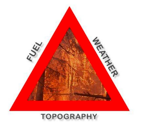
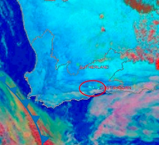
Apart from the central desert areas, the Australian landscape, from the tropics of Far North Queensland to the southern tip of Tasmania has climatic conditions and vegetation which are conducive to wildfires throughout the year. The most volatile of these areas being the south eastern parts of Australia which includes the states of South Australia, Victoria, New South Wales and Tasmania. Australia has large tracts of wilderness which can only be monitored by aircraft and satellite and as such, remote sensing for bushfires within the landscape is virtually mandatory throughout the dry season in the tropics and the summer periods for the southern states. This talk looks at some of the ways that Satellite Remote Sensing has assisted emergency managers for preparedness, response and recovery, the three most important factors for any emergency operation.
Presentation 10 in the Environment Event Week 2016
Length: 30 min
Author: Jose Prieto (EUMETSAT)
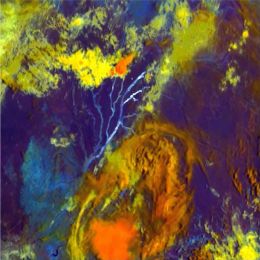
Not only smoke tells you where the fire is. Small active fires 20 meters across, a minute fraction of the pixel size, are sensed by Meteosat from its lofty orbit. We explain how to spot them without burning your fingers. Thresholds, channels and future composite products might ignite your interest.
Presentation 11 in the Environment Event Week 2016
Length: 30 min
Author: Lee-Ann Simpson (SAWS)
South Africa is by nature a dry country, which has very short wet periods, mainly confined to the coastal areas and eastern half of the country. During the dry season, the hot, windy conditions result in a favourable environment for fires to spread uncontrollably and cause large scale damage to the local vegetation and to infrastructure. To be able to anticipate and forecast the risk of runaway fires in South Africa, a forecaster needs to have many sources of information, ranging from precipitation amounts to an understanding of the local vegetation. The inclusion of satellite imagery interpretation is an invaluable part of the forecasting process and the monitoring of fires can be done accurately and on a 24hour basis. This presentation will outline the risk the fires pose within South Africa and our forecasting processes dealing with this environmental hazard.
Jose Prieto talks about solar channels, how to use them, what are the differences and where they are used for.
Length: 67 minutes
Author: Jose Prieto
In the session Jose talks generally about the solar channels, how to use them, what are the differences and where they are used. Later on the talk is about monitoring the vegetation and soil properties using the available solar and near-infrared channels. The presentation ends with examples of products for detecting dust and smoke.
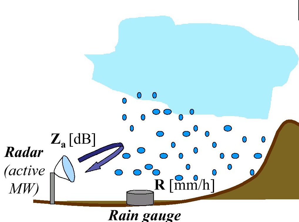
Simone Gabellani presents a merging approach of rain gauge data with remote precipitation retrieval to improve flood modelling.
Length: 68 minutes
Multi-sensor data fusion prove that combining data from rain gauges and remote retrievals represents the best way to obtain an enhanced and more reliable evaluation of Quantitative Precipitation Estimation (QPE) that improve hydrological modelling for river discharge estimation. Although remote sensors produce an observation of precipitation subject to several sources of uncertainty, they capture the general covariance structure of the precipitation field. Thus, the information provided by remote sensors may be used to condition the information from rain gauges, which is limited in terms of spatial representativeness. In this way, an estimate of the rainfall field containing a more realistic spatial structure constrained to the rain gauges data can be produced. The presentation will describe the theoretical background and examples for merging satellite and gauge rainfall data for improving discharge modelling. A Modified Conditional Merging (MCM) approach, developed from the original Conditional Merging proposed by Sinclair and Pegram (2005), will be illustrated.
Luca Ciabatta describes the theoretical background and some examples for using satellite rainfall data for landslides prediction analysis.
Length: 22 minutes
Rainfall-induced landslides are one of the most frequent and dangerous natural hazards, occurring every year and causing fatalities and significant economic losses. Their impact is expected to increase in the next decades due to climate changing. In these premises, several countries have developed and implemented operational early warning systems for rainfall-induced landslides. The main tool for the prediction of landslides is represent by rainfall thresholds. Usually, these empirical thresholds use rainfall characteristics, i.e. intensity and duration, to define the conditions that likely triggered the landslide based on the analysis of historical events. Satellite rainfall data can be beneficial in this application as they provide information over large areas without the need of setting up and maintain a monitoring network. This presentation will describe the theoretical background and some examples for using satellite rainfall data for landslides prediction analysis.
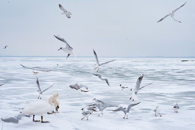
Yulia Mishenina presents the results of studies of the characteristics of snow cover for the territories of Western and Eastern Siberia.
The report presents the results of studies of the characteristics of snow cover for the territories of Western and Eastern Siberia. The research period is from 1976 to 2020.
The report describes the duration of persistent snow cover, the time intervals between the first snowfall and stable snow cover and between the destruction and disappearance, a number of characteristics of the snow cover: duration of occurrence, thickness and water content.
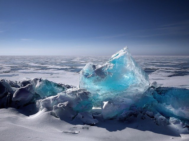
Ákos Horvath talks about ice formation on Lake Balaton and the dependence from local wind and weather.
Lake Balaton is the largest lake in the Carpathian Basin. The shallow lake (with 3.5 m mean depth) responds to the weather rapidly: in hot summers the water temperature increases above 25 °C, and at colder winters thick ice (20-40 cm) appears on the lake surface. The formation of the ice depends very much on the weather. Glassy ice forms when after a cold front passage in the night the wind and waves calm down and the previously mixed up and supercooled water freezes rapidly. During longer cold and windy weather period, ice appears in forms of ice floes, frozen to each other. This presentation tries to give an overview of the metamorphosis and special dynamic of the Balaton ice.
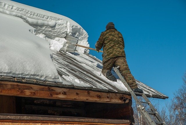
Michael Winkler puts heavily burdened roofs in the spotlight by presenting recent efforts in updating the Austrian snow load standard and showing an actual example of snow load monitoring and hazard management.
Snowy winters lead to heavy snow loads on buildings and constructions. Surprisingly often, the snow load assessment basis of international and national standards are regionally reached or exceeded. Damages or even collapses do occur, cause expenses and threaten human lives. However, extreme snow loads only rarely are considered as natural hazards. This talk puts heavily burdened roofs in the spotlight by presenting recent efforts in updating the Austrian snow load standard and showing an actual example of snow load monitoring and hazard management.