
Land
Michael Rothleitner discusses economic and ecological aspects of winter tourism in the Alpine region.
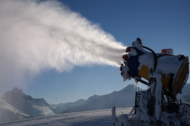
At the beginning, the economic interrelationships of winter tourism in the Alpine region, Austria and finally Tyrol are highlighted. The dependence of value creation on a reliable snow situation in winter therefore forces snow management, the economic and above all ecological tasks of which will be presented. The participants will get to know the essential problems and the existing approaches to solving them.

Sven Kotlarski summarizes current research on the fate of surface snow cover and its implications for climate.
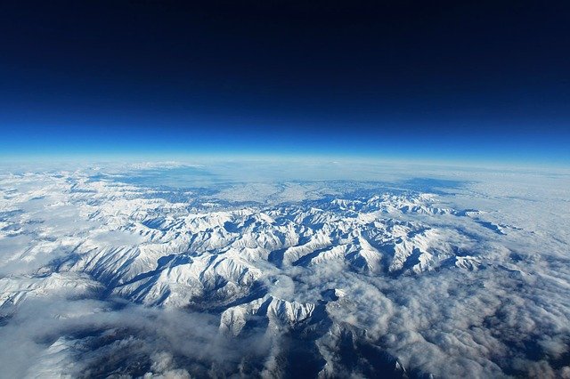
The presence of snow cover on the land surface is closely linked to the prevailing climate. Moreover, by modulating surface energy fluxes snow cover is interactively linked to the atmosphere and constitutes an important component of global and regional climate systems. Available observations show a retreat of snow cover on hemispheric scales as a response to global warming, and climate projections consistently indicate a further decrease. Focusing on Europe and especially on the European Alps, this contribution summarizes current research on the fate of surface snow cover and its implications.
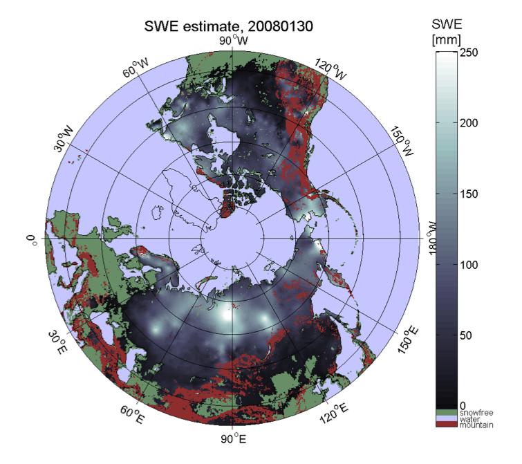
Kari Luojus shows the basic approach to apply passive microwave radiometer data for retrieval of terrestrial snow water equivalent.
The presentation shows the basic approach to apply passive microwave radiometer data for retrieval of terrestrial snow water equivalent. It describes the GlobSnowmethodology to combine satellite-based radiometer data with ground-based snow depth observations and a bias-correction approach to improve the satellite-based retrievals. It also presents the historical satellite-based reconstruction of Northern Hemisphere snow mass, from 1980 to present day (published on Nature, Pulliainen et al. 2020). Pulliainen, J., Luojus, K., Derksen, C. et al. Patterns and trends of Northern Hemisphe re snow mass from 1980 to 2018. Nature 581, 294–298 (2020). https://doi.org/10.1038/s41586-020-2258-0
Veronika Hatvan and Andreas Gobiet present model-based tools used at ZAMG for operational avalanche warning services and local avalanche commissions.
While the usage of models for weather forecasting has been long established, the application of snow cover models for operational avalanche warning purposes is still quite novel. In Austria, the national weather service, ZAMG, develops model-based tools for operational avalanche warning services and local avalanche commissions. In particular, a model-chain consisting of a snow cover model and an ensemble of weather models to operationally assess and predict avalanche hazard in a local context is currently developed. The model-chain provides regional avalanche forecasters and local avalanche commissions with continuous, detailed information about the snow cover from the near-past to the nearfuture. This is to enable early warning of exceptional snow cover situations. In this talk we will give an overview on model-based tools for avalanche services and present the local avalanche prediction model and preliminary results of a first test season in more detail.

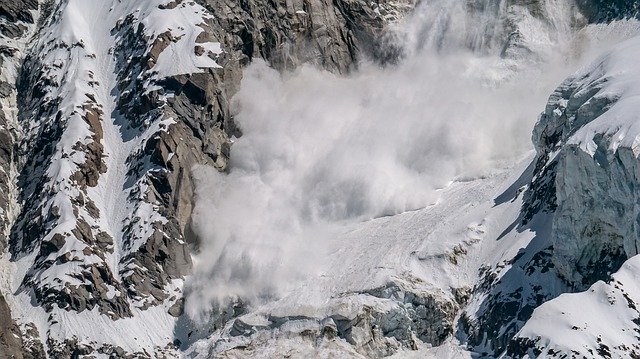
Alec van Herwijnen gives an overview of recent efforts at the WSL Institute for Snow and Avalanche Research SLF in Davos, Switzerland, to develop models for avalanche forecasting.
In mountain regions in winter, snow avalanches are relatively frequent and widespread. Compared to other gravitational mass movements, such as landslides or debris flows, snow avalanches occur much more frequently and over a broader geographical area. This has enabled avalanche forecasters to gain practical experience and develop rule-based empirical methods to manage the danger of this ubiquitous natural hazard. However, the ability to forecast avalanches, i.e. predicting snow instability in space and time, is limited by current experience-based forecasting practices. Improvements in terms of spatial and temporal resolution can only be made through model development. In this talk, I will give an overview of recent efforts at the WSL Institute for Snow and Avalanche Research SLF in Davos, Switzerland, to develop models for avalanche forecasting - from mechanical models to better understand the fundamental processes leading to avalanche release to snow cover models to provide real-time information on snow stratigraphy and stability.
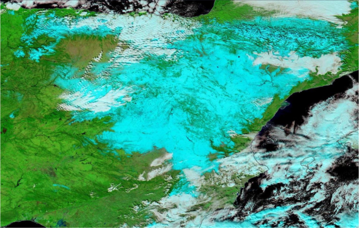
Gaëlle Kerdraon presents the algorithm of snow/ice detection in the cloud mask and cloud type products of the NWC-SAF and shows some examples.
The first step of the cloud detection during day, is the snow/ice detection on the ground or at the sea surface. The talk will give details of the flag snow/ice in the cloud mask and in the cloud type. The algorithm will then be presented and illustrated by a recent example. The importance of this snow/ice detection will be pointed out for a good cloud detection. Finally, we will explain the limitations of this flag snow/ice.
Niilo Siljamo investigates the quality of H-SAF snow products.
H-SAF satellite snow extent products can be used for many meteorological and hydrological applications, for example as inputs for weather models. What are these products? How good are they? Especially, MSG/SEVIRI (H31) and Metop/AVHRR (H32) products are described with examples and validation results.
Rudolf Kaltenböck speaks about the challenges detecting snow from Radar data.
Weather radar data offers high spatial and temporal structures of three dimensional precipitation fields and can be well used for warning and nowcasting of adverse winter weather. Radar reflectivity, Doppler velocity products and polarized radar moments de liver insights into cloud microphysics and dynamical properties, such as the discrimination between different types of hydrometeors, quantitative precipitation estimation, icing conditions or areas of strong shear. Beside aeronautical nowcasting application, also the limitations of using weather radar in a cold winter weather environment will be addressed.
Ivan Smiljanić talks about the future possibilities detecting snow and ice from MTG data.
Detection of snow, but also its classification (depth, crystal size, age) depends mostly on the spectral and spatial resolution of geostationary satellites. Having better spatial resolution and more spectral channels, Meteosat Third Generation satellites (MTG) will be able to see snow better and tell more about its flavours, especially in the visible and near-IR spectral regions. Join if you are interested to know how the snow detection will be done with MTG and what is "the colour of the snow" with future data.
Mária Putsay discusses how single channels and RGB types can be effectively used for snow detection.
Single channels and RGB types will be discussed and compared from the snow detection point of view: how effectively they can be used for this purpose, which benefits and limitations they have. Physical background will be discussed and several examples will be shown.
Ideally an RGB type is usable for snow detection if the snow-covered cloud-free surface has good colour contrast against both now-free surface and clouds. Practically, one problem may cause difficulty: ice clouds and snowy land often appear similarly. Not surprising: their physical properties are similar as both consist of ice crystals. The presentation discusses which RGB types show snow and ice clouds less similarly. Forecasters usually look at animations, this also helps to distinguish snow covered area from moving ice clouds.
Craig D. Smith talks about automated observations of solid precipitation and snow cover that are still one of the most difficult meteorological measurements to make with any known level of uncertainty.
Automated observations of solid precipitation and snow cover are still one of the most difficult meteorological measurements to make with any known level of uncertainty. Many recommendations on best practices for measuring solid precipitation and snow cover emerged during and following the international Solid Precipitation Inter-Comparison Experiment (SPICE), including the development and application of transfer functions for adjusting precipitation gauge under-catch and techniques for minimizing errors in automated snow depth measurements. Following SPICE, work has continued on assessing and utilizing emerging technologies, such as optical and radar based present weather detectors, for improving the in situ measurement of solid precipitation. Furthermore, more effort is required to facilitate the transfer of techniques and best practices from research to application in operational networks.
In this presentation Tomaš Pučik and Christoph Gatzen explore different regimes under which ingredients come together and create marginal CAPE setups typical of winter
Forecasting deep-moist convection and lightning in winter is challenging, partly because it occurs outside the typical season and partly because it forms in the environments characterized by marginal buoyancy. Despite weak CAPE, winter time convective storms often pose a considerable severe weather risk given their frequent collocation with strong vertical wind shear. In this presentation we explore different regimes under which ingredients come together and create marginal CAPE setups typical of winter. These include synoptically strongly-forced situations, elevated storms and the lake-effect over the European seas.