The non-hydrostatic WRF model (Skamarock et al., 2008) of 2.7 km horizontal resolution was used for experimental forecasts of thunderstorms over Belgium. The resolution and setup of the physical parameterization was nearly the same as for the version operationally used at the Hungarian Meteorological Service. Although the model dynamics at this resolution are able to produce updrafts of an intensity that is usually observed in thunderstorms (i.e. 10-20 m/s), it must be emphasized that the deep convection was only partially resolved in these simulations (higher resolution or special physical parameterization would be required for more realistic results). Nevertheless, the model outputs show several convective cells developing over Belgium and propagating in the southwest-northeast direction, even close to the area of the festival (Fig. 3.1). In the study, we concentrated on the intense cell, which passed about 35 km southeast of Hasselt.
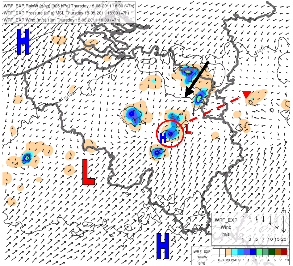
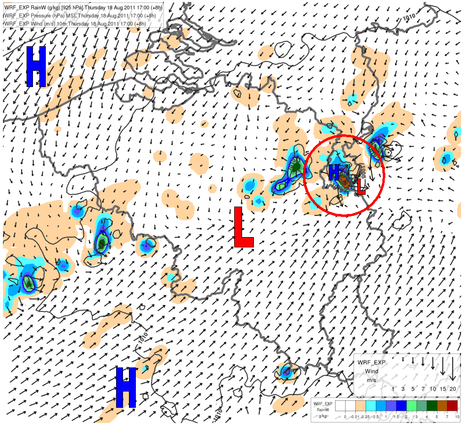
Fig. 3.1. WRF 7 and 8 h forecasts for 18 August 2011 16 UTC (above) and 17 UTC (below): rain water at 925 hPa (colors), wind (arrows) at 10 m and mean sea level pressure (black lines, by 2 hPa). The circles emphasize the cell, which was investigated in more detail. The solid black arrow points toward Hasselt. The dashed red arrow shows the direction of the cell propagation. The letters H and L show the areas of high and low pressure.