At 12 UTC on 18 August 2011, a shallow low was situated over France, Belgium and western Germany. The area of Hasselt was very close to a warm front related to this low (Fig. 2.1). The surface low deepened and propagated over Belgium toward the northeast.
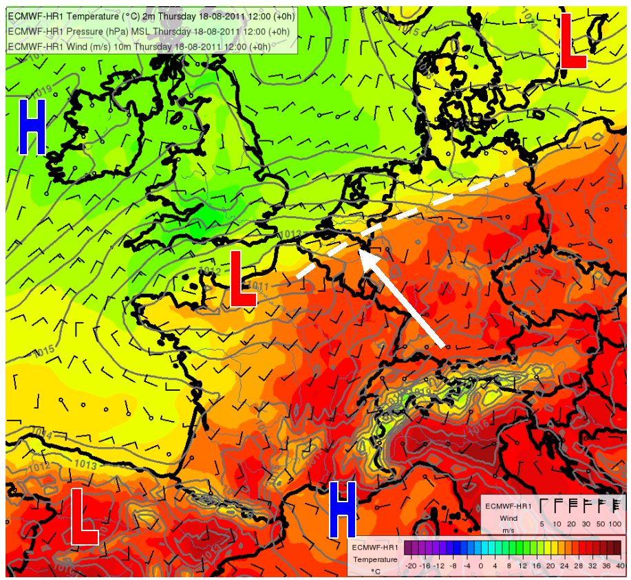
Fig. 2.1. ECMWF analyses of mean surface level pressure (lines by 1 hPa), 2 m temperature (color) and 10 m wind (barbs) valid for 18/08/2011 12 UTC. The dashed line emphasizes the area of high temperature gradients (probably a warm front). The arrow indicates the location of the pop festival. The L and H symbols represent lows and highs, respectively.
At 500 hPa level, there was moderate-to-strong southwesterly upper-air flow at the forward flank of the trough with an axis over Ireland (Fig. 2.2).
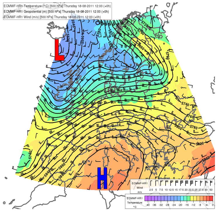
Fig. 2.2. ECMWF analyses for 18 August 2011 12 UTC. Geopotential height (lines), temperature (color) and wind barbs at 500 hPa. The L and H symbols represent lows and highs, respectively.