
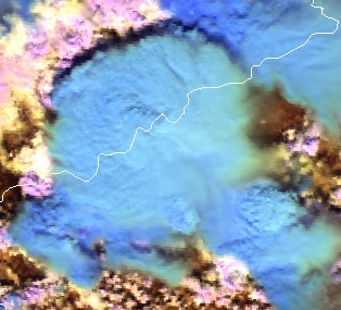
Identify surface features
Cloud Phase RGB is a new product for European users of GEO satellite data, which can be constructed using data from the Flexible Combined Imager (FCI) on the Meteosat Third Generation (MTG) satellite system. The aim of this RGB is to provide improved microphysical information on cloud tops, in particular discrimination between thick water clouds and thick ice clouds, and cloud top particle size.
This extended guide is about the Cloud Phase RGB, a new product for European users of GEO satellite data, which can be constructed using data from the Flexible Combined Imager (FCI) on the Meteosat Third Generation (MTG) satellite system. It uses one of the new FCI channels, not available with the SEVIRI instrument. This document is an extended guide discussing its characteristics in detail; a quick guide is also available on the EUMeTrain webpage. In this guide, the imagers of Japanese and American geostationary satellites (Himawari/AHI and GOES/ABI) and polar satellites (NPP and NOAA-20/VIIRS) are used to provide proxy data for the FCI.
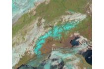
Learn how to detect areas covered with snow, ice or cloudy areas.
In this module you will be able to identify geographical features and surface characteristics and conditions through images and satellite products. Although surface features are not the main purpose of meteorological forecasting, being able to identify and distinguish them from atmospheric features can be useful.
To access the resource click here.
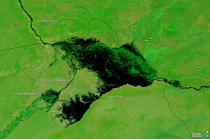
Learn how to recognize areas of flooding.
In this module you will be able to identify geographical features and surface characteristics and conditions through images and satellite products. Although surface features are not the main purpose of meteorological forecasting, being able to identify and distinguish them from atmospheric features can be useful.
To access the resource click here.
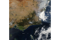
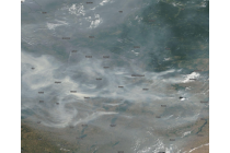
Learn how to recognize burnt areas.
In this module you will be able to identify geographical features and surface characteristics and conditions through images and satellite products. Although surface features are not the main purpose of meteorological forecasting, being able to identify and distinguish them from atmospheric features can be useful.
To access the resource click here.
Learn how to identify hotspots.
In this module you will be able to identify geographical features and surface characteristics and conditions through images and satellite products. Although surface features are not the main purpose of meteorological forecasting, being able to identify and distinguish them from atmospheric features can be useful.
To access the resource click here.
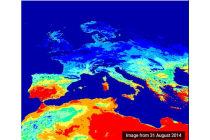
Learn how to identify areas of drought and heatwaves.
In this module you will be able to identify geographical features and surface characteristics and conditions through images and satellite products. Although surface features are not the main purpose of meteorological forecasting, being able to identify and distinguish them from atmospheric features can be useful.
To access the resource click here.
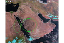
Learn how to identify vegetation free areas as well as how to identify different types of desert surface such as sand or desert pavement.
In this module you will be able to identify geographical features and surface characteristics and conditions through images and satellite products. Although surface features are not the main purpose of meteorological forecasting, being able to identify and distinguish them from atmospheric features can be useful.
To access the resource click here.
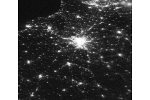
Learn how to distinguish between natural and human modified areas.
In this module you will be able to identify geographical features and surface characteristics and conditions through images and satellite products. Although surface features are not the main purpose of meteorological forecasting, being able to identify and distinguish them from atmospheric features can be useful.
To access the resource click here.
Learn how to discriminate between land and areas of water like oceans, seas, lakes, rivers or inlets.
In this module you will be able to identify geographical features and surface characteristics and conditions through images and satellite products. Although surface features are not the main purpose of meteorological forecasting, being able to identify and distinguish them from atmospheric features can be useful.
To access the resource click here.
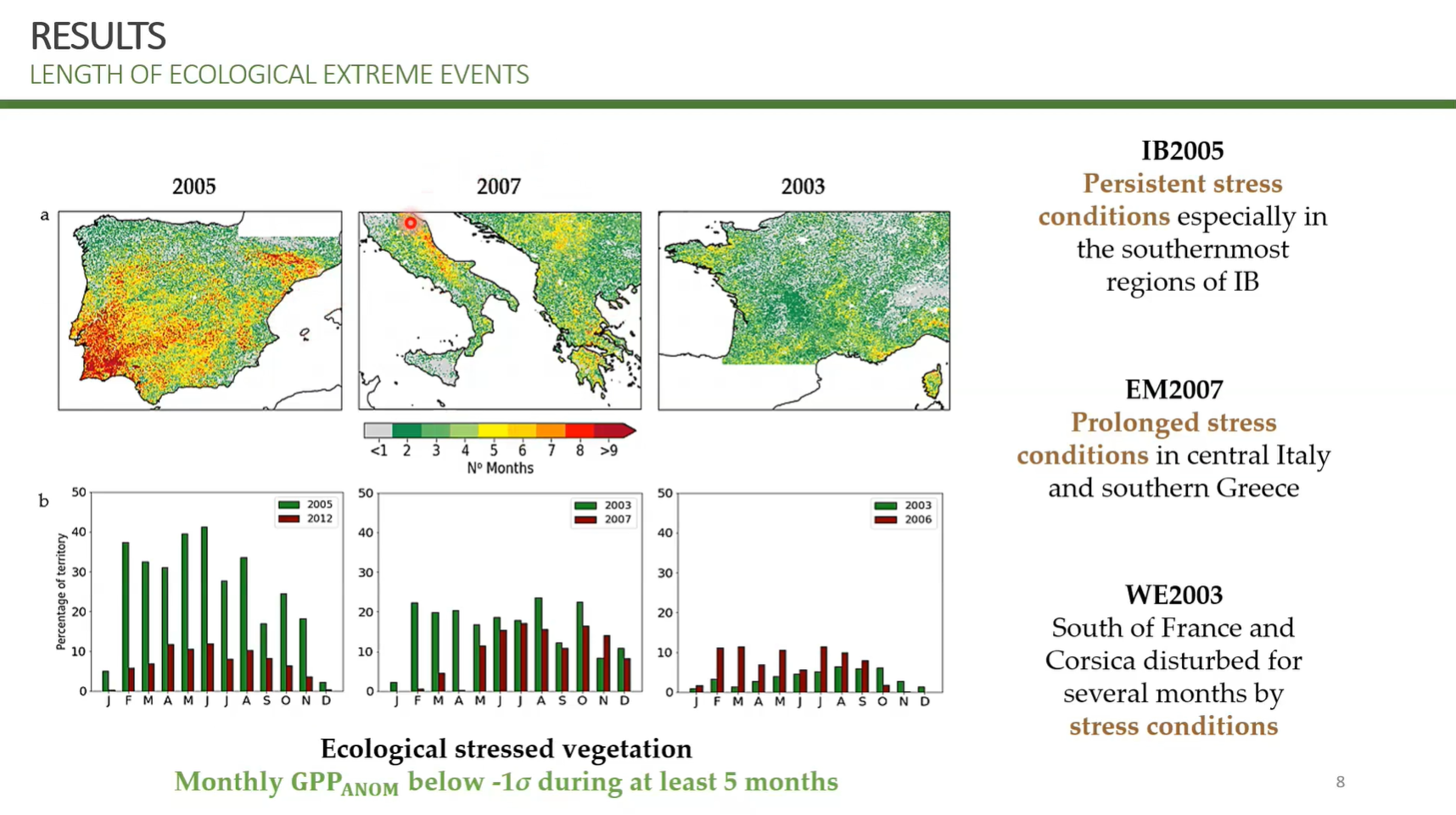
Tiago Ermitão covers practical application of studying impacts of heatwaves and droughts on the carbon cycle, namely vegetation productivity losses.
Droughts and heatwaves have become more frequent and severe over the last years as a consequence of climate change. These events result in water stress conditions to vegetation, affecting photosynthesis and respiration from plant to ecosystem scales, impacting the net carbon balance of ecosystems. This lecture will provide insights on the impacts of climate extreme events on vegetation function and the carbon cycle, showcasing examples on how these impacts can be detected using remote sensing products how Earth System and other models can be used to project future impacts of extreme events on the Carbon cycle.
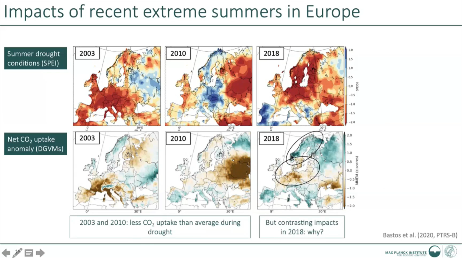
Ana Bastos presents about extreme climate event impact on carbon cycle and vegetation.
Droughts and heatwaves have become more frequent and severe over the last years as a consequence of climate change. These events result in water stress conditions to vegetation, affecting photosynthesis and respiration from plant to ecosystem scales, impacting the net carbon balance of ecosystems. This lecture will provide insights on the impacts of climate extreme events on vegetation function and the carbon cycle, showcasing examples on how these impacts can be detected using remote sensing products how Earth System and other models can be used to project future impacts of extreme events on the Carbon cycle.
Carla Barroso gives insight into EUMETSAT climate data records and services.
The presentation will give an overview on EUMETSAT’s efforts to provide climate data records based on satellite measurements and how EUMETSAT supports the work of climate services through this. Focus will be on satellite products provided by EUMETSAT and the different Satellite Application Facilities (SAFs). During the presentation participants will learn how the creation of climate data records is different from creating a near-real-time product and why EUMETSAT and the SAFs invests in this. Links to further information and learning material will be included.