
Weather
Davide Melfi presents a method that blends GEO and LEO precipitation products.
Length: 19 minutes
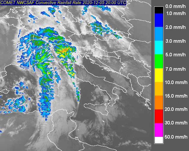
The main precipitation products developed worldwide are based on microwave (MW) radiometry Microwave (MW) radiation is the most effective for precipitation retrieval because of the direct interaction of radiation with the frozen and liquid hydrometeors within precipitating clouds as opposed to visible or infrared observations sensitive to the upper portion of the clouds. However, as microwave instruments are currently only available on-board satellites in Low Earth Orbit (LEO), they do not provide a continuous monitoring of rainfall over a given location. One methodology is to combine geostationary and low orbit satellite observations. This kind of multi-platform algorithm provides global precipitation estimation merging high quality, sparsely sampled data from low earth orbit satellites (e.g. Metop, NOAA series, DMSP, i.e. LEO/MS in general) with continuously sampled data from geostationary satellites (e.g. GEO/IR). The presentation will describe an example of such retrieval techniques used in HSAF and the future approach in combining such different sources of data.
Christian Massari shows that model recalibration or bias correction even with a few rain gauges can provide boost hydrological model performance and thus make satellite rainfall data a valid solution to obtain discharge.
Length: 41 minutes.
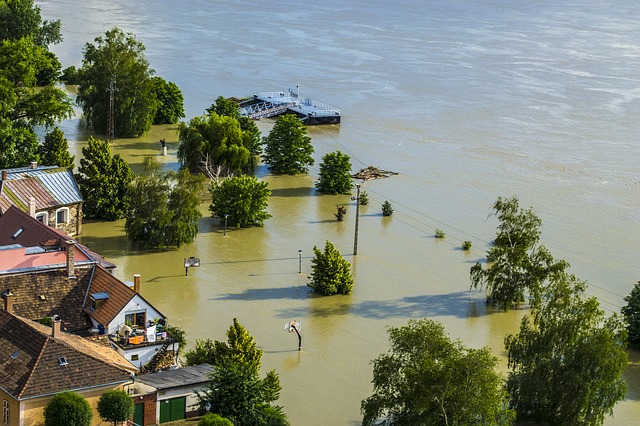
Flood modelling over data scarce regions is challenging. Satellite rainfall data offer a viable tool to force hydrological models and provide discharge prediction at ungauged sites. However, being an indirect type of measurements, satellite rainfall observations can be subjected to significant bias and might be suboptimal over mountainous terrain. Here we show that model recalibration or bias correction even with a few rain gauges can provide boost hydrological model performance and thus make satellite rainfall data a valid solution to obtain discharge. In the presentation we will describe the theoretical background for using satellite rainfall products in flood prediction and provide some tips to enhance their performance in riverine flood modelling.
Go to Webcast... (Part 1 - 25 Minutes)
Giulia Panegrossi presents the challenges and recent advancements in satellite-based snowfall quantification and global monitoring.
Length: 37 minutes
Snow plays an important role in the Earth energy exchange processes, and is a fundamental element of the water cycle. The use of satellites for snowfall monitoring and quantification and for retrieving snow cover properties and variability is necessary to globally quantify water resources. Satellite-based snowfall detection and surface snowfall rate estimation are becoming an increasingly popular topic within both the hydrological scientific community and operational services. Recent studies have evidenced how space borne multi-channel microwave (MW) radiometer measurements respond to both snowfall and snow cover properties. In this presentation the challenges and recent advancements in satellite-based snowfall quantification and global monitoring will be discussed, and the retrieval strategies that are being adopted within the EUMETSAT H SAF to improve detection and quantification of snowfall, with particular focus on higher latitudes, will be presented.
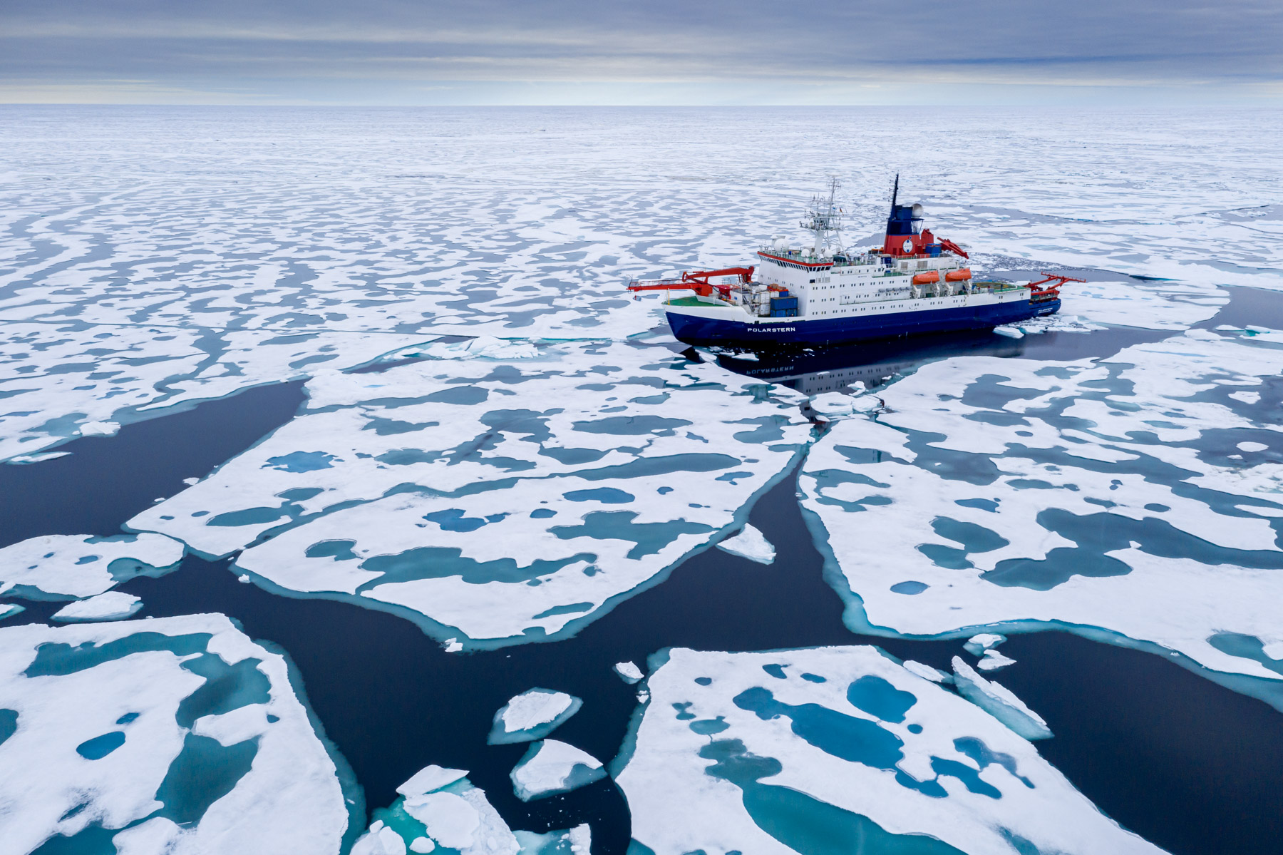
Oliver Sievers and Jens Kieser report from the MOSAiC expedition of the German vessel Polarstern in the Arctic Sea.
Meteorologists and weather technicans from the German Meteorological Service (DWD) attended the entire MOSAiC expedition, the largest-scale Central Arctic research expedition of all time. They were responsible for permanent weather observations and daily meteorological forecasts for scientists, ship master and officers, as well as helicopter pilots. Our presentation will report about personal experiences of a meteorologist on board of the research icebreaker POLARSTERN, with the focus on the daily work of the forecaster and the importance of using satellite images in Polar Regions.
Yulia Mishenina presents the results of studies of the characteristics of snow cover for the territories of Western and Eastern Siberia.
The report presents the results of studies of the characteristics of snow cover for the territories of Western and Eastern Siberia. The research period is from 1976 to 2020.
The report describes the duration of persistent snow cover, the time intervals between the first snowfall and stable snow cover and between the destruction and disappearance, a number of characteristics of the snow cover: duration of occurrence, thickness and water content.
Ákos Horvath talks about ice formation on Lake Balaton and the dependence from local wind and weather.
Lake Balaton is the largest lake in the Carpathian Basin. The shallow lake (with 3.5 m mean depth) responds to the weather rapidly: in hot summers the water temperature increases above 25 °C, and at colder winters thick ice (20-40 cm) appears on the lake surface. The formation of the ice depends very much on the weather. Glassy ice forms when after a cold front passage in the night the wind and waves calm down and the previously mixed up and supercooled water freezes rapidly. During longer cold and windy weather period, ice appears in forms of ice floes, frozen to each other. This presentation tries to give an overview of the metamorphosis and special dynamic of the Balaton ice.
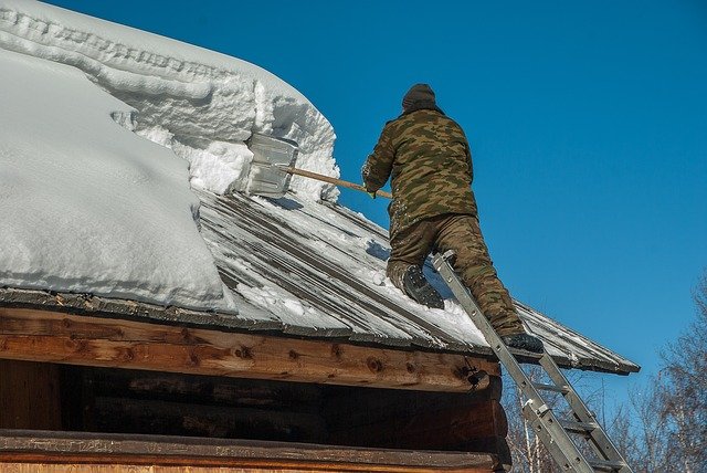
Michael Winkler puts heavily burdened roofs in the spotlight by presenting recent efforts in updating the Austrian snow load standard and showing an actual example of snow load monitoring and hazard management.
Snowy winters lead to heavy snow loads on buildings and constructions. Surprisingly often, the snow load assessment basis of international and national standards are regionally reached or exceeded. Damages or even collapses do occur, cause expenses and threaten human lives. However, extreme snow loads only rarely are considered as natural hazards. This talk puts heavily burdened roofs in the spotlight by presenting recent efforts in updating the Austrian snow load standard and showing an actual example of snow load monitoring and hazard management.
Michael Rothleitner discusses economic and ecological aspects of winter tourism in the Alpine region.
At the beginning, the economic interrelationships of winter tourism in the Alpine region, Austria and finally Tyrol are highlighted. The dependence of value creation on a reliable snow situation in winter therefore forces snow management, the economic and above all ecological tasks of which will be presented. The participants will get to know the essential problems and the existing approaches to solving them.

Sven Kotlarski summarizes current research on the fate of surface snow cover and its implications for climate.
The presence of snow cover on the land surface is closely linked to the prevailing climate. Moreover, by modulating surface energy fluxes snow cover is interactively linked to the atmosphere and constitutes an important component of global and regional climate systems. Available observations show a retreat of snow cover on hemispheric scales as a response to global warming, and climate projections consistently indicate a further decrease. Focusing on Europe and especially on the European Alps, this contribution summarizes current research on the fate of surface snow cover and its implications.
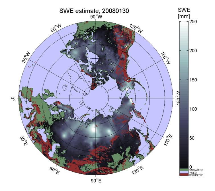
Kari Luojus shows the basic approach to apply passive microwave radiometer data for retrieval of terrestrial snow water equivalent.
The presentation shows the basic approach to apply passive microwave radiometer data for retrieval of terrestrial snow water equivalent. It describes the GlobSnowmethodology to combine satellite-based radiometer data with ground-based snow depth observations and a bias-correction approach to improve the satellite-based retrievals. It also presents the historical satellite-based reconstruction of Northern Hemisphere snow mass, from 1980 to present day (published on Nature, Pulliainen et al. 2020). Pulliainen, J., Luojus, K., Derksen, C. et al. Patterns and trends of Northern Hemisphe re snow mass from 1980 to 2018. Nature 581, 294–298 (2020). https://doi.org/10.1038/s41586-020-2258-0
Veronika Hatvan and Andreas Gobiet present model-based tools used at ZAMG for operational avalanche warning services and local avalanche commissions.
While the usage of models for weather forecasting has been long established, the application of snow cover models for operational avalanche warning purposes is still quite novel. In Austria, the national weather service, ZAMG, develops model-based tools for operational avalanche warning services and local avalanche commissions. In particular, a model-chain consisting of a snow cover model and an ensemble of weather models to operationally assess and predict avalanche hazard in a local context is currently developed. The model-chain provides regional avalanche forecasters and local avalanche commissions with continuous, detailed information about the snow cover from the near-past to the nearfuture. This is to enable early warning of exceptional snow cover situations. In this talk we will give an overview on model-based tools for avalanche services and present the local avalanche prediction model and preliminary results of a first test season in more detail.

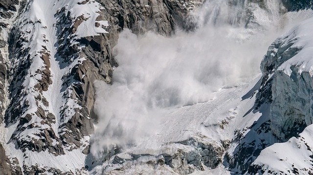
Alec van Herwijnen gives an overview of recent efforts at the WSL Institute for Snow and Avalanche Research SLF in Davos, Switzerland, to develop models for avalanche forecasting.
In mountain regions in winter, snow avalanches are relatively frequent and widespread. Compared to other gravitational mass movements, such as landslides or debris flows, snow avalanches occur much more frequently and over a broader geographical area. This has enabled avalanche forecasters to gain practical experience and develop rule-based empirical methods to manage the danger of this ubiquitous natural hazard. However, the ability to forecast avalanches, i.e. predicting snow instability in space and time, is limited by current experience-based forecasting practices. Improvements in terms of spatial and temporal resolution can only be made through model development. In this talk, I will give an overview of recent efforts at the WSL Institute for Snow and Avalanche Research SLF in Davos, Switzerland, to develop models for avalanche forecasting - from mechanical models to better understand the fundamental processes leading to avalanche release to snow cover models to provide real-time information on snow stratigraphy and stability.