Introduction: A conversation on the Phone - Part 3
On 13 June 2005 at 18h UTC in the afternoon

"There is Mrs. Arts from the Open Air Opera in Mörbisch again. We just began the opening ceremony of our opera
festival. But we see black clouds and lightnings at the horizon. Do you think we will be able to do the opera? Or do we
have to break?"

"Yes Mrs. Arts I know there are lots of thunderstorms. But let me have a look into my material. Maybe you will be
lucky."
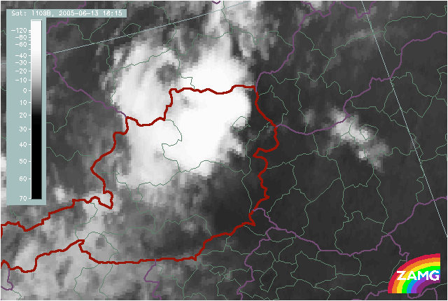
IR Satellite image 18.15 UTC
There is the extended cloud shield of a big convective cell complex over western and northern parts of Lower Austria.
"The already existing thundertorms which you see at the horizon are over the Southwestern Lower Austria while close to your area there are mostly only high level clouds. The thunderstroms have a tendency to move to the Northeast during the next two hours and to pass by close to your event. But the precipitation forecast does not show any precipitation in your area. Consequently you have to expect clouds, the wind might also refresh and some rain drops cannot be excluded. But the center of the thunderstorm will pass by. Of course new thunderstorm can develop but at this time of the day the probability becomes smaller. So I hope you will have a nice opera performance!"
Follow
this link
to find out what happens next!