Introduction

"Till now we have looked only at the 24 hours available IR images and for fog also into the HR Vis images. With MSG 12
channels representing different features of the troposphere are available. And an appropriate combination of channels in form of RGBs and differences and combiantions of both can give you much more insight.
Here we will not go into learning about RGBs. For this you should look into relevant trainings material like the "MSG Interpretation Guide" and the CAL about RGBs."
Here we will not go into learning about RGBs. For this you should look into relevant trainings material like the "MSG Interpretation Guide" and the CAL about RGBs."
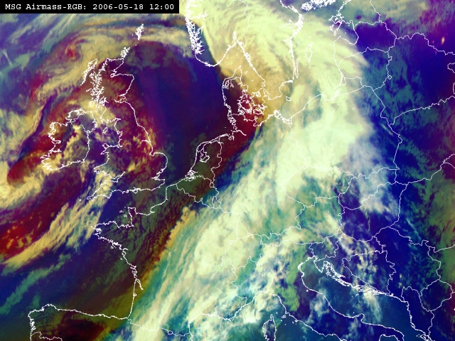
This is the typical Air Mass RGB which is the result of a complex combination of IR and WV channels. The main advantage is the possibility to differentiate between humid and dry air masses. One of the most important advantage of such images is the recognition of dry air in upper and middle levels behind the fronts. Such areas are dark-red to brown and are partly superimposed on the cloudiness of the fronts. They represent sinking dry stratospheric air and implicitely represent - according to Hoskins theory - the possibility of inducing cyclogenesis.
"Now lets look with this new material into the three synoptic situations we have already treated in the chapter of basic Nowcasting."
"Let's start with fronts. Follow
this link
to begin!"