
pastel green
Low water clouds depict in pastel green colours in the Night Microphysics RGB images.
When a colour appears in a pastel tone, the contribution from all 3 channels is relatively high and we get a high amount of white mixed to the colour (e.g. whitish green).
The BTD (IR12.0 - IR10.8) responsible for the red colour beam is near zero on a scale reaching from -4 (dark) to +2 degrees (intensive red). Hence, the red colour contribution has an average value.
The green colour beam is of varying intensity depending on the thickness of the low cloud layer. The thinner the low cloud layer, the smaller the green contribution. This makes the colour turn into magenta (red+blue=magenta), i.e. the colour of cloud free land. On the other hand, when the low level cloud becomes thicker, the colour turns into red (less green and blue).
The blue colour beam is contributing with an average value. The warmer the low cloud is, the more the radiation from IR10.8 is contributing to the blue colour intensity.
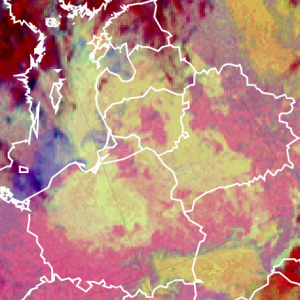
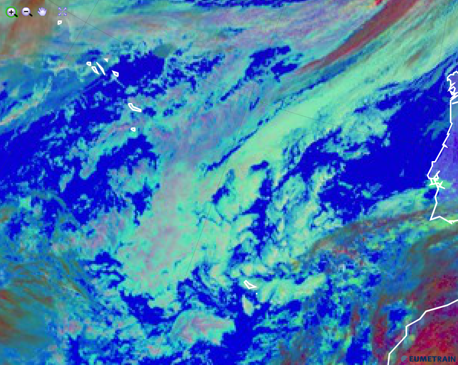
The Night Microphysics RGB image below shows an extended area of low water clouds from the Baltic States to the Ukraine. In the winter season, the pastel green colour can become very intensive.
Night Microphysics RGB from 10 January 2016, 00:00 UTC
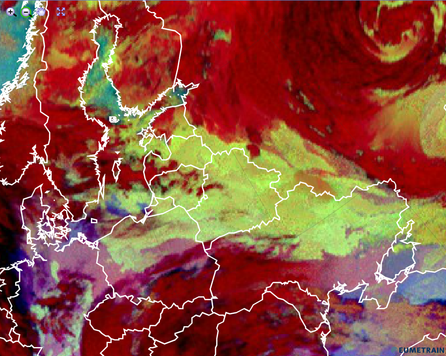
When low water clouds are warmer (e.g. in the summer season), the colours turns into a greyish blue as the blue colour beam becomes more intensive.
Night Microphysics RGB from 26 October 2015, 00:00 UTC
Explanation of the pastel green colour of low water clouds in the Night Microphysics RGB (see the recipe):
• All 3 colour beams contribute largely in case of low level water clouds. The green colour beam is sensitive for low water clouds, using the BTD (IR10.8 - IR3.9) which is widely used to detect low stratus and fog in the night.
Low water clouds depict in pastel green colours in the Day Microphysics RGB images.
Low level water clouds in the Day Microphysics RGB depict in pastel green colours, i.e. they include a high amount of white. All 3 colour beams contribute with approximately the same intensity. Depending on cloud microphysical processes, the green colour beam dominates more or less over the other colours.
Small water droplets reflect much of the short wave solar radiation at 0.8 and at 3.9 micrometer. Hence the red and the green colour is of some importance. The blue colour beam depends on the amount of measured IR10.8 radiation and intensifies with increasing temperatures
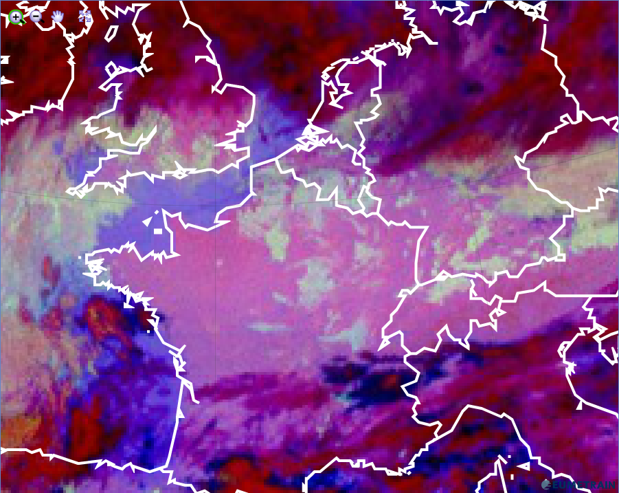
Very low and warm water clouds can be seen over the Atlantic (see image below). They turn into a whitish green, because they mainly consist of small water droplets which have a high reflectivity at 3.9 micrometer. The green colour beam gains importance over the other involved colours. On top of some low level clouds, a red veil can be seen. These are the frozen parts of the clouds.
Day Microphysics RGB from 5 February 2016, 12:00 UTC
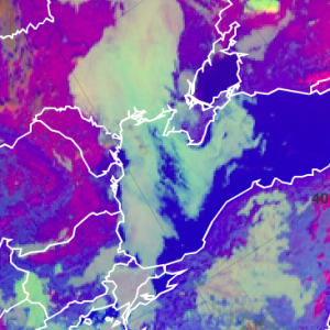
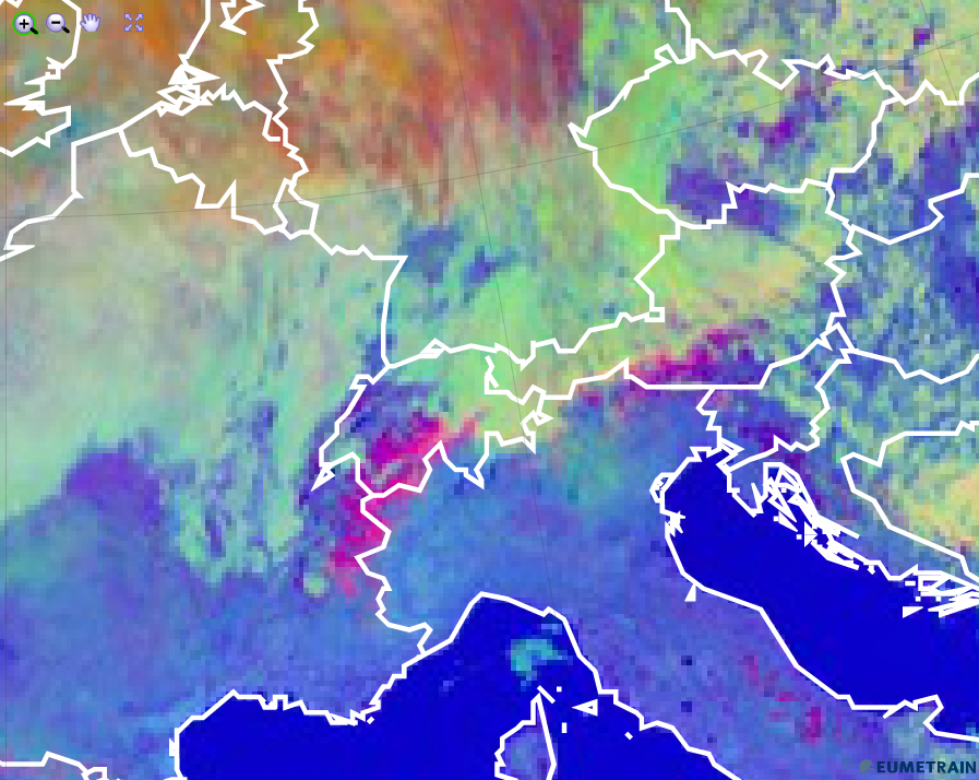
When getting colder, the blue colour beam contributes less and the other colour beams are of equal intensities (see image below).
Day Microphysics RGB from 5 February 2016, 12:00 UTC
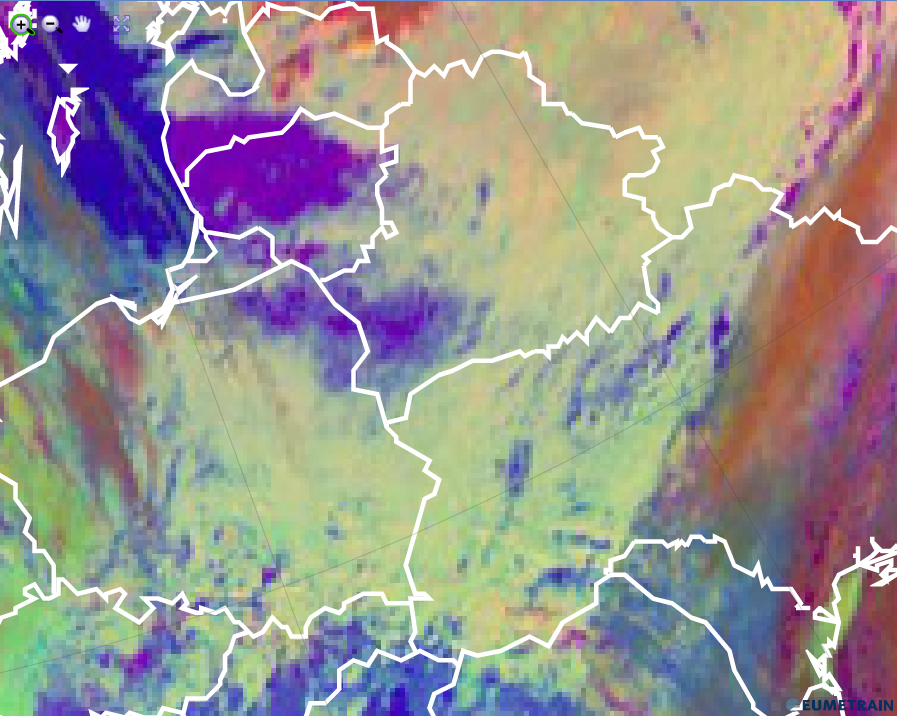
The Day Microphysics RGB is perfectly suited to distinguish snow (red) on the ground from low level water clouds (whitish green).
Day Microphysics RGB from 5 February 2016, 12:00 UTC
Explanation of the pastel green colour of low water clouds in the Day Microphysics RGB (see the recipe):
All 3 colour beams contribute with about the same intensity in case of low level water clouds. Nevertheless, the green colour dominates when these clouds are composed of very small water droplets.