
Cirrus clouds
High and thick Cirrus clouds depict in black in the Dust RGB images. Thin Cirrus clouds turn into blue.
For high and thick Cirrus clouds, none of the colour beams is contributing.
The brightness temperature difference BTD (IR12.0 - IR10.8) is used for the detection of Cirrus clouds. When they are present, the BTD turns negative and the contribution from the red colour beam is near zero.
The same is valid for the BTD (IR10.8 - IR8.7), used to detect low water clouds. When Cirrus clouds are present, the BTD is near zero and the contribution from the green colour beam null.
The contribution from the blue colour beam is related to the amount of radiation measured by the SEVIRI instrument at 10.8 micrometer. For thick and cold ice clouds, the contribution of the blue colour beam is null, but when these ice clouds become thinner and are located over a warm surface (e.g. sea), they turn into a dark blue.
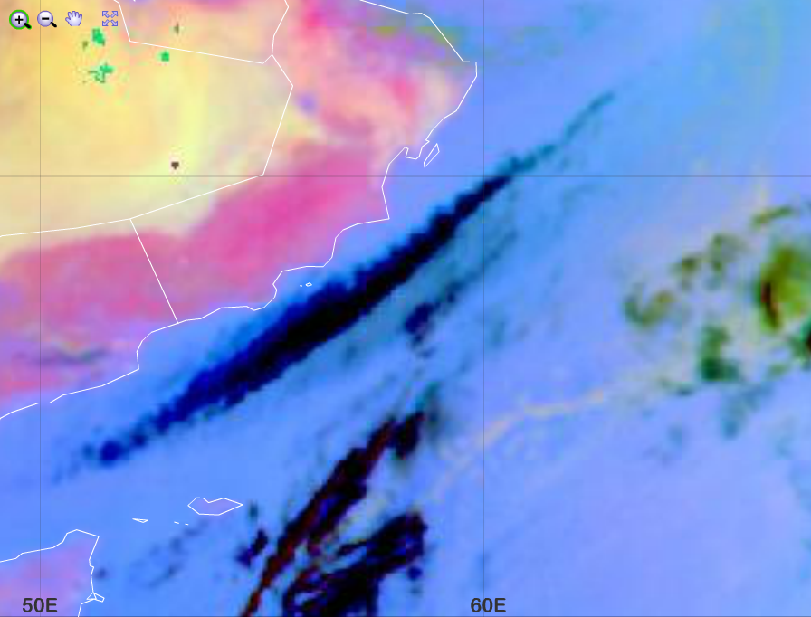
Dust RGB from 10 January 2016, 00:00 UTC
The image below shows an elongated Cirrus cloud over the Indian Ocean. The south-western part of the cloud turns into blue. This is a clear sign that the Cirrus cloud gets thinner.
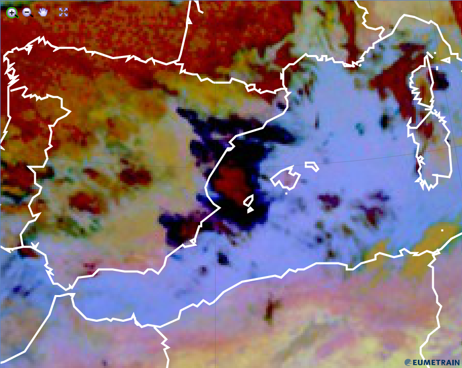
Dust RGB from 5 February 2016, 00:00 UTC
Explanation of the black colour of Cirrus clouds in the Dust RGB (see the recipe):
For high and thick Cirrus clouds, none of the colour beams contribute. In case of thin Cirrus over a warm ground, black turns into dark blue.