
black
Open water bodies (outside the sunglint region) usually appears black in VIIRS Cloud Phase RGB. In some special conditions it might appear dark blue.
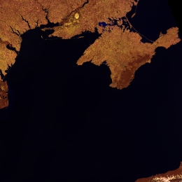
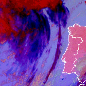
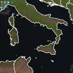
Fig. 1 shows Mediterranean Sea appearing black in the Cloud Phase RGB image. (Snow-free land appears brownish, while snow-covered land is depicted in medium blue. Some water clouds are also seen in yellowish and pinkish colours).
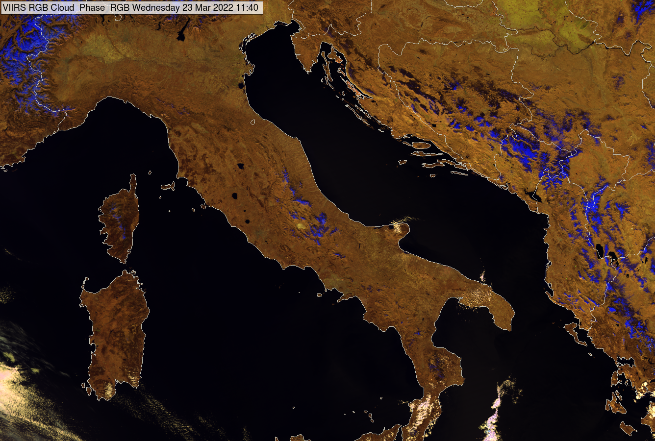
Fig. 1: VIIRS Cloud Phase RGB image for 23 March 2022, 11:40 UTC.
The left panel of Fig. 2 shows part of the English Channel and the North Sea between England and the continent appearing black in the Cloud Phase RGB image. The right panel shows the Crimean Peninsula, and part of the Black Sea. The sea and the River Dnieper (with its tributaries) appear black.
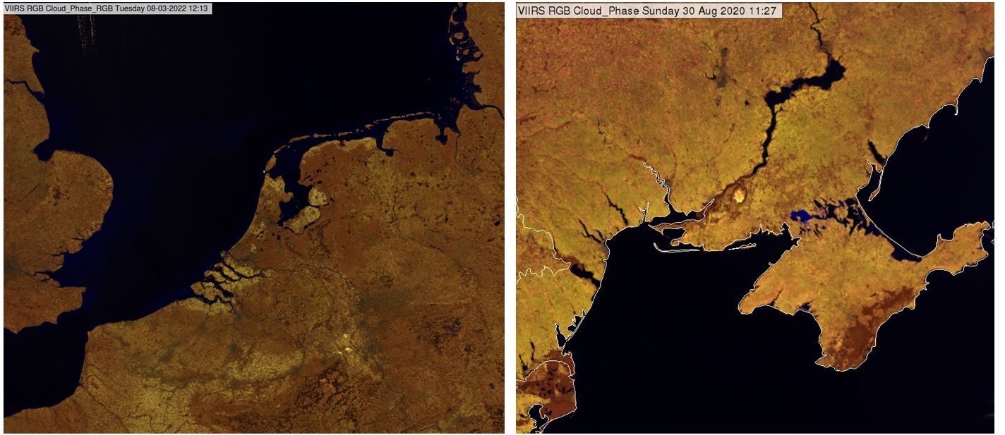
Fig. 2: VIIRS Cloud Phase RGB images for 08 March 2022, 12:13 UTC (left) and 30 August 2020, 11:27 UTC (right).
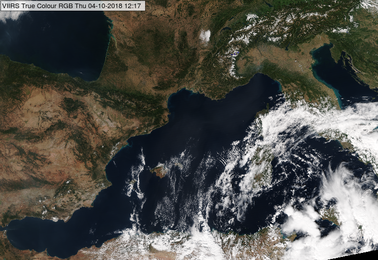
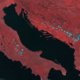
Fig. 3 shows the Alps with large lakes: Garda, Iseo, Como, Maggiore, Geneva, and Neuchatel. The lakes appear black. (The yellow, blue and brown colours indicate water clouds, snow and cloud-free land, respectively).
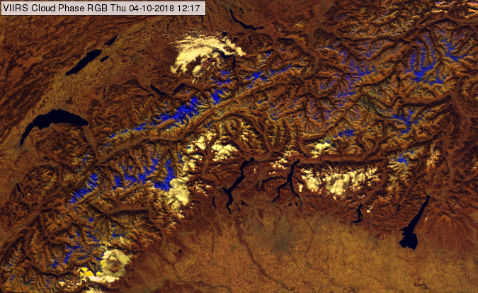
Fig. 3: VIIRS Cloud Phase RGB image for 04 October 2018, 12:17 UTC.
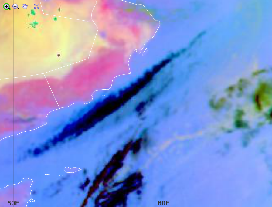
Open water bodies may appear dark blue (instead of black) in some special conditions, e.g. extreme high sediment concentration and/or special viewing geometry. As an example, see the Strait of Dover and a part of the North Sea in the left panel of Fig. 4. The right panel shows the same area in True Colour RGB highlighting the sediment concentration. (In the True Colour RGB tan and greenish cyan colours indicate very high and high sediment concentration, respectively; while deep, clean water appear dark blue.) Additionally, this region was close to the edge of the swath during the studied overpath.
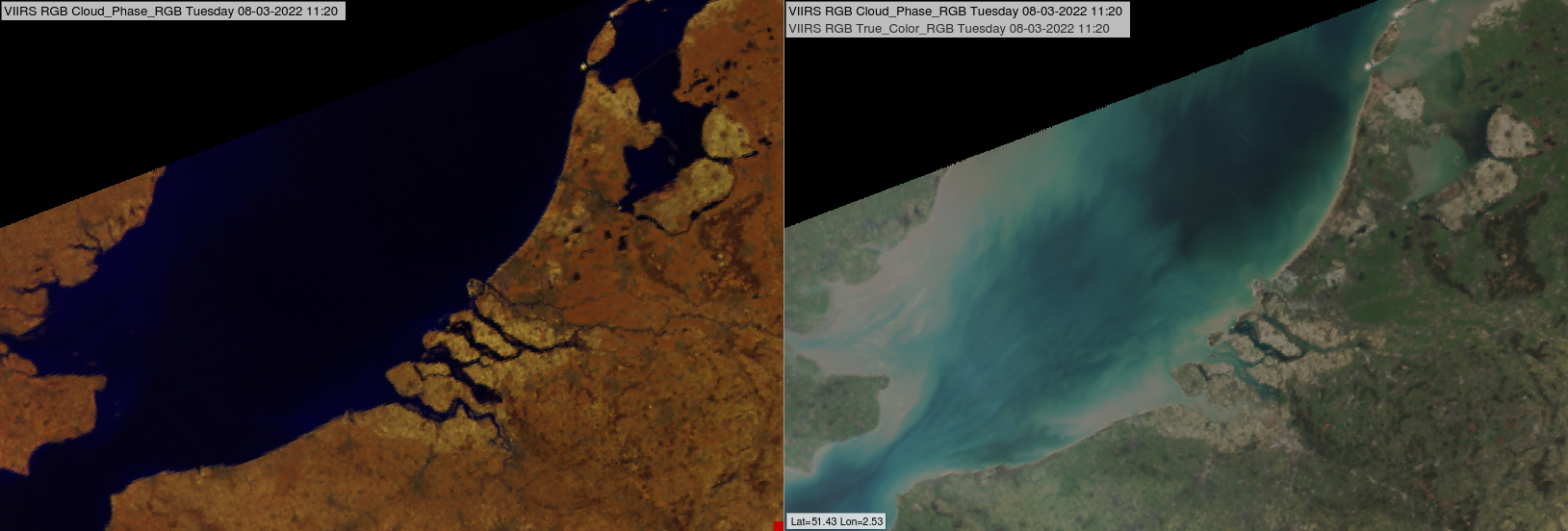
Fig. 4: VIIRS Cloud Phase and True Colour RGB images for 08 March 2022, 11:20 UTC.
Note, that salty lakes also appear dark blue.
Note, that the colour of a water body may be different than black (or dark blue) in the following cases:
• Its size is not enough large compared to the pixel size.
• It is covered by clouds.
• It is covered by vegetation.
• It is in the area of sun glint
• It is covered by large amount of aerosols (e.g. dust).
Explanation of the colours of open water bodies outside the sunglint area (see also the recipe on the left side):
• The reflectivity values of both near infrared channels are extremely low, almost zero (water absorbs strongly at these wavelength), see the graph below. In the visible channel the reflectivity is somewhat higher but usually very low. Consequently, open water bodies usually appear black.
• In some special conditions (e.g. special combination of solar and satellite directions and/or extreme high sediment concentration in the water) the visible reflectivity somewhat increases and so, the water body might appear dark blue.
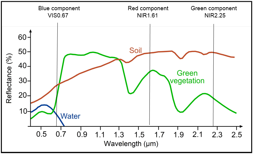
Fig. 5: Typical reflectance spectra of green vegetation, soil and water. The central wavelengths of the three channels the VIIRS Cloud Phase RGB is created from are indicated by vertical lines. © CEOS project
Deep, clean water bodies - most parts of oceans and seas – usually appear dark blue, almost black in the VIIRS True Colour RGB images, except the area of sunglint which is blurred greyish, sometimes whitish.
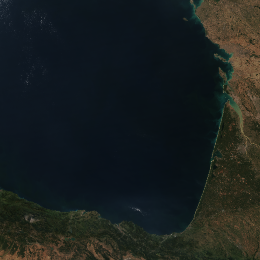
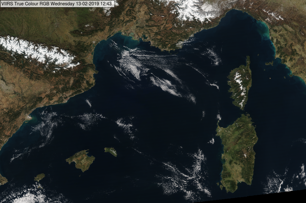
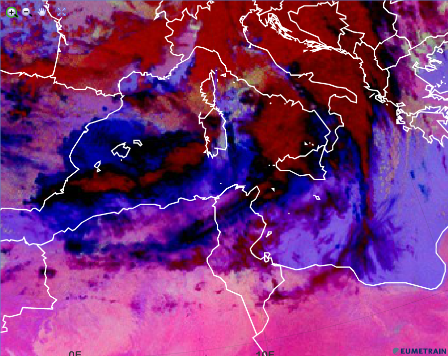
The next images show the Atlantic Ocean and the Mediterranean Sea.
NPP, VIIRS True Colour RGB image for 04 October 2018, 12:17 UTC
NPP, VIIRS True Colour RGB image for 31 July 2013, 16:29 UTC
The image below shows sunglint, see the blurred greyish straight strip. A sunglint is the mirror-like reflection of the Sun from a water surface. Sunglint has more complicated structure in case of higher surface roughness (high waves). In the image below the brownish grey area east of the sunglint is dust cloud and the white patches are water and ice clouds.
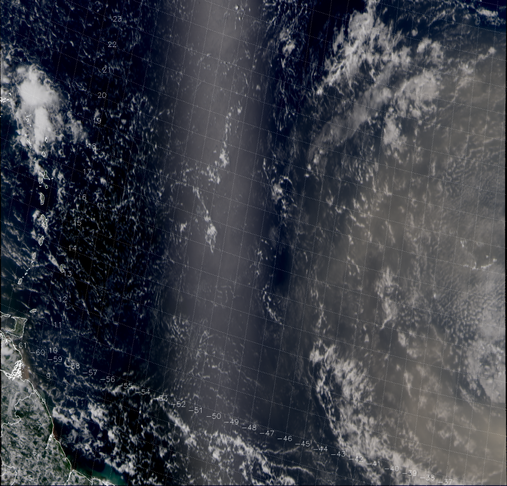
NPP, VIIRS True Colour RGB image for 31 July 2013, 16:29 UTC
(source: http://rammb.cira.colostate.edu/projects/npp/blog/index.php/uncategorized/abafado-bruma-seca/)
Note that:
• The water reflectivity depends not only on the water characteristics but as well as on the solar and satellite viewing directions. Towards the edge of the swath the water colour may be brighter, while along the sub-satellite track it might be darker.
• Sea ice appears whitish.
• If the water is not deep and clean then its colour modifies, see examples separately.
• If there is high concentration aerosol plume above the sea (such as lofted dust, smoke) the colour of the sea trough the aerosol layer turns to greyish/brownish.
Explanation of the colour of deep, clean water bodies in the True Colour RGB (see the recipe):
The reflectivity is very low in all three visible channels, but still a bit higher at lower wavelengths, and so the deep, clean water bodies appear dark blue, almost black in the True Colour RGB.
Sea, lakes, rivers (open water surfaces) appear black in the HRV Fog RGB images. See for example the Adriatic Sea, Mediterranean Sea, Baltic Sea, North Sea and several lakes in the images left and below.
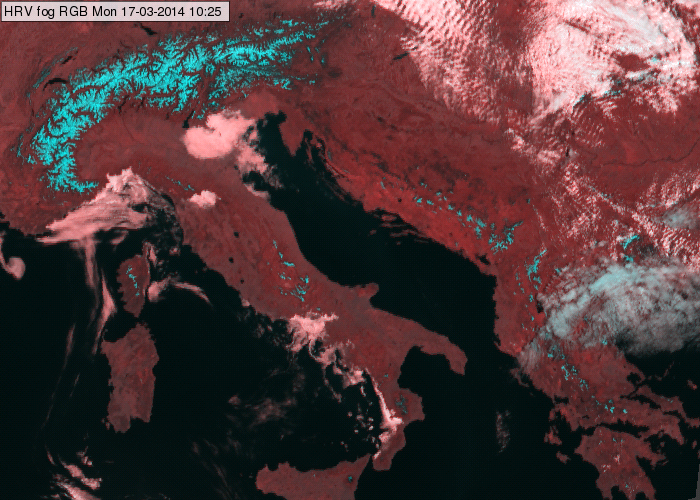 Meteosat, SEVIRI HRV Fog RGB for 17 March 2014, 10:25 UTC
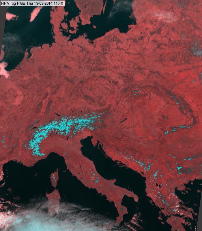
Meteosat, SEVIRI HRV Fog RGB for 13 March 2014, 11:40 UTC
Explanation of the colours of the open water surfaces (see the recipe):
The reflectivity is very low in both the NIR1.6 and the HRV channel. After performing the linear stretching the signals are still very low.
The AVHRR instrument measures only small amounts of backscattered solar radiation from the direction of water surface because water strongly absorbs the shortwave radiation. Therefore the Natural Colour RGB depicts ocean, sea and lake surfaces in black colours (see the AVHRR images left and below).
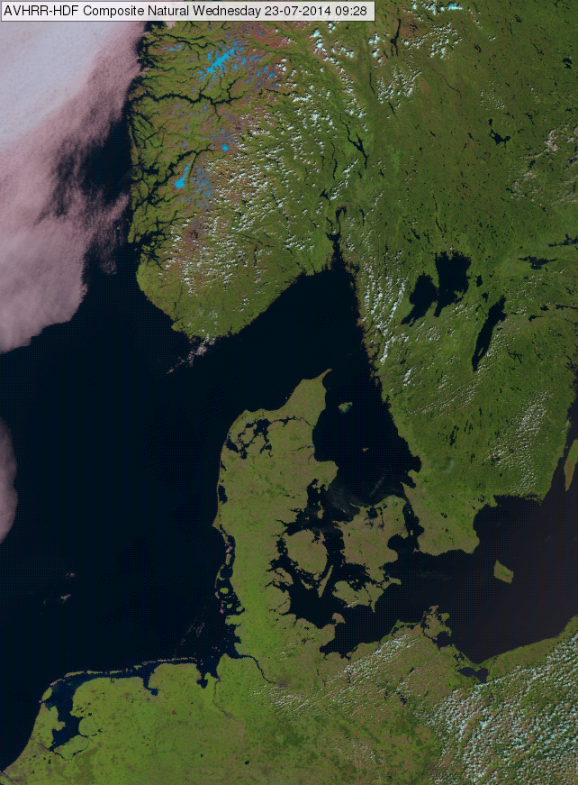
MetOp AVHRR Natural Colour RGB image, 23 July 2014 09:28 UTC
An exception is the sunglint area, where increased amount of solar energy is reflected from the water surface. In the area of the sunglint the water surface becomes silver, pale brownish or pale pinkish. An example is shown in the image below, where sunglint area is indicated by the yellow circle. Sunglint is the mirror-like reflection of the Sun off a water surface in a satellite image. Smooth ocean water becomes a silvery mirror, while rougher surface waters (with big waves) appear darker. As the ocean and sea is never perfectly smooth or calm, the Sun’s reflection gets blurred giving the water surface a washed out appearance.
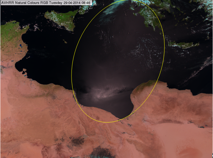
MetOp AVHRR Natural Colour RGB image, 29 April 2014 08:46 UTC
Explanation of the black colour of lakes and seas in the Natural Colour RGB (see the recipe):
- With a very weak contribution of the green and the blue colour beam over lakes and seas (water), the resulting colour is black.
- In case of a sun glint, stronger reflection of solar radiation, equally strong in each colour beam, results in a whitish, grey hue.
High and thick Cirrus clouds depict in black in the Night Microphysics RGB images. Thin Cirrus clouds turn into blue.
For high and thick Cirrus clouds, none of the colour beams is contributing.
The brightness temperature difference BTD (IR12.0 - IR10.8) is used for the detection of Cirrus clouds. When they are present, the BTD turns negative, the contribution from the red colour beam is near zero.
The same is valid for the BTD (IR10.8 - IR3.9), used to detect low water clouds. When Cirrus clouds are present, the BTD is near zero and the contribution from the green colour beam null.
The contribution from the blue colour beam is related to the amount of radiation measured by the SEVIRI instrument at 10.8 micrometer. For thick and cold ice clouds, the contribution of the blue colour beam is null, but when these ice clouds become thinner and are located over a warm surface (e.g. sea), they turn into blue (see image below).
Night Microphysics RGB from 10 January 2016, 00:00 UTC
Explanation of the black colour of Cirrus clouds in the Night Microphysics RGB (see the recipe):
• For high and thick Cirrus clouds, none of the colour beams contribute. In case of thin Cirrus over a warm ground, it turns into blue.
High and thick Cirrus clouds depict in black in the Dust RGB images. Thin Cirrus clouds turn into blue.
For high and thick Cirrus clouds, none of the colour beams is contributing.
The brightness temperature difference BTD (IR12.0 - IR10.8) is used for the detection of Cirrus clouds. When they are present, the BTD turns negative and the contribution from the red colour beam is near zero.
The same is valid for the BTD (IR10.8 - IR8.7), used to detect low water clouds. When Cirrus clouds are present, the BTD is near zero and the contribution from the green colour beam null.
The contribution from the blue colour beam is related to the amount of radiation measured by the SEVIRI instrument at 10.8 micrometer. For thick and cold ice clouds, the contribution of the blue colour beam is null, but when these ice clouds become thinner and are located over a warm surface (e.g. sea), they turn into a dark blue.
Dust RGB from 10 January 2016, 00:00 UTC
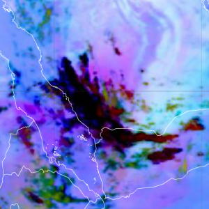
The image below shows an elongated Cirrus cloud over the Indian Ocean. The south-western part of the cloud turns into blue. This is a clear sign that the Cirrus cloud gets thinner.
Dust RGB from 5 February 2016, 00:00 UTC
Explanation of the black colour of Cirrus clouds in the Dust RGB (see the recipe):
For high and thick Cirrus clouds, none of the colour beams contribute. In case of thin Cirrus over a warm ground, black turns into dark blue.
Oceans and lakes appear black in the Natural Colour RGB images.
Liquid water strongly absorbs short wave radiation emitted from the sun. The SEVIRI instrument onboard MSG measures only small amounts of back scattered radiation from the sun in the spectral range between 0.6 and 1.6 microns. Therefore the Natural Colour RGB depicts ocean and lake surfaces in dark (black) colours.
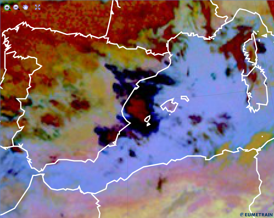
More solar energy is reflected from the water surface when the sun reflection angle is the same than the satellite sensor is viewing the surface. In the area of the sunglint (red arrow) the ocean surface becomes greyish (see image below).
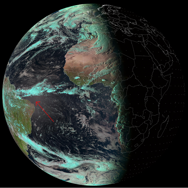
Sun glint visible near the Brasilian coast in the Natural Colour RGB (indicated by the red arrow).
Explanation of the colours of water surfaces in the Natural Colour RGB (see the recipe):
Liquid water absorbs most of the solar energy in the spectral range between 0.6 and 1.6 micrometer. As the sensor does not receive noticable radiation in all three spectral channels, the resulting colour is black. In the special case of "sun glints", the SEVIRI sensor receives a higher fraction of reflected solar radiation (equal amount in all three channels) and the resulting colour is grey.