
Basic Satellite Course: Contrails and ship trails
Competency Framework
WMO Satellite Skills
Application
Description
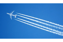
Identify contrails and ship trails.
Content
In this part of the course you will not only learn more about the identification of clouds such as Stratus, Cumulus and Cirrus from satellite images, and you will also discover various methods to derive cloud height information. Microphysical properties of clouds like cloud phase and cloud particle size are also addressed.
To access the resource click here.
Note: all resources are provided as an external link which redirects you to https://eumetcal.eu where you will need to create a user account in order to gain access to the course