
Tropical Meteorology Event Week 2026
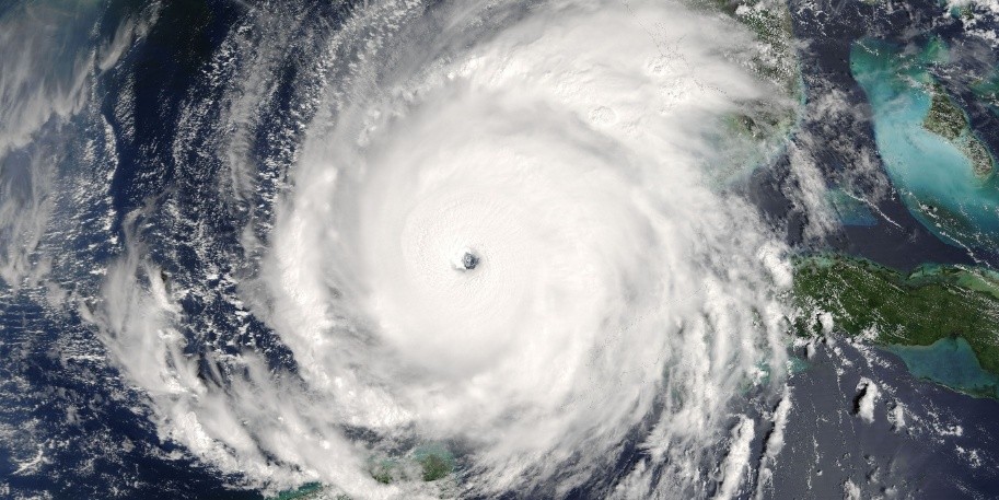
From 20 to 22 October 2026, EUMeTrain organised an online Event Week exploring tropical meteorology. Through presentations, forecasters and experts shared their experience of observing and forecasting phenomena such as monsoons, tropical cyclones, El Niño, convection, dust storms and more.
The programme was primarily intended for European operational forecasters who may encounter tropical meteorological situations in their daily work. The objective was to provide a deeper understanding of tropical weather phenomena and their impacts on populations, infrastructure and socio-economic activities.
Session 1 - 20 October 2026
Nanda Alfuadi (BMKG) - Forecasting a heavy rainfall case in Jakarta
The presentation examines the performance of four numerical weather prediction models (WRF assimilation, WRF non-assimilation, IFS, and GFS) during a heavy rainfall case in Jakarta, the capital city of Indonesia. Specifically, the discussion focuses on how effectively these models captured the high-impact weather signal starting three days before the event.
Nanda Alfuadi - Recording & lecture slides
Abhishek Lodh (NCMRWF) - From observations and coupled NWP to impacts: advancing tropical weather and monsoon forecasts over the Indian subcontinent
Accurate representation of initial conditions in NWP is critical for improving the prediction of high-impact tropical weather and monsoon systems over the Indian subcontinent. Operational developments at NCMRWF, including the assimilation of satellite-derived ASCAT soil moisture and INSAT-3D land surface temperature observations, demonstrate improved prediction of monsoon depressions, tropical cyclones, precipitation, and extreme temperatures, with enhanced forecast skill and extended predictive capability. These advances in land–atmosphere initialization strengthen operational early-warning information for weather-sensitive sectors and support better anticipation of impacts on communities, agriculture, infrastructure, and critical services.
Abhishek Lodh - Recording & lecture slides
Session 2 - 20 October 2026
Mirriam Mwende Musyoka (Kenya Meteorological Services Authority) - Convection in the tropics: seasonal patterns, hazards and impacts, and operational forecasting and nowcasting
Deep, moist convection is the principal producer of high-impact weather in the tropics and remains one of the most demanding forecast problems in operational forecasting in the tropics. This presentation reviews three interlinked themes. First, the typical seasonal patterns of tropical convection, i.e., the Zonal and meridional migration of the Intertropical Convergence Zone and the resulting monsoonal and bimodal rainfall regimes of equatorial regions, the afternoon-to-evening convective maximum, and the modulation of convective activity by intraseasonal variability such as the Madden–Julian Oscillation. Seasonal tropical cyclone activity in the Indian Ocean basin is also placed within the same framework. Secondly, it examines the major hazards from these convective developments and their impacts. Heavy rainfall and flash flooding, lightning, hail, damaging downdrafts and gust fronts, and visibility-reducing phenomena affect local populations through loss of life, displacement, damage to infrastructure and agriculture, and disruption of surface transport. Third, the presentation reviews the forecasting and nowcasting methods used operationally. The presentation will conclude by discussing how these tools are integrated into early warning services for high-impact weather scenarios.
Mirriam Mwende Musyoka - Recording & lecture slides
Soukaina Boughanem (Maroc Météo) - Tropical convection over Morocco: forecasting and monitoring
The presentation focuses on tropical convection over Morocco, with emphasis on its forecasting and monitoring in relation to the northward extension of the ITCZ. The main atmospheric features and the use of numerical models, satellite, radar and observations for operational monitoring are also briefly discussed.
Soukaina Boughanem - Recording & lecture slides
Session 3 - 21 October 2026
Michaël Claudon (Météo-France) - Application of NWC SAF convection (RDT and CI) products in the tropics
The RDT-CW (Rapidly Developing Thunderstorm - Convection Warning) product and the CI (Convective initiation) product are developed by Météo-France in the framework of the EUMETSAT NWC SAF. Using mainly geostationary satellite data, they provide information on pixels/clouds related to convective initiation or significant convective systems. In the presentation, the application of RDT/CI in the tropics is discussed in terms of performance (use of MTG-LI for tuning and validation purposes), product representation (CI object mode), and assessment of thunderstorm severity (new detection of cloud-top features in the RDT).
Michaël Claudon - Recording & lecture slides
Matshidiso Mogale (SAWS) - Wildfires in Southern Africa: from weather conditions to satellite detection and impacts
This presentation explores wildfire risk across Southern Africa, with a focus on the Western and Eastern Cape of South Africa, highlighting the seasonal and meteorological conditions that favour wildfire development and spread. It demonstrates how satellite products can be used for wildfire detection and monitoring, while highlighting the impacts of wildfires on communities, infrastructure and the environment.
Matshidiso Mogale - Recording & lecture slides
Session 4 - 21 October 2026
Ivan Smiljanić (EUMETSAT) - Storms and storm monitoring over the tropics (vs mid-latitudes)
Deep moist convection exhibits distinct characteristics across the tropics and mid-latitudes, reflecting differences in thermodynamic environments, vertical wind shear, and the mechanisms governing storm organisation. This talk compares the genesis, organisation, and dynamics of tropical and mid-latitude convective storms, and discusses how these differences influence their monitoring and observation from space-based platforms.
Ivan Smiljanić - Recording & lecture slides
Hama Hamidou (ASECNA/EAMAC) - Dust storms: impacts, forecasting, and monitoring
Dust storms are one of the major high-impact weather phenomena that affect tropical arid and semi-arid areas, with important socio-economic impacts. Even though dust storms are generated in these regions, they can affect areas far beyond their source regions, depending on the weather systems present. In this presentation, the socio-economic impacts of dust storms, conceptual models for dust forecasting, and methods used for dust monitoring are presented.
Hama Hamidou - Recording & lecture slides
Session 5 - 22 October 2026
Sofia Chabhi (Maroc Météo) - Impact of Storm Ingrid on the coastal and marine environment of Morocco
This presentation examines the passage of Storm Ingrid (22 - 24 January 2026) and its severe impacts along the Moroccan coastline using satellite observations and remote sensing data. It analyzes the key oceanographic and meteorological features of the storm, highlighting how satellite imagery aids in monitoring extreme events and improving coastal vigilance.
Sofia Chabhi - Recording & lecture slides
Gwenaël Le Bras (Météo France/OSI SAF) and Ad Stoffelen (KNMI/OSI SAF) - Contribution of OSI SAF data to the marine tropical meteorology
EUMETSAT OSI SAF provides near-real-time retrieval of key parameters for marine meteorology in the tropical areas and around the globe. Here are presented the Sea Surface Temperature and Ocean Wind retrieval catalogue, illustrated with particular meteorological phenomena.
Gwenaël Le Bras and Ad Stoffelen - Recording & lecture slides
Session 6 - 22 October 2026
Brian LaMarre (Inspire Weather) – Hurricane Ian: a case for impact-based, probabilistic decision support services for emergency management and public safety
Hurricane Ian made landfall as an intense Category 4 hurricane on September 28, 2022, on the southwest coast of Florida in the United States, claiming 156 lives in the U.S., including 66 direct fatalities in Florida. Drowning in storm surge waters was the primary cause of death. This presentation highlights how the National Weather Service worked proactively to prepare the public through engagement with core partners in media and emergency management before, during and after the storm. Public perception, based on lived experiences from past storms impacting the region, was a factor in the overall response. Additionally, there was a lack of understanding of how small changes in track can result in significant differences in impact based on the angle of approach of a hurricane moving toward Florida's north-south oriented coastline.
Brian LaMarre - Recording & lecture slides
José Manuel Gálvez (CIRA/CSU) - Monitoring El Niño and its impacts on weather and climate using satellite tools
The session aims to build an understanding of how El Niño modifies weather and climate in tropical regions and beyond, with a focus on satellite-based and numerical weather prediction tools. It covers the basic concepts and definitions of El Niño, its typical impacts, monitoring and classification, and applications of satellite observations for monitoring its evolution and impacts. It also examines the expected impacts of the current El Niño event, which has already exceeded the intensity of previous events observed since 1950.
José Manuel Gálvez - Recording & lecture slides