MPEF Divergence Product (DIV)
The MPEF Divergence product is calculated hourly by EUMETSAT and delivered to users via Eumetcast. The DIV product provides information about the upper-tropospheric flow, and more precisely about upper-level horizontal convergence and divergence.
This product is a special application of the WV AMVs. It uses AMVs from the WV 6.2 mm channel for deriving upper tropospheric divergence in order to forecast areas of deep moist convection. This is based on the fact that upper tropospheric divergence is the result of a strong updraft throughout the troposphere, which makes the area favorable for convection. The WV 6.2 µm channel is the best choice for this purpose, since it can track humidity features as well as clouds in the layer between 100 and 400 hPa.
Of note is that this product should be used in combination with instability parameters (for example GII) rather than by itself.
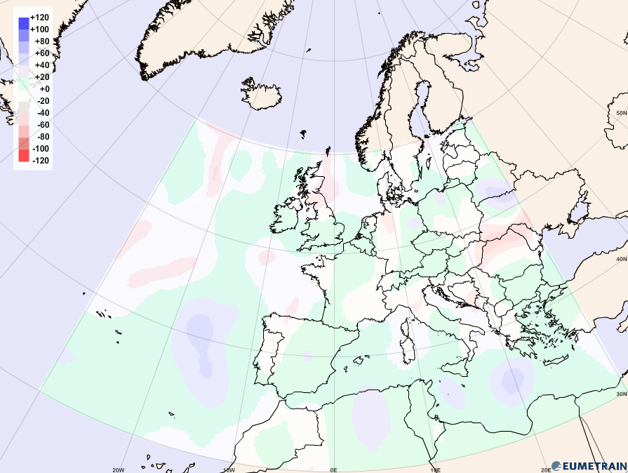
Figure 4a: MPEF DIV product, 13 June 2012, 12:00 UTC. Blue and green colors show divergence in upper tropospheric layers, red colors indicate convergence.
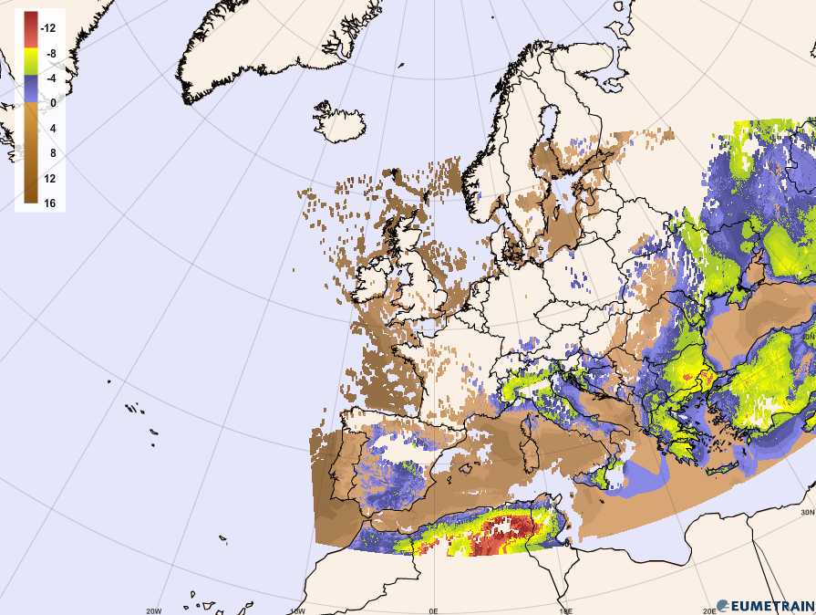
Figure 4b: Global Instability Index (GII), 13th June 2012, 12:00 UTC. The more negative the values are, the more unstable are the atmospheric conditions.
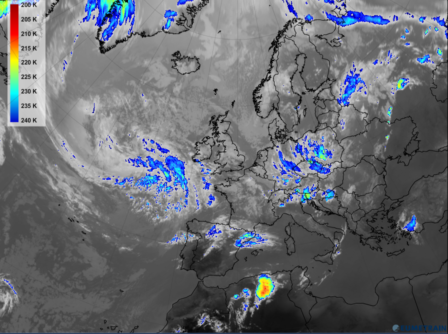
Figure 4c: Enhanced IR 10.8 µm image, June 13 2012, 18:00 UTC.
Figure 4a shows the MPEF DIV-field on 13 June 2012 at 12:00 UTC. Divergence in upper tropospheric layers (blue colours) can be detected west of the Iberian Peninsula, over North Africa and over the western Mediterranean Sea.
By comparing these regions with the GII fields (figure 4b), a distinct sign of instability can be seen over northern Africa. This is a region that forecasters should keep under observation in case there will be convective developments during the day.
Taking a look at the situation six hours later (figure 4c) a distinct convective cell has developed in this area.