
Mid-level water clouds
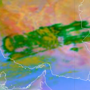
Semitransparent mid-level water clouds depict in green colours in the Dust RGB images. Over deserts, thin ice clouds also appear in green.
The green colour in the Dust RGB generally indicates thin, mid-level semitransparent cloudiness, thin Altostratus or Altocumulus, but can also be thin high-level ice cloud (if the cloud is above sand desert).
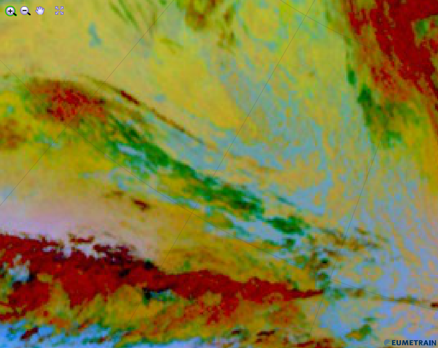
The red colour beam contribution is represented by the brightness temperature difference (BTD) IR12.0-IR10.8 in a scale between [-4;+2]. The BTD is low (negative), because the cloud is semitransparent.
The green colour beam is represented by the BTD (IR10.8-IR8.7). It is ~(2-4 K) for water clouds and low (around zero or negative) for ice clouds. A mid level cloud is usually a mixed phase cloud so it has a BTD in between. As the cloud is semitransparent, the IR10.8-IR8.7 difference depends on the transmissivity and the BT of the underlaying surface as well. Be aware that with a strong conribution of surface radiation (e.g. from deserts), the BTD can become positive also for ice clouds. As for the green component a strong gamma correction (with 2.5 gamma) is applied, the green signal becomes medium strong.
The BT of IR10.8 is low, because it is a mid-level cloud. For a semitransprent cloud, BT is higher than the real cloud top temperature, it depends on the transmissivity and the temperature of the underlaying surface as well, but usually it is low in the (261-289) K range. Therefore, the blue colour contribution is low.
The Dust RGB image below shows semitransparent water clouds over the Atlantic.
Explanation of the green colour of high opaque clouds in the Dust RGB (see the recipe):
• Only the BTD (IR10.8-IR8.7) contributes to the Dust RGB in case of semitransparent mid-level water clouds. The small positive values are enhanced by a strong gamma correction.