
Low land surface temperatures
Low land surface temperatures appear greenish in the Airmass RGB images.
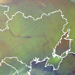
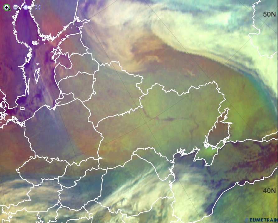
In winter time, large greenish areas appear in the Airmass RGB imagery depicting cloud free areas especially in conjunction with a pronounced high pressure system. This green colour indicates very cold conditions on ground level as can be seen in the image below over the Ukraine and Russia in February 2012.
Explanation of the greenish colour of cold land surfaces in the Airmass RGB (see the recipe):
In this high pressure zone, the air is relatively dry and subject to sinking. The red colour contribution from the brightness temperature difference (BTD) WV6.2 and WV7.3 is moderately high.
The main contribution comes from the green colour beam, the BTD (IR9.7 – IR10.8), which can take values from -40 to +5 K, where -40 K corresponds to no green contribution and +5 K to a maximum green contribution. As the surface temperature in the window channel IR10.8 is comparable or just a little bit higher than the BT from the ozone channel IR9.7, the brightness temperature difference of those two channels is small, hence the green colour contribution large.
The air in high pressure areas is rather dry due to sinking air masses. Hence the blue colour contribution of the inverted channel WV6.2 to the Airmass RGB is moderately high because it is very cold.
Conclusion: Although the red and the blue colour beam contribute moderately in case of very cold land surfaces, the green colour beam dominates the Airmass RGB.