
Snow and ice on the ground
A fresh, cold, homogeneous snow cover appears pale-yellow in the AVHRR Cloud RGB images. Melting snow has slight orange tone.
The image below shows snow-covered mountains: Alps, Massif Central and Pyrenees.
Note that this RGB type does not contain information about the phase. Snow and low water clouds have similar colours, because their reflectivity and temperature are similar, see for example the snowy mountains and the yellow low-level clouds over Toscana in the image below.
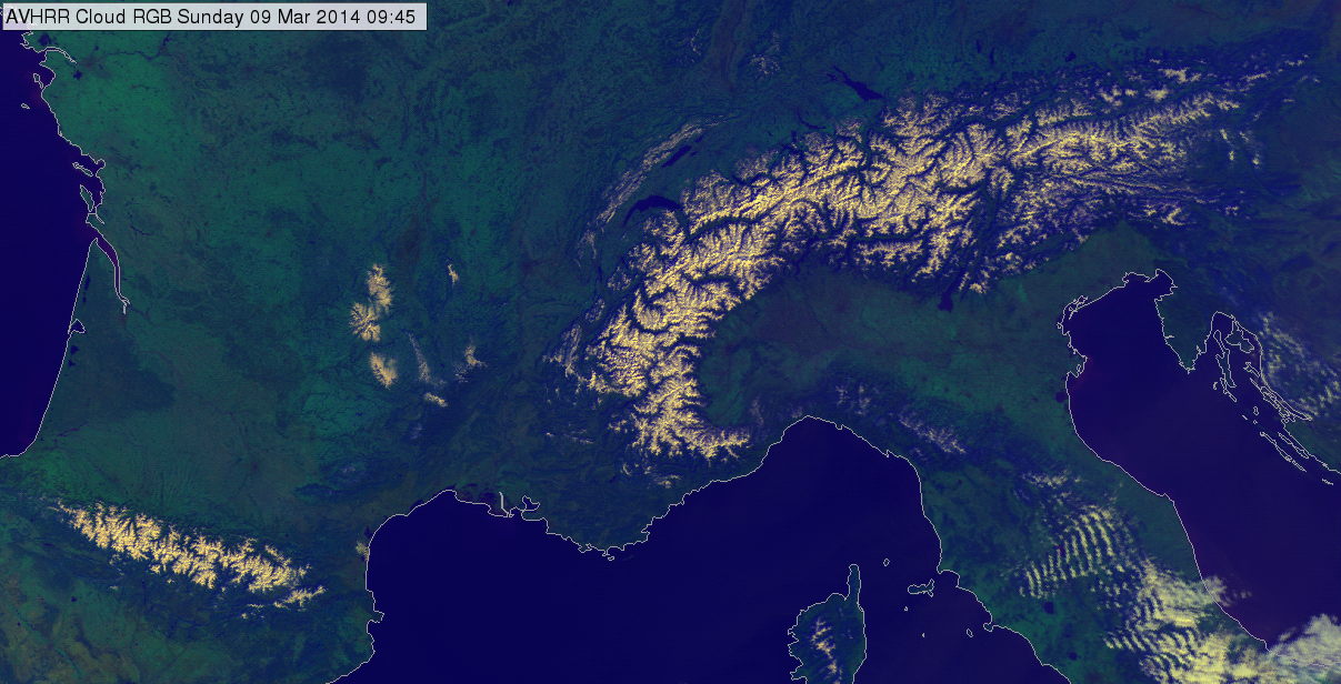
AVHRR Cloud RGB image of the Pyrenees and Alps region for 09 March 2014 at 09:45 UTC
The image below shows snow covered low-land north of the Caspian Sea. The rivers are seen as dark lines in the snow-covered area. In the north-east corner of the image clouds cover the snow.
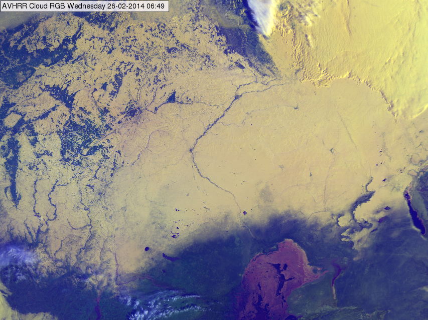
AVHRR Cloud RGB image of the region north of the Caspian Sea for 26 February 2014 at 06:49 UTC
The image below shows Iceland and Greenland in AVHRR Natural Colour and Cloud RGB images. At the coast of Greenland Sea ice can be seen as well. We present Natural Colour RGB as well to help to distinguish snow and ice from clouds.
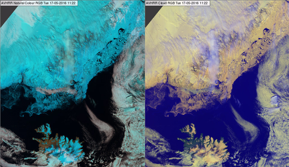
AVHRR Natural Colour (left) and Cloud (right) RGB images of Iceland and Greenland for 12 May 2016 at 11:25 UTC
The image below shows the Alps region in AVHRR Cloud and Day Microphysics RGB images. We present the Day Microphysics RGB to help to distinguish snow from clouds. The snow has orange tone; it is smelting in May.
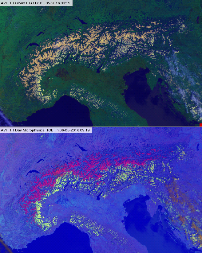
AVHRR Cloud (up) and Day Microphysics (bottom) RGB images of the Alps region for 06 May 2016 at 09:19 UTC
Explanation of the colours of snow (see the recipe):
• The reflectivity of a fresh, cold, homogeneous snow cover is high both in VIS0.63 and NIR0.87 channels and their values are close to each other. Therefore, the red and green signals are high and similarly strong.
• For melting snow the reflectivity decreases slightly in the VIS0.63 channel, and more strongly in the NIR0.87 channel. The red signal is still high, while the green signal is lower.
• The blue signal is medium strong, as the temperature of the snow is around zero or colder, but not as cold as a high-level cloud.
As a consequence, cold, deep, homogeneous snow surfaces appear yellow, while melting snow is yellow with slight orange tone.