Typical colors
Fig. 4 shows the typical colors of Cloud RGB images. These are just examples, and many other colors and tones are possible. Note that the brightness and shades of the colors may vary across the swath. For more on this, see the chapter 'Effects of the scanning geometry'.
Clouds:
- high-level thick cold clouds are white
- high-level thin cirrus clouds are bluish
- thick medium- and low-level clouds are yellowish
Cloud-free areas:
- Open water surfaces (sea, ocean, big deep lakes) are medium blue - except for increased aerosol content (like dust clouds) or sunglint.
- Ice-covered seas are yellowish (melting ice is yellow with some reddish tones)
- Snow on land appears yellowish (melting snow is yellow with some reddish tones)
- The color of snow-free land reflects the green vegetation fraction ('chlorophyll content'): more vegetation - more green. However, it also depends on temperature.
- warm vegetated area - bright green
- cold vegetated area (e.g. mountains) - bluish green
- bare soil - greyish (with bluish tones in cold areas)
- desert - yellowish green
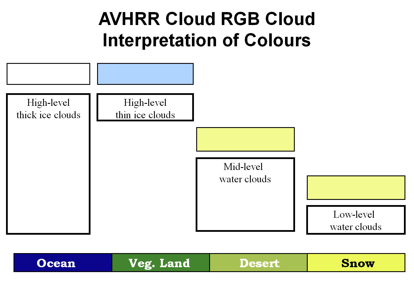
Figure 4: Typical colors of Cloud RGB images
Open water surfaces (ocean, sea, ...) are usually medium blue in AVHRR Cloud RGB images. Areas with sunglint are an exception. Sunglint is the mirror-like reflection of the sun off a water surface. Sunglint occurs on the surfaces of cloud-free oceans, seas, rivers and lakes at a given geometry between the sun and satellite viewing angles. In the sunglint area an increased amount of solar energy is reflected from the water surface. Smooth ocean water becomes a 'silvery mirror', while rougher surface waters (with big waves) appear less bright. Since oceans and seas are nearly never perfectly smooth or calm, the sun's reflection gets blurred, which gives the water a washed-out appearance. Because the reflection has similar intensity in the VIS0.63 and NIR0.87 channels and there is no reflection in the IR10.8 channel, sunglint appears yellowish in Cloud RGB images. Fig. 5 shows sunglint over the Mediterranean during two overpasses. Note that in Metop AVHRR images (morning orbit) the sunglint area typically lies on the eastern side of the satellite ground track.
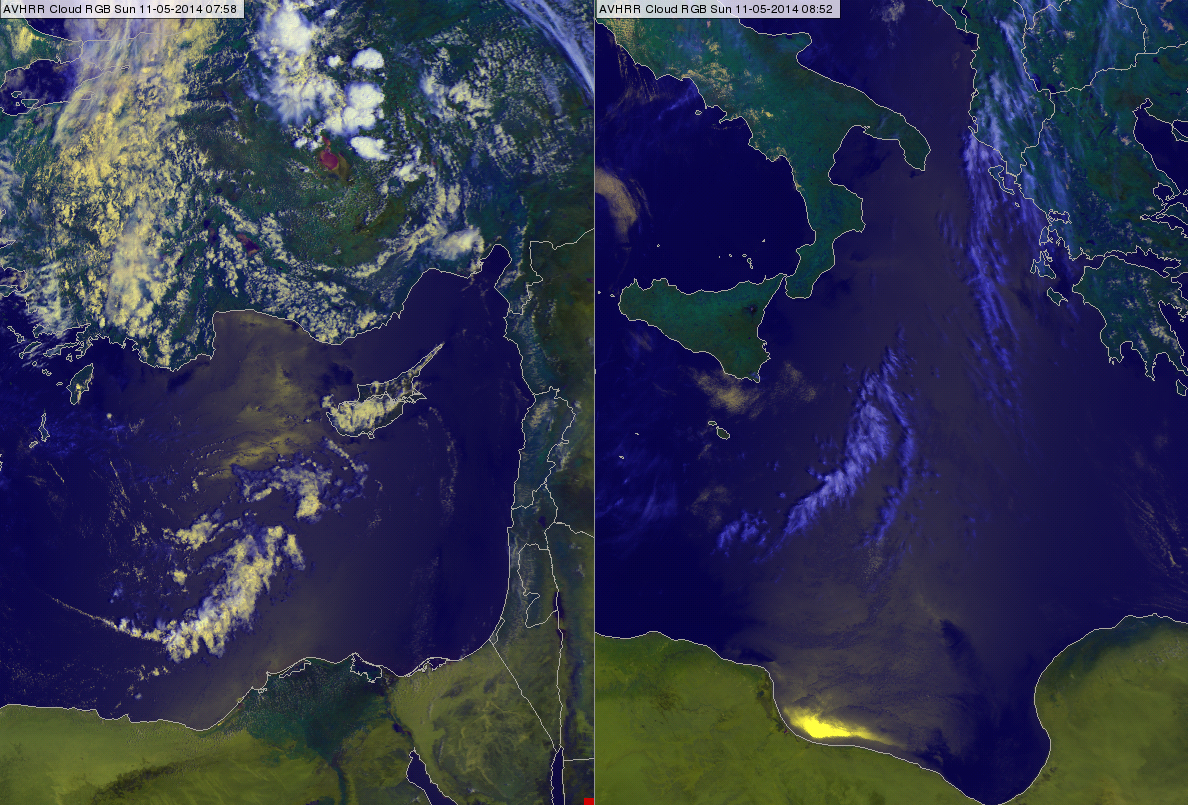
Figure 5: Sunglint over the Mediterranean Sea in AVHRR Cloud RGB images on 11 May 2014 at 07:58 (left) and 08:52 UTC (right)