
Identify and interpret fields and derived products
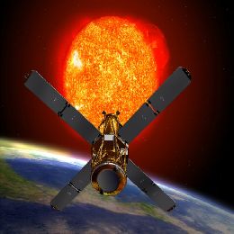
This one hour lecture, held by Jose Prieto, is covering topic of solar satellite channels, mostly from SEVIRI instrument on board MSG.
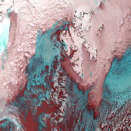
This one hour lecture, held by Jose Prieto, is covering topic of solar satellite channels, mostly from SEVIRI instrument on board MSG. Of all twelve channels form SEVIRI these are the first four, with central wavelengths of 0.3-1.1; 0.6; 0.8 and 1.6 µm, respectively. First one is a high resolution broad band, second two are narrow band and the fourth one is a microphysics channel. There is significant correlation between channels 0.6 and 0.8 µm, where channel 1.6 µm is somewhat different from them. Also small correlation between solar and other thermal channels is discussed.
Some of the topics that are covered in this lecture are; Solar channels characteristics, Vegetation monitoring, Cloud phase and particle size, Sun glint occurrence and Aerosols. Questions like How to discern clouds from forest, how to find ice on planet Earth, how to avoid squinting on satellite images or escape the smoke of a fire are discussed and answered within all this topics.
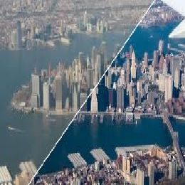
Image enhancement is a process of image modification or improvement of its quality, the aim of which is to achieve a more pleasing appearance of the final image.
This short, but interesting and to all satellite community very useful lecture is brought by Martin Setvak.
Image enhancement is a process of image modification or improvement of its quality, the aim of which is to achieve a more pleasing appearance of the final image. However, in science, the main goal for image enhancement is to increase the interpretability of the image to a human eye and brain, typically focusing on a certain feature carried by the image.
Example of this kind of enhancement you can see in everyday use of digital cameras, which have some kind of built-in image enhancement (software based). So the \'raw\' images captured by the EM sensor can be further improved by simple computer post-processing (in other words - enhancement).
Processes of enhancement can be done with various methods, such as; histogram-based methods, curves adjustment, gamma function adjustment, noise reduction, utilization of advanced filters, etc. Also a few nice examples you can see here and taste the abilities of this kind of image improvement.
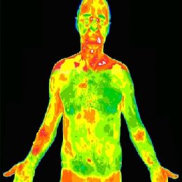
The scope for this 30 minutes lecture is to define origins of IR radiation and how it is measured by meteorological satellites.
Overview and application of infrared channels presented by Jan Kanak. The scope of this 30 minutes lecture is to define origins of IR radiation and how it is measured by meteorological satellites. Thermal radiation wavelengths are spread in wide interval from basically 1 µm up to 1000 µm, but in this case interest is only in middle IR (3 - 8 µm) and long IR (8 - 15 µm) spectrum.
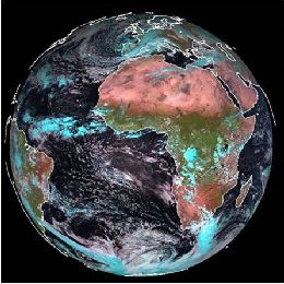
Physical background and meteorological interpretation of satellite images is similar to all meteorological satellites, but in this lecture emphasis will be on those derived from SEVIRI instrument, on board MSG satellite. Some of the practical aspects of utilization of MSG SEVIRI data, examples and useful remarks on IR images visualization you can see here. IR imagery is historically very basic observation method of atmosphere and clouds, together with visible imagery.
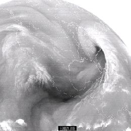
For knowing which processes are present in the atmosphere good interpretation of WV satellite images is needed. For gathering information about water vapor, SEVIRI instrument on board MSG satellite is scanning atmosphere in two channels in water vapor absorption band; 6.2 and 7.3 µm.
WV images are like a footprint of absorption of radiation by a water vapor, which is the main absorber in the atmosphere. Therefore it is clear that understanding of these images can tell us a lot about footprint of atmosphere itself and about processes in it. For knowing which processes are present in the atmosphere good interpretation of WV satellite images is needed.
For gathering information about water vapor, SEVIRI instrument on board MSG satellite is scanning atmosphere in two channels in water vapor absorption band; 6.2 and 7.3 µm. Among these two WV channels, the radiation in channel 6.2 µm is more easily absorbed by water vapor and has a larger information content. Thus is called primary WV channel and is broadly used in image format for weather analysis and forecasting based on synoptic scale interpretation. 7.3 µm channel can also be used in operational forecasting environment for detecting mid-level moisture features associated with low-level thermodynamic conditions. Presenter for this one hour lesson is Christo Georgiev, from Bulgarian National Institute of Meteorology and Hydrology.
This lecture on absorption channels and IASI instrument on board MetOp satellite was held by Xavier Calbet from EUMETSAT.
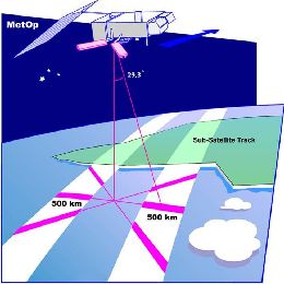
This lecture on absorption channels and IASI instrument on board MetOp satellite was held by Xavier Calbet from EUMETSAT. MetOp is LEO polar orbiting satellite that is spinning around Earth at a height of approximately 800 km. IASI instrument is scanning atmosphere below him in mostly infra-red spectrum band, therefore it can detect emission/absorption of gases like CO2 and O3 quite good, due to their intrinsic physical properties. In that way you one can track these gases in the atmosphere and mark their spatial and temporal distribution.
Lecture starts with comprehensive physical background of radiation, with topic like absorption/emission of the atmosphere, properties of the black bodies (Sun and Earth) and EM waves, etc. which are crucial for understanding of instrument functioning. After that there is explanation of spectral band of IASI instrument, CO2 and O3 SEVIRI channels, followed by some examples of application areas of these.
Two software packages for producing products for nowcasting purposes are SAFNWC/MSG (for geostationary satellites) and SAFNWC/PPS (for polar satellites) and the overview of these are given here.
This lesson, given by Maria Putsay from Hungarian Meteorological Service, is about derived products for nowcasting applications. Objectives of the Nowcasting SAF are development of Nowcasting products derived from MSG and Polar satellite systems, delivering of the SW Packages to users and User\'s support task through Help Desk. Two software packages for producing products for nowcasting purposes are SAFNWC/MSG (for geostationary satellites) and SAFNWC/PPS (for polar satellites) and the overview of these are given here. Products may be used in two ways; as an input to a program (e.g. to an objective meso-scale analysis or as intermediate product input to other products) and as an final image product for display at a forecaster\'s desk, or case studied. But the main aim is firs one mentioned. Also in this lecture applications of the NWC SAF products at the Hungarian Meteorological Service are discussed.
Lecture starts with explanation of Vegetation monitoring and some applications of Vegetation products, such as NDVI index, FVC index, LAI and FAPAR indices.
The new generations of sensors on board meteorological satellites (SEVIRI -MSG, ASCAT -EPS, etc. ) enabled a whole new range of products related to the properties of the surface. Applications of such products are great. Some of them are; Vegetation monitoring, Wild Fires detection, Floods and Heat waves monitoring, detection of Urban heat islands, Crop water requirements, etc.
Lecture starts with explanation of Vegetation monitoring and some applications of Vegetation products, such as NDVI index, FVC index, LAI and FAPAR indices. After that Evapotranspiration parameter and Reference evapotranspiration overview is given. And at the end Land surface temperature is observed and various applications of this product are discussed.
Scatterometer is a main instrument that is gathering information on ocean winds. It is a radar instrument mounted on a satellite.
Another presenter from the OSI SAF, Anton Verhoef (KNMI), did a lecture on Wind products which are closely related to the concept of scatterometry. Scatterometer is a main instrument that is gathering information on ocean winds. It is a radar instrument mounted on a satellite. In this lecture the explanation of principle of scatterometry is given along with explanation of deriving wind fields from scatterometer data. Also there is brief overview of currently available wind products and of tools and methods which are available for visualisation and monitoring of the information. At the end of presentation some words will be given about Quality information and Data formats.
To track and measure sea ice motion and concentration, Passive microwave imagers are used (SSM/I or AMSR-E). These instruments are measuring emitted radiances from below.
Thomas Lavergne from Norwegian Meteorological Institute is presenting the work that has been done within OSI SAF on Sea Ice Applications. General physical role of the sea ice in Earth\'s system we can look through the radiation. In winter time sea is relatively warmer than atmosphere and when sea ice is present it acts like cover to the sea radiation. On the breaking points of ice thus there is suddenly transfer of moisture and heat from the sea to atmosphere, both sensible heat and radiation. This process is responsible for cloud formation and the weather conditions overall. So for (e.g. ship) safety, weather prediction, climate monitoring or ecosystem studies the information on sea ice coverage is crucial. To track and measure sea ice motion and concentration, Passive microwave imagers are used (SSM/I or AMSR-E). These instruments are measuring emitted radiances from below. Thus they don\'t need solar light and can operate both day and night.
Presentation on OSI SAF radiative fluxes Products and Services.
This short presentation on OSI SAF radiative fluxes Products and Services is given by Pierre Le Borgne from Meteo-France. Two main products that are described here are Surface Solar Irradiance (SSI) product and Downward Longwave Irradiance (DLI) product. For SSI product, physical parametrization is applied and for DLI product bulk parametrization. What is derived from satellite is the visible channel for SSI and cloud precipitation DLI. Hourly SSI and DLI products and the flux validation results are also shown in this lecture.
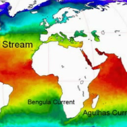
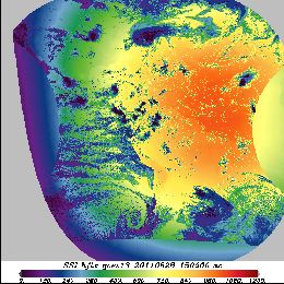
Sea surface temperature (SST), defined as one of the essential climate variables, has a key role in climate research and weather prediction by representing the boundary condition for both the ocean and the atmosphere.
Sea surface temperature (SST), defined as one of the essential climate variables, has a key role in climate research and weather prediction by representing the boundary condition for both the ocean and the atmosphere.
This presentation shows how the SST is retrieved from satellite observations and its main retrieval errors, the instruments and satellites used in its retrieval and the main SST applications. At the end, a brief overview of the future satellite SST-related missions is given.
Scatterometer winds are used by all major NWP centres and by the oceanographic community. At KNMI high resolution ASCAT scatterometer data is assimilated in the NWP High-Resolution Limited Area Model (HiRLAM).
Over the last years the processing of ERS scatterometer winds has been refined. Subsequently, High Resolution Limited Area Model, HIRLAM, and ECMWF model data assimilation experiments have been carried out to assess the impact of one scatterometer, ERS-1 and of two scatterometers, ERS-1 and ERS-2, on the analyses and forecasts. We found that scatterometer winds have a clear and beneficial impact in the data assimilation cycle and on the forecasts. Furthermore, ECMWF has shown that ERS scatterometer data improve the prediction of tropical cyclones in 4Dvar, where unprecedented skillful medium-range forecasts result of potential large social-economic value. Nevertheless, scatterometer winds contain much sub-synoptic scale information where the smallest scales resolved are difficult to assimilate into a Numerical Weather Prediction, NWP, model. This is mainly due to the otherwise general sparsity of the observing system over the ocean. In line with this it is found that scatterometer data coverage is very important for obtaining a large impact. In that respect future scatterometer systems such as SeaWinds on QuikSCAT and ADEOSII, and ASCAT on EPS are promising.