
Weather
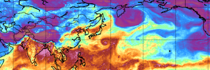
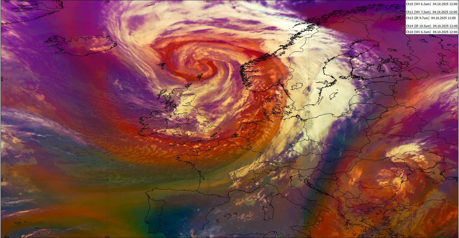
Have you ever wondered what an Atmospheric River is or how to recognize it in model or satellite data? The freshly released training module will assist you by guiding you step by step through the identification process.
First you will learn some basic facts on Atmospheric Rivers; how and where they are created, their typical characteristics and their appearance in satellite and model data. Step by step, you will then be guided through the identification process until you are certain that you are dealing with the phenomenon that is called an Atmospheric River.
Later stages of Atmospheric Rivers are sometimes tricky to identify as they are often merged with mid-latitude frontal systems. But here again, model fields and the timely evolution can give a precise answer whether there is an embedded AR or not.
And finally, it is well invested time going through this training module as ARs are responsible for many floods and heavy precipitation in Western Europe once they make a landfall.
The purpose of this Training Module is to provide step-by-step instructions for identifying Atmospheric Rivers.
This mini-module is part of a series of MTG mini modules produced by EUMETSAT/EUMeTrain with the aim of providing quick and useful learning experience about the new satellite products.
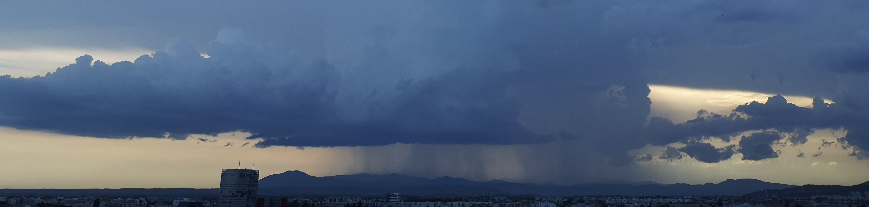
In this exercise you are giving forecast for a shipment route that could be affected by a convective event.
Enter the mini-module.
This mini-module is part of a series of MTG mini modules produced by EUMETSAT/EUMeTrain with the aim of providing quick and useful learning experience about the new satellite products.
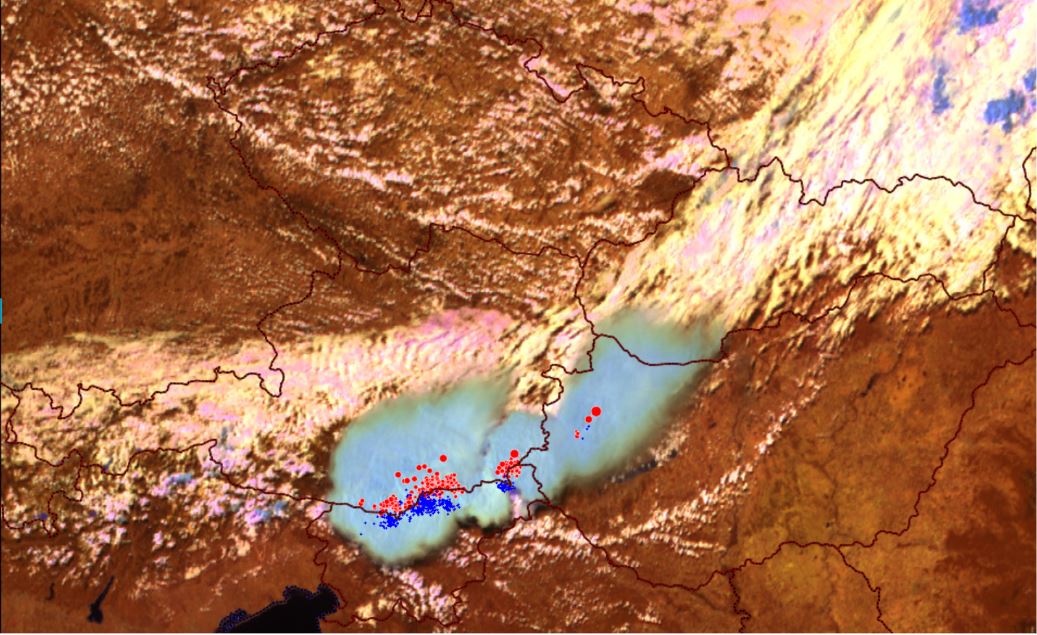
In this exercise you will learn how to use LI data together with ground based measurements.
Enter the mini-module.
This mini-module is part of a series of MTG mini modules produced by EUMETSAT/EUMeTrain with the aim of providing quick and useful learning experience about the new satellite products.
In this exercise you will learn how using MTG products can help you recognize convective initiation.
Enter the mini-module.
This mini-module is part of a series of MTG mini modules produced by EUMETSAT/EUMeTrain with the aim of providing quick and useful learning experience about the new satellite products.
In this exercise you will learn how to detect fog and low clouds by using FCI products.
Enter the mini-module.
This mini-module is part of a series of MTG mini modules produced by EUMETSAT/EUMeTrain with the aim of providing quick and useful learning experience about the new satellite products.
In this exercise you will learn about detection of supercooled droplets which pose a problem for the air traffic.
Enter the mini-module.
This mini-module is part of a series of MTG mini modules produced by EUMETSAT/EUMeTrain with the aim of providing quick and useful learning experience about the new satellite products.
In this exercise you will learn about the improvements in fog & low cloud detection using the new FCI products.
Enter the mini-module.
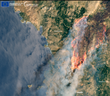
This mini-module is part of a series of MTG mini modules produced by EUMETSAT/EUMeTrain with the aim of providing quick and useful learning experience about the new satellite products.
In this exercise you will learn about FCI ability to detect fires and how it compares to previous generation of satellite instruments.
Enter the mini-module.
This mini-module is part of a series of MTG mini modules produced by EUMETSAT/EUMeTrain with the aim of providing quick and useful learning experience about the new satellite products.
In this exercise you will learn about different MTG products for severe weather forecasting.
Enter the mini-module.
This mini-module is part of a series of MTG mini modules produced by EUMETSAT/EUMeTrain with the aim of providing quick and useful learning experience about the new satellite products.
In this exercise you will learn about features in LI data as well as some limitations.
Enter the mini-module.

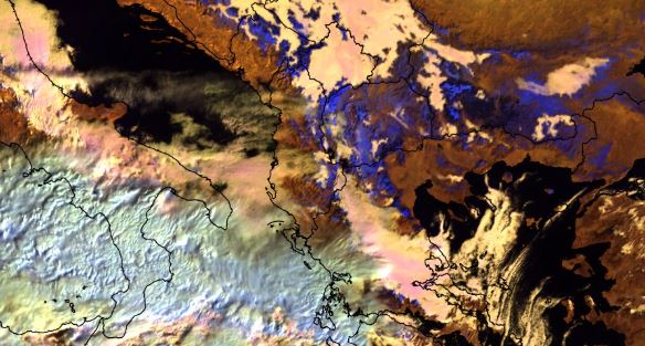
This training module shows the unique challenges that forecasters face when using satellite imagery in high latitude regions. Using a lot of examples and fun exercises, it compares different types of satellites (geostationary, polar) and different generations of satellites as well as benefits and drawbacks of each. It also explains different phenomena that occur in these high latitude regions due to viewing geometry and much more.

This resource was created in order for users to be able to access Weather Briefings page via resources search.
To access the Weather Briefings recordings, click here.