By combining the temperature in 2m, mean wind speed and the weather observations we will get information about the air mass, front passages and significant weather conditions like rain, hail or thunderstorms.
Mild air can be found over France and colder air in the other regions. At the transition between both airmasses we see light to moderate rain. This happened in relation to a wave that moved during the next hours from Belgium and Central Germany to the east. However, we will not consider this wave any longer.
The wind speed increase over Northwest Scotland.
This image reveals increasing wind speed and partly moderate and heavy rain over North Ireland and Scotland.
The wind speed continued intensifying and in the meanwhile the rain area was covering whole Ireland, Scotland.
Mean wind speed up to 40 knots were measured and the temperature increased to 12ḞC. The warm front passed most parts of Ireland that can also be seen from the wind turn. Rain was observed over the entire UK.
The area of rain and strong wind moved to the east. The succeeding cold front arrived over Northwest Scotland what can be seen from the change of the wind direction.
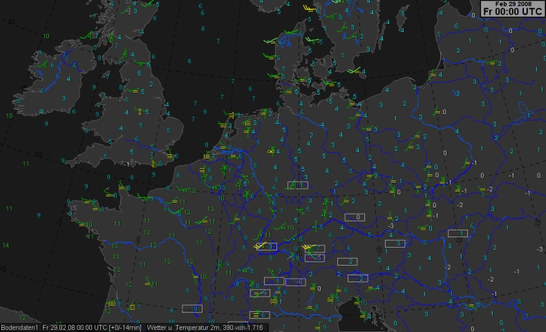
The field of strong wind hit the German coast. Rain was observed from North France to North Germany. South Germany was now influenced by relatively mild air.
The cold front moved to the Southeast. First hints to destabilisation can be taken from the showers over Northwest Ireland . Over Germany and NE-France moderate rain in connection to warm was reported. In Cuxhavn (Northwest Germany) heavy rain (near the cocclusion point) occured.
The cold front was near-by the Belgium, Dutch and German coast (see surface weather chart). High mean wind speeds (30 to 40 knots) were measured. Mild air influenced South England, France and parts of Germany.
The occlusion and the convective line moved fast to the Southeast and in its rear the temperature dropped. Over the Netherlands first thunderstorm observations can be found.
The cold front/occlusion moved very fast to the Southeast and extended at 06 UTC from Central Germany to West France (see surface weather chart). The succeeding convective line became more active. This image reveals line orientated reports about thunderstorms and we see a clear temperature contrast and a significant wind change over Germany and France.
The cold front and the convective line arrived over South Germany. Many thunderstorms were reported. At the Danube river one severe thunderstorm with hail (coding = 99) was observed. Probably due to hail the temperature dropped partly to only 1ḞC.
This image reveals two fields with storm (mean wind speeds up to 45 knots (Beaufort 9) and even 55 knots over the North Sea (Beaufort 11)).
The occlusion and convective line arrived at the line "Alps-East Austria-Hungary". We see again the distinct wind direction change and the temperature decrease. However, the wind abated.
Both systems continued moving to the Southeast and still some thunderstorms were reported (Croatia, West Romania). This image reveals a good example of Foehn over North Italy: Temperatures between 18 and 22ḞC can be found. The relative humidity was partly only 15%. (The reports about dust do not automatically mean that the spread was not more than 4 K). For more background click upon meteogram Magadino (Switzerland) and/or Torino (Northwest Italy).
The cold front arived over the northern Balcan Peninsula and the foehn continued. High mean winds were still measured over Denmak and higher stations in Germany.
The storm field moved to the Baltic Sea. The wind decreased over Germany.