
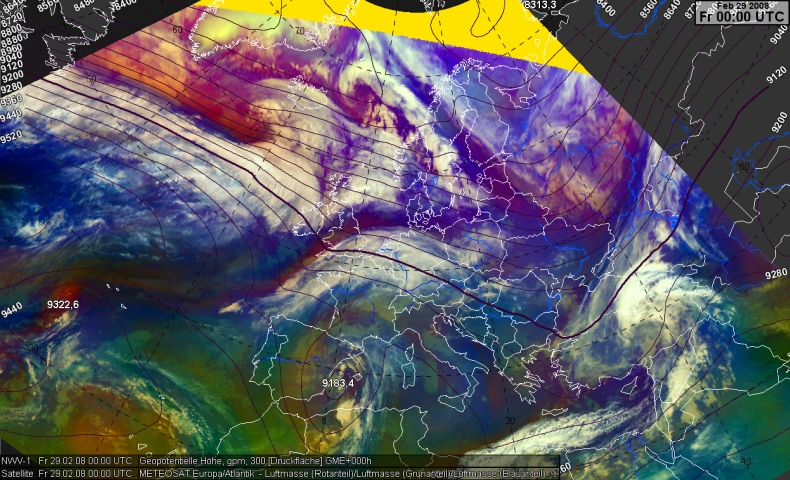
The geopotential height in 300 hPa reveals a pronounced upper air trough over western Europe. However, more relevant is the Central and West Atlantic: From New Foundland to the area south of Iceland the image reveals almost line-orientated countours with a strong gradient that indicates an intense frontal zone. A short wave trough and divergent isolines can be seen south of Iceland. This is a typical structure during a rapid cyclogenesis.
In the following, we will concentrate upon this short wave trough.