
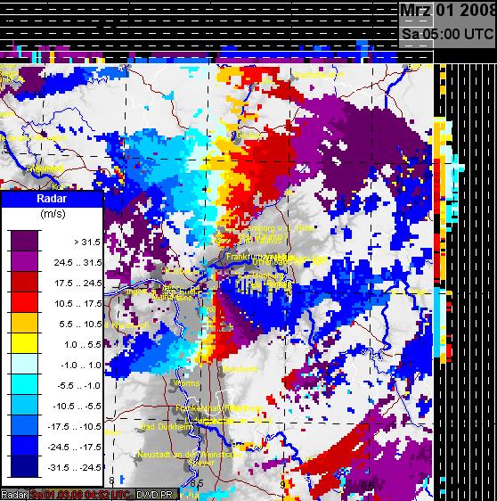
This chapter contains a time sequence of radial winds from the Doppler radar near Frankfurt. Although each image contains the legend you may click upon the key symbol (above) for better reading.
The radar equipment of the DWD covers wind speeds of -31.5 m/s (blueish pixels approaching) and +31.5 (redish pixels, streaming away from the station). Higher wind speeds are displayed by folding. In that case you have to subtract or to add 63 m/s. For example, wind speeds of -35 m/s are displayed as violet pixels because (-35 m/s+63 m/s)=28 m/s which is displayed in violet (according to the legend for 24.5 to 31 m/s). Analogous, positive wind speeds of 35 m/s are shown as blue pixels because (35-63)m/s=-28 m/s that is displayed as blue (according to the legend). Folding is likely if you do not find a zero-line (light blue) between the redish and blueish colours. This is the case in this image northwest and southeast of Frankfurt.
This image reveals high radial winds of -31.5 to -38.5 m/s (west of Frankfurt) and 31.5 to 38.5 m/s (east of this station). The light blue areas are orientated almost perpendiculary, i.e., indicating almost west wind.