
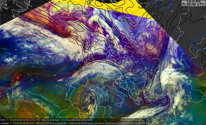
In this chapter we consider the combination of airmass composite and the potential vorticity at the isentrope 310 Kelvin (roughly about 6 km high). This gives more understanding about the dynamical processes and how they were related to the cloud structures and airmasses gained from the airmass RGB.
South of Iceland we see the cloud head and the Warm Conveyer Belt in relation to the surface low. The airmass RGB exhibits violet/purple areas in connection to a PV-maximum. Further to the west we see a line-shaped transition of purple to blueish. Near the strong gradient of PV we have the frontal zone and the jet stream. (Because the jet and the frontal zone exhibits vertical tilting this can be used only as an estimation).
