10 March 2006, 00 UTC
The temperature field at 700 hPa reveals warm air spreading from the Mediterranean and northern
Africa to the middle of Europe. On the other hand there is a
pool of cold air present in the western part of Europe, especially over Great Britain and northern France.
10 March 2006, 06 UTC
The cloud bulge is located in the warm air and the southern part of frontal cloudiness is
situated in the
cold air. This indicates circulation
of the air masses within the deepening low, giving rise to suitable conditions for further spiral cloud development.
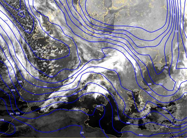
10 March 2006, 12 UTC
By this time the spiral cloud has developed from the first wave. The second wave has already developed and is now situated between Corsica and Italy.
10 March 2006, 18 UTC
The warm air is pushed farther towards the eastern Europe and a prounoced cold advection exists behind
the frontal cloud band. Temperature gradients are the strongest in the region of
the cold front.
11 March 2006, 00 UTC
This image shows the conditions in which a continuation of the cyclonic rotation
can be expected. There is still warm air
located within the cloud bulge whereas cold and dry air is placed behind the frontal cloudiness.