10 March 2006, 00 UTC
In the early stage of the cold front development there is a prounounced trough behind
the frontal cloudiness which is connected to a deep low located over Great Britain
and Iceland.
10 March 2006, 06 UTC
As the system moves farther eastward the large scale trough in the upper levels is
deepening. This is a very frequent case in wave development.
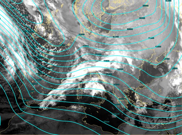
10 March 2006, 12 UTC
A trough with cloudiness in south-westerly stream is now more prounounced. The system is still developing.
Since there are also PVA maxima superimposed on the upper level trough and situated
over the cold front cloudiness, conditions for the wave development are
existing. (PVA fields are available in the chapter: "Meteorological parameters").
10 March 2006, 18 UTC
The upper level trough located behind the frontal cloudiness is continuing to deepen. The whole system moved
eastward.
11 March 2006, 00 UTC
The large scale trough is now spreading from the Nordic countries to the northern
Africa. Strong gradients in the upper level pressure field over the
south-eastern Europe indicate the presence
of very strong south-westerly wind responsible for cloudiness growth. This wind
is
bringing very wet, warm and unstable air from the Mediterranean and the northern Africa.