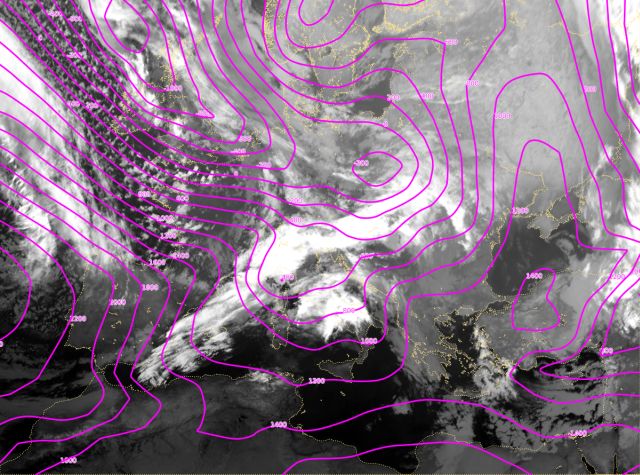
10 March 2006, 00 UTC
Several important features can be seen in this surface chart. There is a high
pressure over Turkey. The main low is
located near Iceland, the second one over the Central Europe, and a
shallow low over the Gulf of Genoa. The cloud band of interest is associated with the low over Poland and with the cold front extending from
the north
of Italy towards the south of Spain.
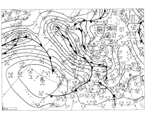
10 March 2006, 06 UTC
The low over
the Central Europe is weakening and the one over the northern Italy is intensifying.
This is typical configuration in case of a classical wave because there is a strong surface trough south of the
wave cloud bulge.
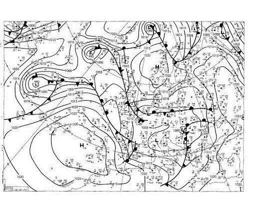
10 March 2006, 12 UTC
The cloud system is moving from west to east and the high pressure over Turkey
is now moving farther to northeast. Notice that the low over the northern Italy is
more intense than 6 hours earlier as is the cloud band associated with the cold
front.
10 March 2006, 18 UTC
The cold front and its cloud band have moved to the northeast. The low that was
located over the northern Italy split into two separate lows, one of these is
now influencing the convective cloud development over the northern Italy.
11 March 2006, 00 UTC
At this instant there is low over the central and eastern Europe and the associated
cloud band is strongly influencing the weather in that region. A cold front
cloud band is associated with the trough connected to that low. A small low
formed in the northern Adriatic which is a rather common follow-up of the cold
front passage.