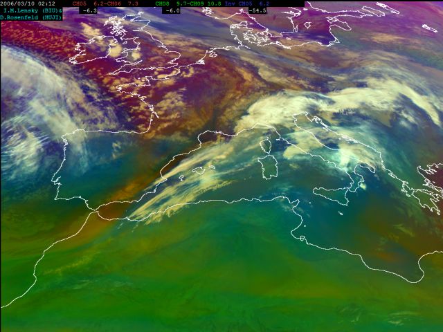
Several important features can be seen during the early stage of the cold front development illustrated in this image. Over the northern Africa and most of the Mediterranean there is warm air, whereas the northern part of Europe is covered by cold air. The reddish colour near the frontal cloudiness reveals dry stratospheric air. This can be seen at the rear side of the cold front and on the left side of the frontal system approaching western Europe. A bright cloud bulge, which is the first wave developing at the rear edge of the cold front, can be seen over the northern Italy.