13 February 2005/12.00 UTC
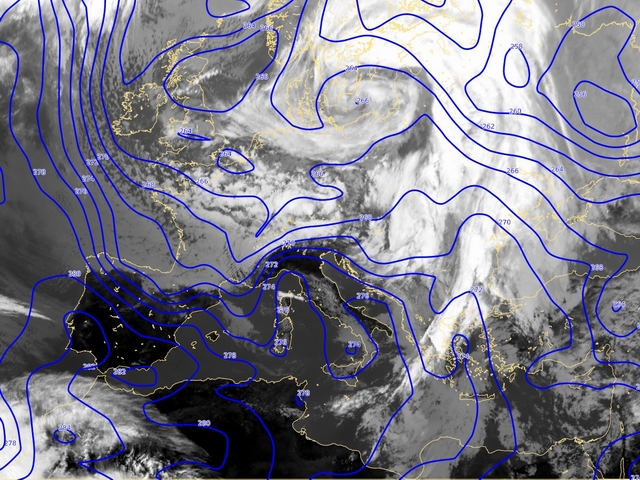
At 850 hPa, temperature field shows also some features characteristic for cyclonic rotation. The intrusion of the cold air from the north can nice be followed
by the sinking of isotherms over the West Mediterranean in the time sequence. The warmer air is located over Mid-Mediterranean and South-east Europe
accompanied with the cloudiness (can be followed especially from 14th February at 06UTC).
The main feature in the field of temperature is the pronounced CA maximum behind the cloud structure.
The convective development which is in the upper level in the cold air (cold core which can be followed at 500 hPa
from 15th February at 06UTC), at 850 hPa is still in the warmer air.