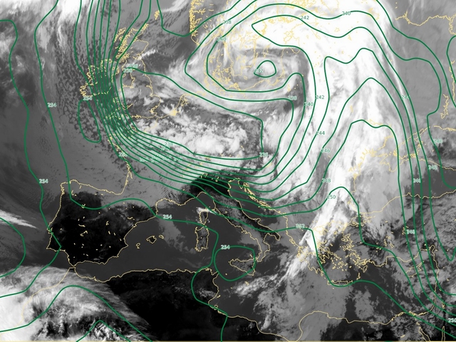
13 February 2005/12.00 UTC
The temperature field at 500 hPa shows the typical distribution for this situation - the warmer air is located over the cloudiness area while
the colder air is coming from the north accompanied with characteristic cloud configurations (cellular structures).
The cold advection, which plays the important role in the process below, was connecting
with jet streak oriented from north down to Mediterranean. The warm advection over Eastern Mediterranean coverd by clouds was connecting with the
front system which moved toward the east. During the proces of cyclogenesis in the Genoa Bay cold advection triggered the convective
development (can be noticed from 15th February at 06UTC). The core of the cold air was present over South France (from 15th at 00UTC) and
after some time (from 16th at 00UTC) also over West Mediterranean.