The model wind field showes the strong wind in the inland of France. Along the coast the wind is much weaker, but the second maxima appeared over the Mediterranean.
The wind speed over land increased. The model shows the mechanism of Mistral - the strong wind will be tunneled east and west of Central Massif.
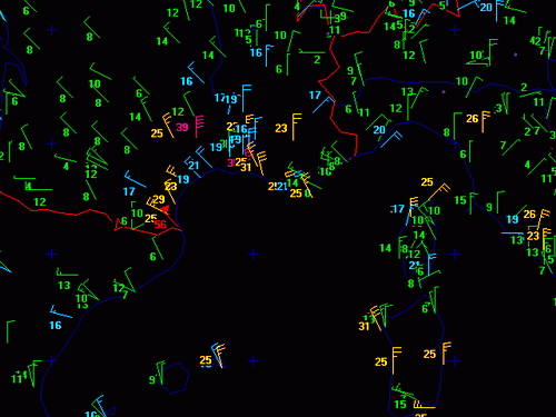
The measurments exhibits mean wind speeds of more than 25 knots along the southern coast of France. The model wind speed at this time shows the values from 8 to 12 m/s.
This is the point when the model wind reaches values larger than 20 m/s. Measured mean wind speed at that time was up to 54 knots at the south coast of France.
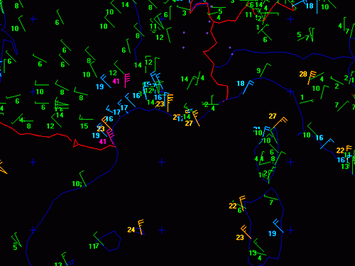
The model wind over sea reached values greater than 22 m/s. About at this point of time the damage of the cruise ship happened.
The model wind becames a little bit weaker, but unfortunately there was no measurment over sea.
The similar situation like 6 hours before. The second maxima, weaker than this over Mediterranean, can be noticed over Adriatic Sea. This wind field fits well with
intesification in the Adriatic and other parameters, but mesaurments are not shown here.
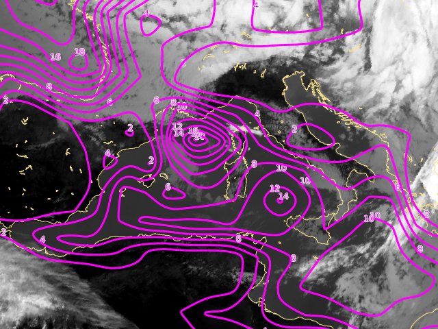
Notice the maximum of the wind speed in the Mediterranean, south of Italy - it is connected with the cyclonic circulation.
The three wind speed maximum - the first over West Mediterranean, the second over southern parts of the Mediterranean and the third over Adriatic, are still present.
The cloude spiral moved toward the south and the wind field weakened. The maximum will be over West Mediteranean till the end of time sequence with wind speed over 10 m/s.
The similar situation like six hours before. The model shows that maximum over Adriatic is weaker.
The simillar situation like six hours before. The model shows that maximum over Adriatic is weaker. A little bit weaker is also the maximum over Mediterranean, south of Italy.
The similar situation like six hours before. The maximum over West Mediterranean is still constant.
The wind speed maximum over West Mediterranean shows that Mistral is still present.
The system was dissipating and the cyclone moved further to the east. The maximum of the surface wind is still over West Mediterranean.