LST from GEO and LEO instruments - ESA's GlobTemperature
GlobTemperature is an ESA project that provides access to multipurpose satellite-based land, lake and ice surface temperature data sets in a harmonized format through a single web portal.
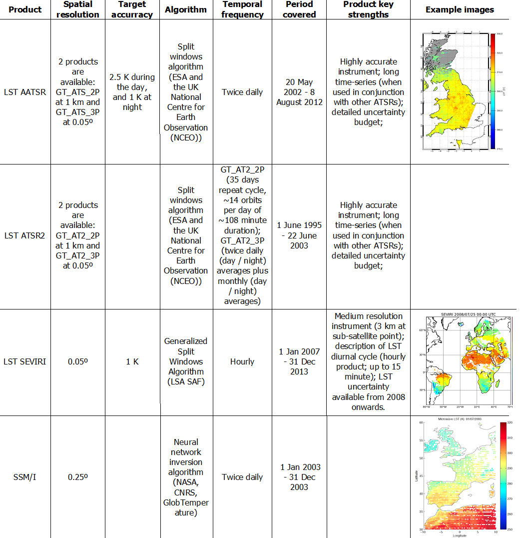
Instruments: AATSR (Advanced Along Track Scanning Radiometer), ATSR2 (Along Track Scanning Radiometer 2), SEVIRI (Spinning Enhanced Visible and Infrared Imager), SSM/I (Special Sensor Microwave/Imager Radiometer).
Spatial coverage: Low orbit derived products have global coverage whereas LST from SEVRI is limited to the MSG disk area.
Projection: fixed grid map
File format: NetCDF-4 CF-Compliant "Harmonised Format"
LST products made available via the GlobTemperature Data Portal

Products available at http://data.globtemperature.info/