Lee Waves In Satellite Images
Lee waves are stationary atmospheric waves and are depicted as a bunch of parallel, white and narrow cloud bands in VIS images (figure 2). In IR imagery, most of them appear as dark grey cloud bands due to their relatively warm cloud tops.
Lee waves are internal gravity waves in a stable atmosphere; the clouds are generated by topographic elevations like mountains or coasts. Wind passing over such features receives a vertical pulse and kinetic energy is transformed into potential energy. The horizontal spacing of the waves is related to the wind speed over the elevation in question. The higher the wind speed, the longer the wave length. Stronger winds are also related to stronger turbulence. Atmospheric conditions during the winter season are more favorable to the development of lee clouds because of the stable stratification in the lower troposphere.
To diagnose mountain waves from satellite imagery, the highest available resolution should be chosen (e.g. HRV channel for Meteosat or AVHRR images from NOAA/Metop satellites). A coarser resolution of the image data will blur the cloud pattern and the waves will appear as a homogenous cloud shield. Lee clouds are best seen in the visible channels during the day. They offer a higher contrast between clouds and land than IR or WV imagery. Night time lee cloud detection with IR or WV channels is more challenging.
|
|
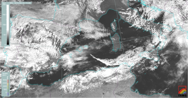
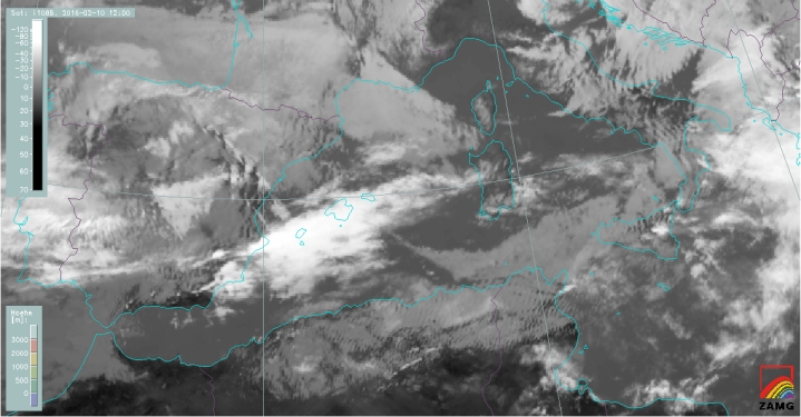
Figure 2: Comparison between MSG IR10.8 and HR-VIS image for 10 February, 2016 at 12:00 UTC (use the slider).
In many cases, water vapor imagery can complement wave detection in regions where cloud condensation does not occur and therefore no signal in IR or VIS channels exists. Figure 3 shows both, an HRV and a WV7.3 μm image. While the Po Valley and the Mediterranean Sea east of Corsica are cloud free in the visible image, the water vapor image shows a distinct wave pattern in these areas.
The WV7.3 μm channel is sensitive to water vapor concentration, especially between 700 and 500 hPa. As the total column water content of the atmosphere is constant whether this column is located in the wave's trough or wave's crest, the varying absorption in this WV channel can only be explained by the different amount of water vapor in the layer which contributes most to the 7.3 μm channel. In case of very strong waves, drier upper tropospheric air protrudes down to lower layers and hence reduces the amount of water vapor within the highest contributing layers (the moisture is pushed down towards layers below 700 hPa where the 7.3 μm channel is more or less blind).
|
|
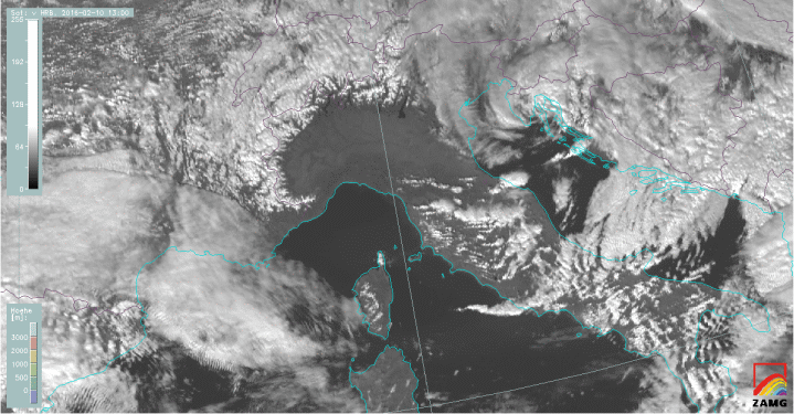
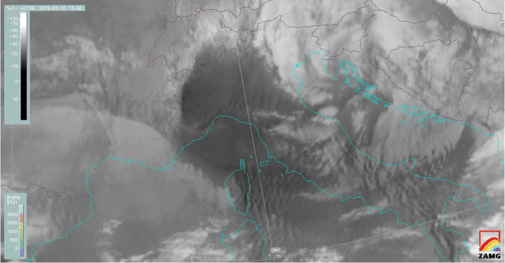
Figure 3: Comparison between MSG WV7.3 and HR-VIS image for 10 February, 2016 at 13:00 UTC (use the slider).
Though the MSG Severe Storms RGB does not include the high resolution HRV channel, it is very suited for detecting lee clouds composed of ice crystals. Typically, Severe Storms RGB imagery is used for detection of convective systems, especially for the most active cores or updrafts. Small ice particles, characteristic of high level lee cloudiness, are shown in the same bright yellow colors (figure 4). These high level lee clouds consist of the same type of small ice crystals as active thunderstorms.
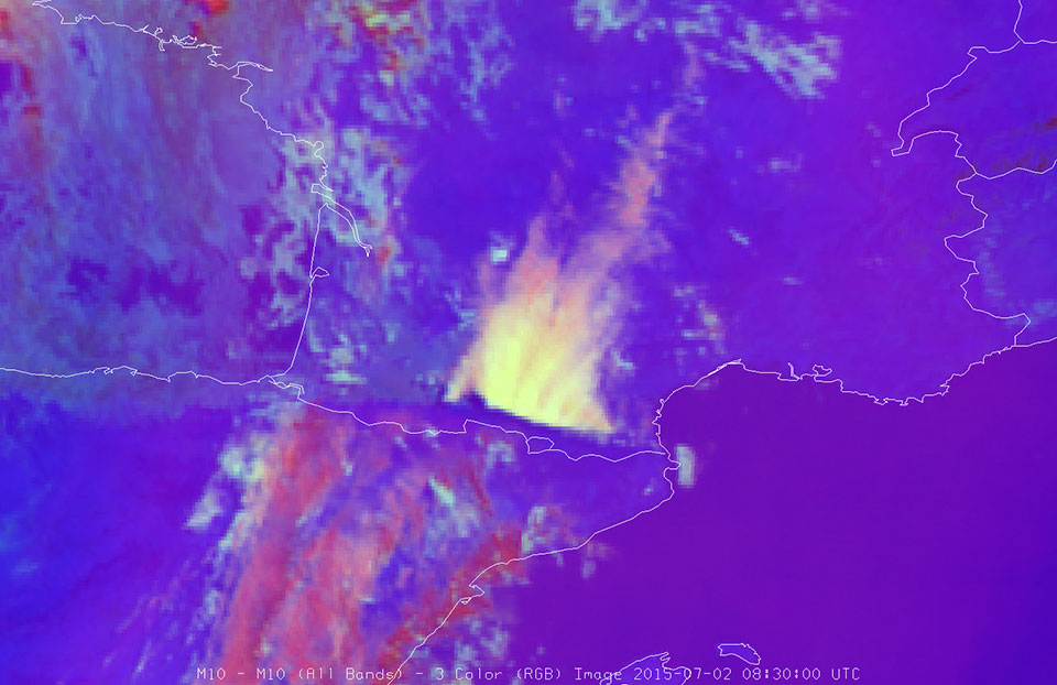
Figure 4: Meteosat-10 Severe Storms RGB, 2 July 2015 at 08:30 UTC. High lee clouds formed north of the Pyrenees.