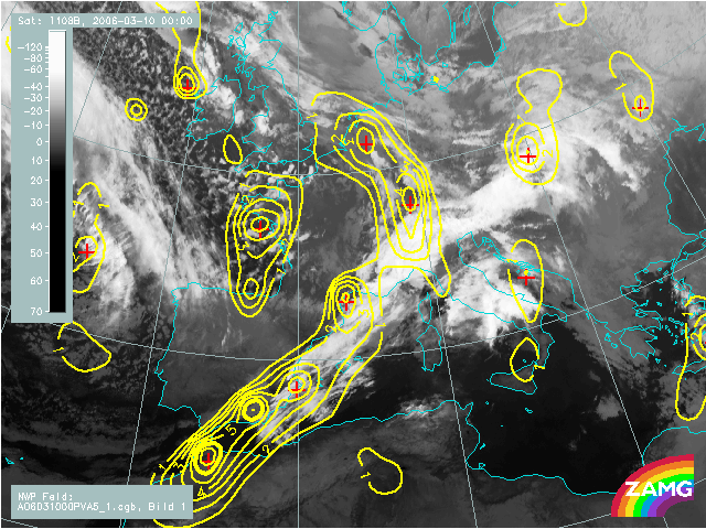
10 March 2006, 00 UTC
The frontal cloud band is superimposed by high values of PVA connected with two
jet streams, one coming from the nortwest and ending over Spain and the
other located behind the cold front cloud band. The maximum over Central
Europe is found in the left exit region of a jet stream. Another maximum placed
over Belgium and Netherlands is associated to the upper level trough and the low
forming in the Central Europe.
10 March 2006, 06 UTC
High values are responsible for increased cloudiness of the wave bulge on the cold front.
10 March 2006, 12 UTC
PVA is an indication for the areas that are more cyclonic. Over the cold front area there are several maxima and the most expressed ones are over
the northern Italy and
Tirenian sea.
10 March 2006, 18 UTC
Like in a sequence before, high values of PVA are located over the whole frontal
system. At this instant a new pronounced PVA maximum is situated over western France.
It is indicating an intensification of a low in the upper levels (500 hPa).
11 March 2006, 00 UTC
The distribution of PVA is somewhat different then 6 hours earlier. The high
values of PVA show three more or less separate maxima: over the warm front
cloudiness, over the occlusion cloud band and over the cold
front cloud band. The high values of PVA are further contributing, however
slightly weaker, to the cyclogenetic processes as well as to the frontal
cloudiness enhancement.