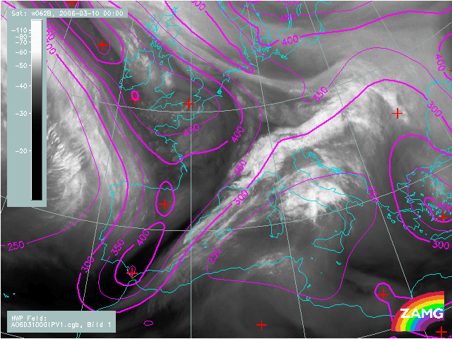
10 March 2006, 00 UTC
At this stage of development it can already be seen that at the rear side of the cold front there is very dry stratospheric air protruding downward. The cloud bulge of the first Wave can be seen in
the Alpine region and now there are several good conditions for further cyclogenesis.
10 March 2006, 06 UTC
The system moved farther to the east. The gradient of height of PV=1 units lies above
the
frontal cloudiness. This kind of distribution of potential vorticity (height of
PV=1) field makes a difference between classical Waves and Waves with double
structure. The first Wave already developed to a cloud spiral and the second one is rising over Corsica.
10 March 2006, 12 UTC
The anomaly is moving farther to the east and in this image it can be seen that the cloud band is intensifying, especially the wave bulge
located over northern Adriatic Sea.
At the southern rear edge of the frontal cloudiness stratosperic air protruded downward to 400 hPa wich is an indication for further development of a second Wave.
10 March 2006, 18 UTC
The frontal system moved farther to the east.
11 March 2006, 00 UTC
Overrunning of the southern part of frontal cloudiness by dry air, causes cloud
top lowering and dissipating. Still there is a typical distribution of potential
vorticity field for Waves with double structure.