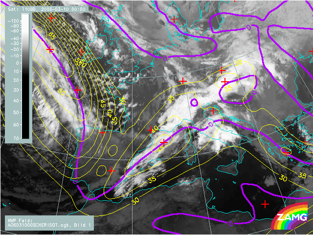
10 March 2006, 00 UTC
In this image two very strong jet streaks can be observed. One is streching from Iceland to Portugal and the second one, wich is of our interest,
is spreading from Algeria to the Alpine region. The jet of our interest is parallel to the Cold Front cloudiness and the zero line of shear vorticity is situated
within the cloud band. Cloud bulge located over southern France already reveals some Wave structure and it
is situated at the left exit region of the jet streak.
10 March 2006, 06 UTC
In the last six hours the cloud bulge developed into a Wave and then into a Cloud spiral.
The situation for development of the second Wave is similar to the
one six hours earlier. Again there is a cloud bulge at the left exit region of the jet streak.
10 March 2006, 12 UTC
In few hours frontal cloudiness intensified and the second Wave already shows some spiral structure. At this
instant one amazing thing to notice is the strenght
of jet streak over the Atlantic.
10 March 2006, 18 UTC
Cyclogenesis is further developing.
11 March 2006, 00 UTC
Frontal cloudiness follows the jet stream but it is already showing some cloud dissipation and weakening.
The maximum of the jet in the southern part is overrunning the cloud band
whereas upper maximum follows the rear side of the cloud bulge.