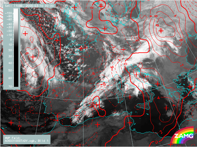
10 March 2006, 00 UTC
At this moment a warm advection can be seen on the right side, ahead of
the front, in Alpine, middle Italy and Croatia region. The cold advection is
taking place behind and across the
front. The zero line of TA is in advance of the frontal cloud band which is a key parameter for a cold front
in cold advection.
10 March 2006, 06 UTC
The warm advection is now cleary seen and the zero line of the temperature advection passes at the rear side of the cloud bulge.
10 March 2006, 12 UTC
As in the previous image there is warm advection ahead of the front, and at this point
of time a pronounced cold advection behind the cloud bulge.
This indicates the circulation within deepening low. The warm advection is weaker than cold advection.
10 March 2006, 18 UTC
The situation is similar to the one 6 hours earlier. The only difference is that the cold advection is already weaker.
11 March 2006, 00 UTC
The field of temperature advection still shows characteristic features for Conceptual Models Cold front in cold advection and Wave.
The zero line of TA is in advance of the frontal cloud band, the warm advection is within cloud bulge and the strong cold advection is behind the frontal cloudiness.