Divergence
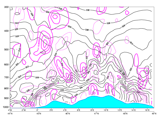
This cross section shows potential instability over the northern edge of the Alps. Especially around 14°E we find high potential instability. At about 15°E strong surface convergence is superimposed by divergence. However, this cannot be reproduced in the wind measurements in 10 m height.
The advection of vorticity and temperature is only small between 10° and 16°E. West of about 8°E we see a classical situation of destabilization by warm air advection in lower and cold air advection in upper parts of the troposphere. A few hours later partly severe convection occurred. The model fields of vertical motion reveal small upward motion around 15°E and descending air between 8° and 11°E which hints at a thermal direct circulation yielding a squall line during the next few hours.